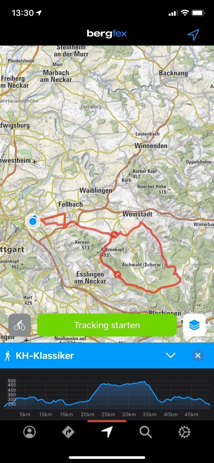
Stuttgart Radfahren
medium
Navigate
Navigate
Get this tour on your mobile
Stuttgart Radfahren
medium
Cestovni bicikl
49,29
km
Scan the QR code and start navigation in the bergfex app

Hiking & Tracking


Distance
49,29
km
Duration
02:07
h
Ascent
558
m
Sea level
225 -
490
m
Track download
Stuttgart Radfahren
medium
Cestovni bicikl
49,29
km


Route
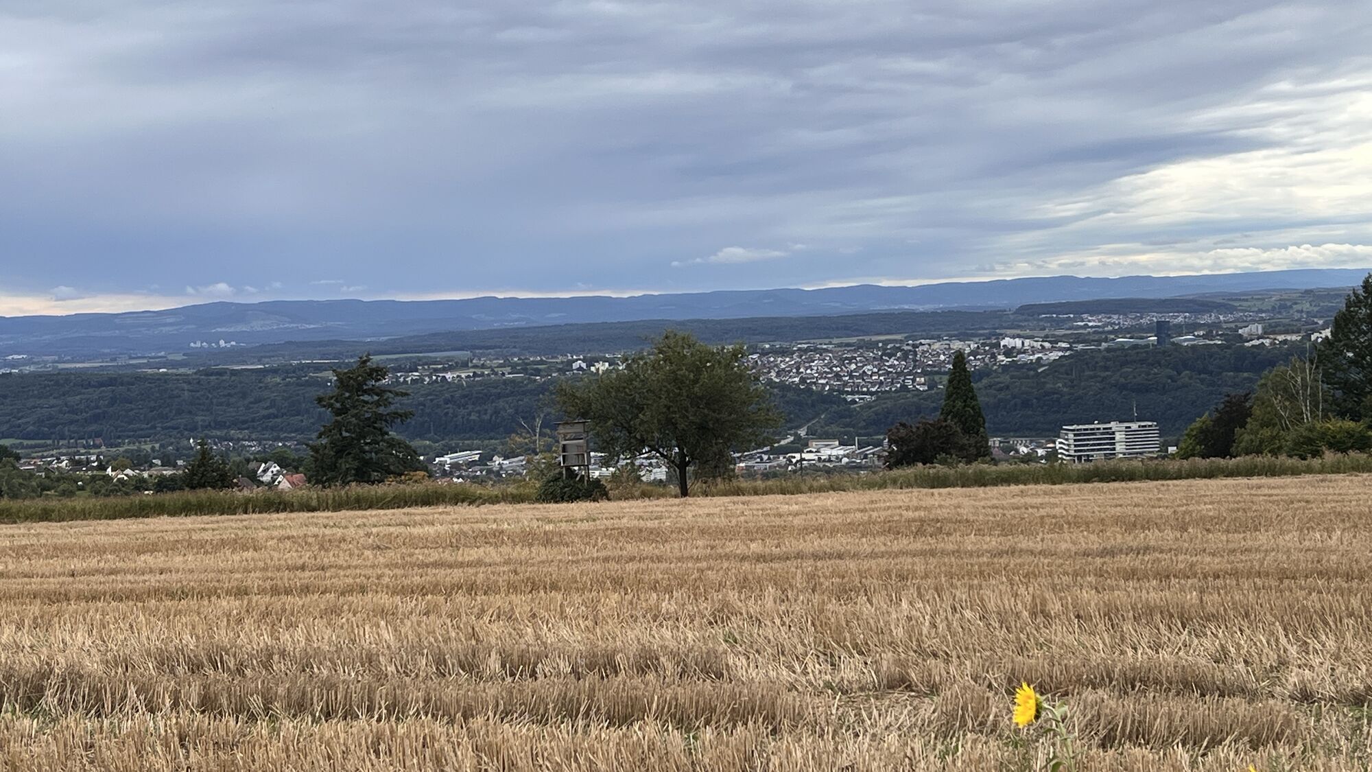
Stuttgart
(247 m)
City
0,0 km
Fellbach
(287 m)
City
5,1 km
Heilig-Kreuz-Kirche
(269 m)
Place of worship
9,8 km
Schnait
(264 m)
Village
17,0 km
Mariä Himmelfahrt
(459 m)
Place of worship
23,4 km
Katzenkopf
(425 m)
Mountain saddle
34,2 km
Heilig-Kreuz-Kirche
(269 m)
Place of worship
37,8 km
Route
Stuttgart Radfahren
medium
Cestovni bicikl
49,29
km
Stuttgart
(247 m)
City
0,0 km
Fellbach
(287 m)
City
5,1 km
Waiblingen
(230 m)
City
6,5 km
Harthof
(299 m)
Corridor/terrain
8,4 km
Heilig-Kreuz-Kirche
(269 m)
Place of worship
9,8 km
Esslingen am Neckar
(247 m)
City
9,9 km
Stetten
(263 m)
Village
10,1 km
Im See
(251 m)
Neighbourhood
11,3 km
Eulenhof
(284 m)
Corridor/terrain
11,9 km
Beutelsbach
(237 m)
Neighbourhood
14,9 km
Schnait
(264 m)
Village
17,0 km
Gasthaus Rössle
(285 m)
Restaurant
20,0 km
Baach
(287 m)
Settlement
20,1 km
Adler
(290 m)
Restaurant
20,2 km
Mariä Himmelfahrt
(459 m)
Place of worship
23,4 km
Baltmannsweiler
(456 m)
Village
23,8 km
Jägerhaus
(473 m)
Restaurant
31,6 km
Esslingen am Neckar
(247 m)
City
33,5 km
Katzenkopf
(425 m)
Mountain saddle
34,2 km
Torbogen "Tor ins Remstal"
(339 m)
Viewpoint
35,9 km
Stetten
(263 m)
Village
37,7 km
Heilig-Kreuz-Kirche
(269 m)
Place of worship
37,8 km
Harthof
(299 m)
Corridor/terrain
38,9 km
Waiblingen
(230 m)
City
40,6 km
Fellbach
(287 m)
City
45,5 km
Hend'l & Gretel
(301 m)
Restaurant
46,8 km
Christo's Stuben
(284 m)
Restaurant
47,2 km
Stuttgart
(247 m)
City
48,9 km

No reviews yet
Popular tours in the neighbourhood
-
Esslinger Höhenweg
mediumPješačenje 26,8 km -
4,0
Stuttgarter Rössleweg (im Uhrzeigersinn)
mediumPješačenje 58,5 km -
Höhenweg Sillenbuch und Bußbachtal
lightPješačenje 8,30 km -
4,0
Eastern Route (German half-timbered houses route)
heavyMeđugradska biciklistička staza 560,7 km -
Neckartal/Schwarzwald | Deutsche Fachwerkstraße: Rundtour Neckartal/Schwarzwald
heavyMeđugradska biciklistička staza 367,7 km -
5,0
Stuttgart Ultra sehr Zentral
mediumPješačenje 53,0 km -
Stuttgarter Rössleweg extended (gegen den Uhrzeigersinn)
heavyPješačenje 62,4 km -
Stuttgart rosensteinpark Baden-Württemberg
lightPješačenje 11,2 km -
Tour durch Stuttgart, Esslingen, Kernenturm, Württemberg
heavyPješačenje 50,2 km -
5,0
50 km Ultra in der Region Stuttgart
mediumPješačenje 51,1 km
bergfex Tours

Over 550.000 tour suggestions, detailed maps and an intuitive route planner make the app a must-have for all nature enthusiasts.

Ne propustite ponude i inspiraciju za vaš sljedeći odmor
Subscribe to the newsletter
Error
An error has occurred. Please try again.
Thank you for your registration
Your e-mail address has been added to the mailing list.
Tours throughout Europe
Austrija
Švicarska
Njemačka
Italija
Slovenija
Francuska
Nizozemska
Belgija
Poljska
Lihtenštajn
Češka
Slovačka
Španija
Hrvatska
Bosna i Hercegovina
Luksemburg
Andora
Portugal
Island
Ujedinjeno Kraljevstvo
Irska
Grčka
Albanija
Sjeverna Makedonija
Malta
Norveška
Crna Gora
Moldova
Kosovo
Mađarska
San Marino
Rumunjska
Estonija
Latvija
Bjelorusija
Cipar
Litva
Srbija
Bugarska
Monako
Danska
Švedska
Finska