© Hochschwarzwald Tourismus GmbH - Klaus Hansen 79761Waldshut GERMNY

© Hochschwarzwald Tourismus GmbH

© Hochschwarzwald Tourismus GmbH - Klaus Hansen 79761Waldshut GERMNY
- Kratak opis
-
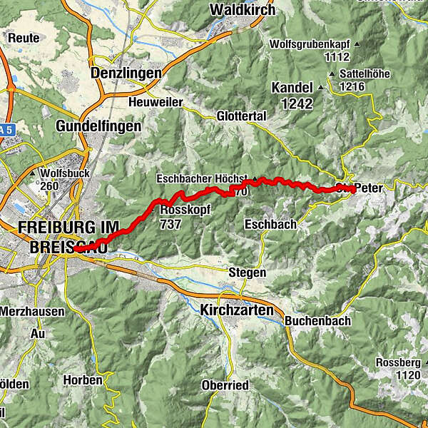
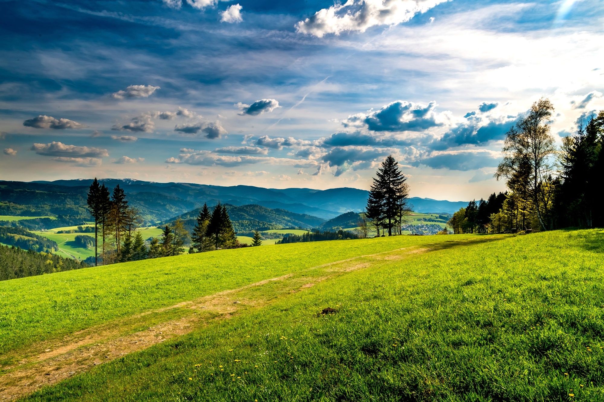
Hike with scenic views of the Black Forest and Rhine plain.
- Teškoća
-
srednje
- Vrednovanje
-
- Wegverlauf
-
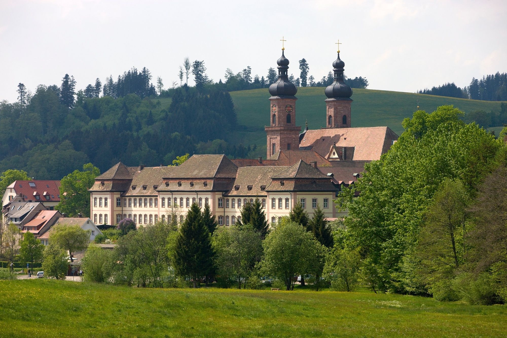
St. Peter0,0 kmJosefsbrunnen3,7 kmFlaunsereck7,4 kmHohstegkopf (706 m)8,9 kmStreckereck9,7 kmHornbühl (727 m)10,0 kmOchsenlager11,5 kmMartinsfelsen (686 m)12,3 kmRosskopf (737 m)12,7 kmMurmelbahn16,8 kmKleiner Kanonenplatz16,8 kmKanonenplatz17,3 kmFreiburg im Breisgau (278 m)17,7 kmOld Town17,7 km
- Beste Jahreszeit
-
sijveljožutrasvilipsrpkolrujlisstupro
- Höchster Punkt
- 817 m
- Zielpunkt
-
Schwabentor Freiburg
- Höhenprofil
-
 © outdooractive.com


- Autor
-
Die Tour On the Kandelhöhenweg from St. Peter to Freiburg wird von outdooractive.com bereitgestellt.
GPS Downloads


Opće informacije
Aussichtsreich
Weitere Touren in den Regionen
-
Schwarzwald
1858
-
ZweiTälerLand Elztal & Simonswäldertal
837
-
Stegen
376