- Kratak opis
-
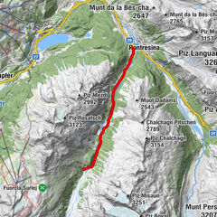
Walk up the sunny slope between Madulain and Zuoz to the cosy Alp Es-cha Dadour.
- Teškoća
-
srednje
- Vrednovanje
-
- Wegverlauf
-
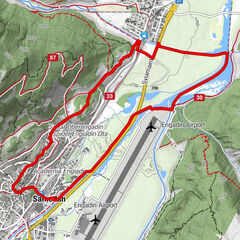
Madulain (1.697 m)0,0 km
- Beste Jahreszeit
-
kolrujlisstuprosijveljožutrasvilipsrp
- Höchster Punkt
- 2.055 m
- Zielpunkt
-
Madulain, station
- Höhenprofil
-
 © outdooractive.com
- Autor
-
Die Tour Alp Es-cha Dadour wird von outdooractive.com bereitgestellt.
GPS Downloads


Opće informacije
Einkehrmöglichkeit
Aussichtsreich
Weitere Touren in den Regionen
-
Engadin St. Moritz
102
-
Madulain
36