
- Kratak opis
-
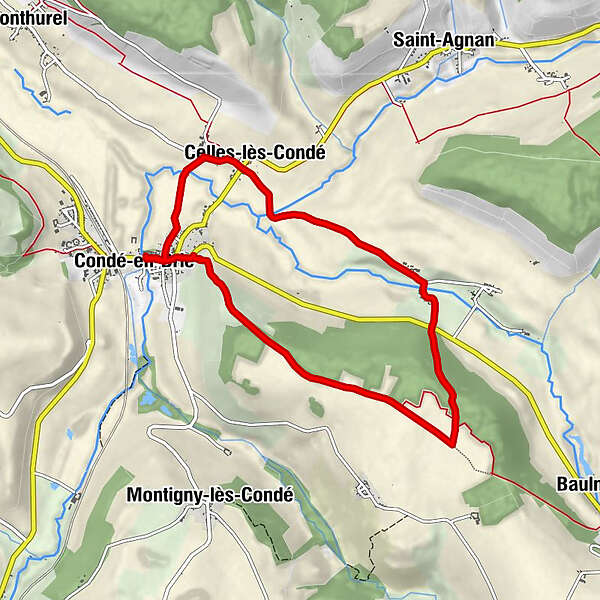
A circuit based on the attractive small town of Conde en Brie, featuring the valley of the River Surmelin, with agricultural areas, vines high up one valley side and a belt of woodland.
- Teškoća
-
srednje
- Vrednovanje
-
- Wegverlauf
-
Condé-en-Brie0,0 kmÉglise Saint-Rémi0,0 kmÉglise de la Nativité-de-la-Vierge1,4 kmCelles-lès-Condé1,5 kmÉglise Saint-Rémi8,1 kmCondé-en-Brie8,1 km
- Höchster Punkt
- 200 m
- Höhenprofil
-
 © outdooractive.com
-

-
AutorDie Tour HPB St Simeon: Conde en Brie wird von outdooractive.com bereitgestellt.