- Kratak opis
-
A circle on Sečovelje salt fields
- Teškoća
-
lagano
- Vrednovanje
-
- Wegverlauf
-
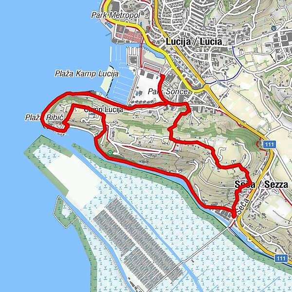
Ribič1,7 kmSezza4,7 km
- Beste Jahreszeit
-
sijveljožutrasvilipsrpkolrujlisstupro
- Höchster Punkt
- 59 m
- Zielpunkt
-
Marina Lucija
- Höhenprofil
-
 © outdooractive.com
- Autor
-
Die Tour Donkey's trail along the Seča ridge wird von outdooractive.com bereitgestellt.
GPS Downloads


Opće informacije
Heilklima
Kulturell/Historisch
Weitere Touren in den Regionen