© Weissensee Information - CC BY-ND-NC Weissensee Info

© Weissensee Information - CC BY-ND-NC Lammerhuber

© Weissensee Information - CC BY-ND-NC Lammerhuber

- Kratak opis
-
Nordic Walking-Zentrum "Nord"
- Teškoća
-
srednje
- Vrednovanje
-
- Wegverlauf
-
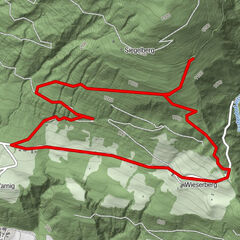
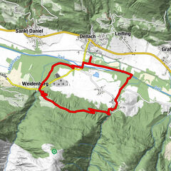
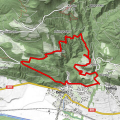
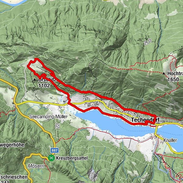
TechendorfGatschach0,5 kmOberdorf1,1 kmErlebnishof Tschabitscher4,5 kmTschabitscher4,5 kmOberdorf7,1 kmGatschach7,9 kmTechendorf10,0 kmOberdorf12,3 km
- Beste Jahreszeit
-
sijveljožutrasvilipsrpkolrujlisstupro
- Höchster Punkt
- 1.099 m
- Zielpunkt
-
Promenadenweg in Gatschach/Höhe Wiesenhof
- Höhenprofil
-

- Autor
-
Die Tour Trail 3 "Tschabitsch" - Nordic Walking wird von outdooractive.com bereitgestellt.
GPS Downloads


Opće informacije
Einkehrmöglichkeit
Geheimtipp
Aussichtsreich
Weitere Touren in den Regionen