
- Kratak opis
-
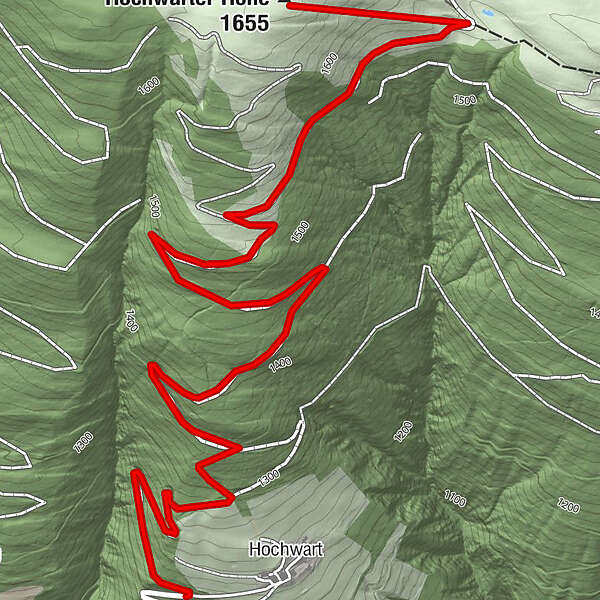
Von Hochwart über den Forstweg auf die Hochwarter Höhe, Abstieg über Schimanberger Höhe und Tramun - Waidegg möglich.
- Teškoća
-
srednje
- Vrednovanje
-
- Wegverlauf
-
Hochwart0,7 kmHochwarter Höhe (1.655 m)3,8 km
- Beste Jahreszeit
-
kolrujlisstuprosijveljožutrasvilipsrp
- Höchster Punkt
- 1.647 m
- Zielpunkt
-
Hochwarter Höhe (1.688 m)
- Höhenprofil
-

- Autor
-
Die Tour Hochwarter Höhe wird von outdooractive.com bereitgestellt.
GPS Downloads


Opće informacije
Aussichtsreich
Weitere Touren in den Regionen