
- Kratak opis
-
The CFL rail trails take you from one station to another, so you can easily get back to your starting point by train.
- Teškoća
-
srednje
- Vrednovanje
-
- Wegverlauf
-
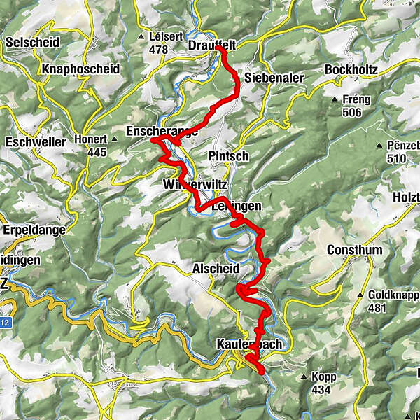
DrauffeltEnscheringen3,8 kmNew Shanghai6,2 kmWilwerwiltz6,3 kmChapel St. Willibrord6,7 kmChapelle Saint-Pierre7,9 kmLellingen7,9 kmKautenbach15,1 kmHuberty15,3 kmSaint-Bernard15,4 kmKautenbach16,1 km
- Beste Jahreszeit
-
sijveljožutrasvilipsrpkolrujlisstupro
- Höchster Punkt
- 423 m
- Zielpunkt
-
At the station in Kautenbach / Drauffelt
- Höhenprofil
-
 © outdooractive.com

- Autor
-
Die Tour CFL-Bahnwanderweg 4 (Drauffelt - Kautenbach) wird von outdooractive.com bereitgestellt.
GPS Downloads


Opće informacije
Einkehrmöglichkeit
Kulturell/Historisch
Aussichtsreich
Weitere Touren in den Regionen