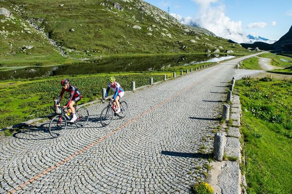
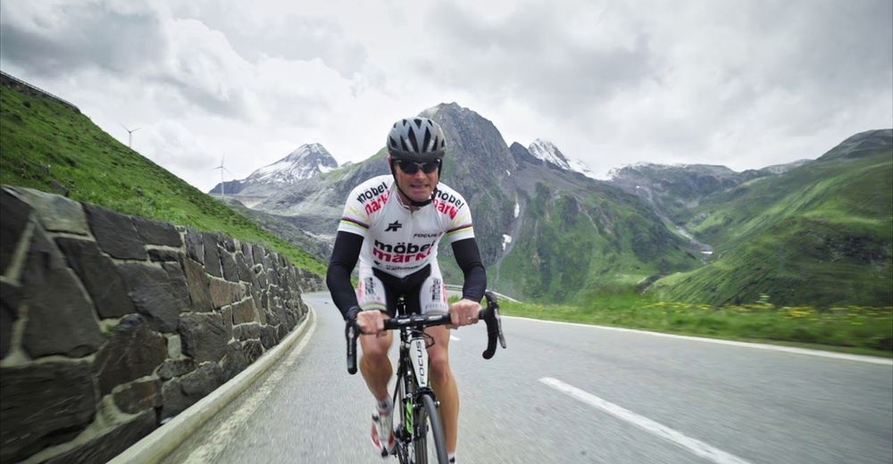
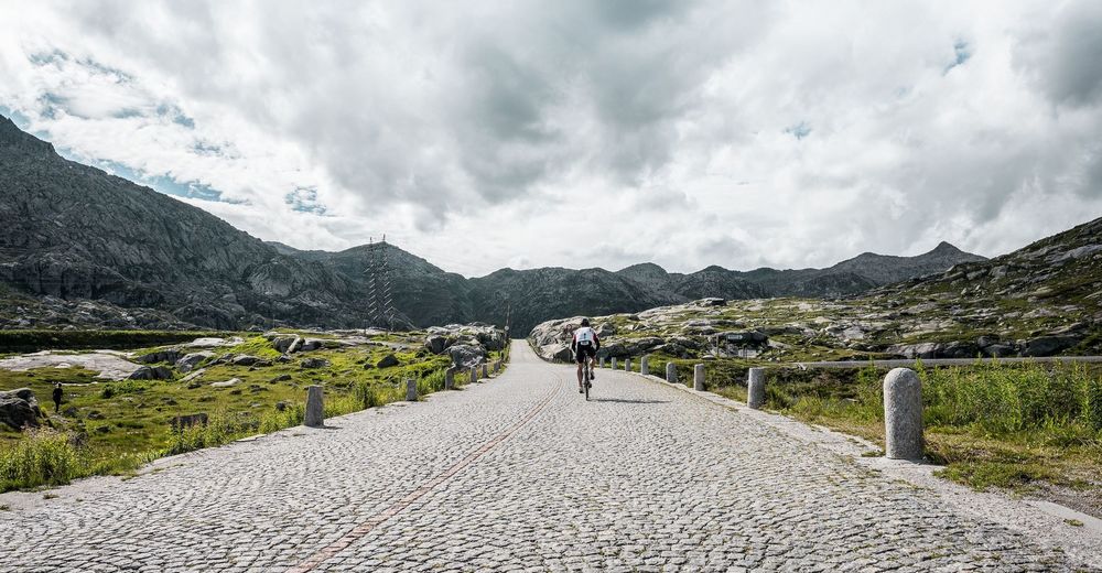
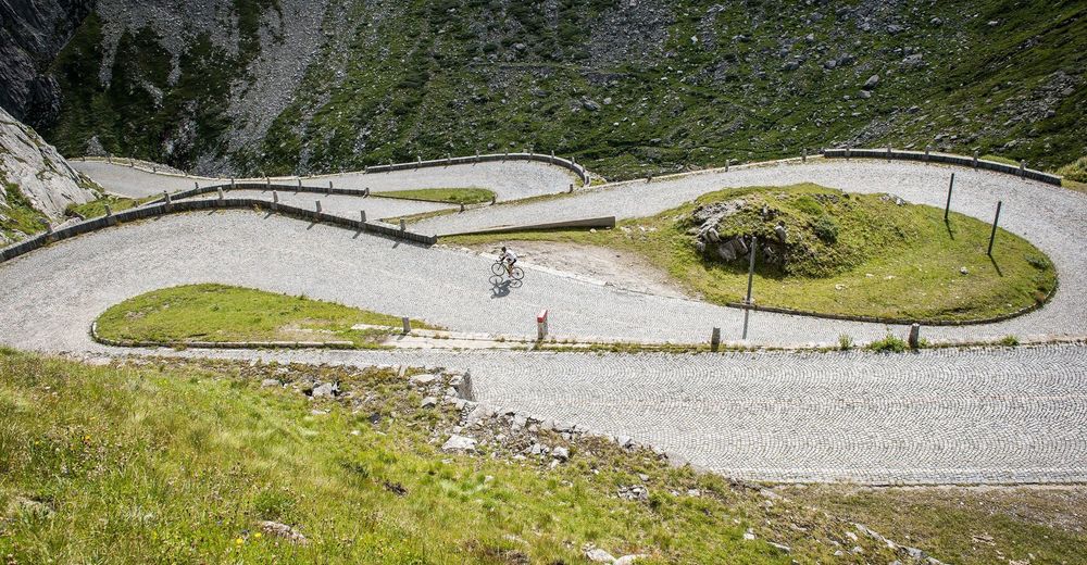
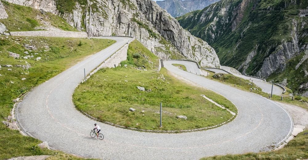
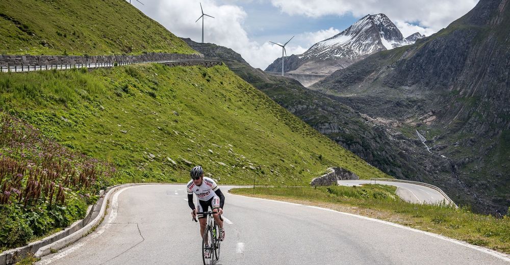
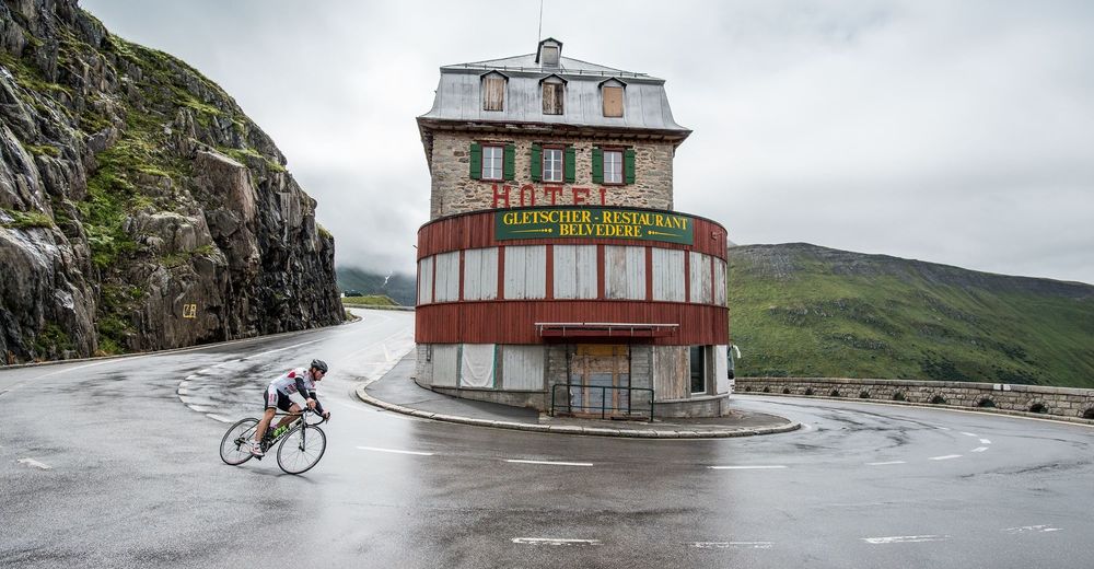
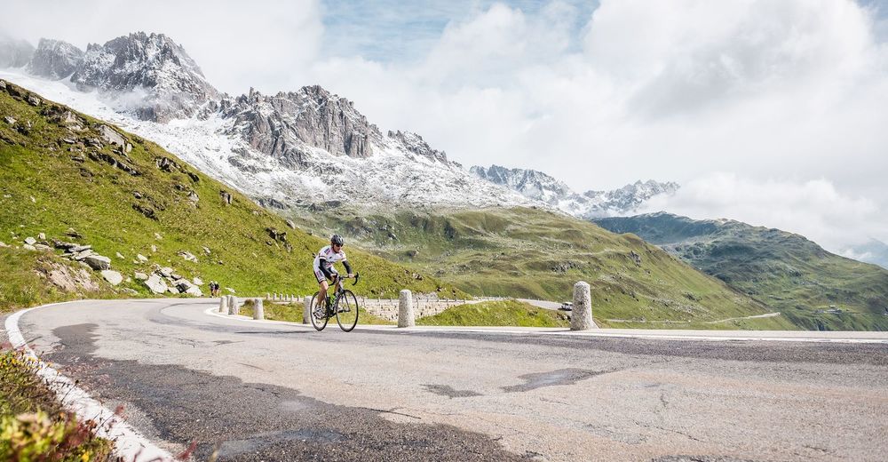
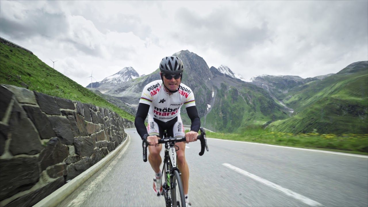
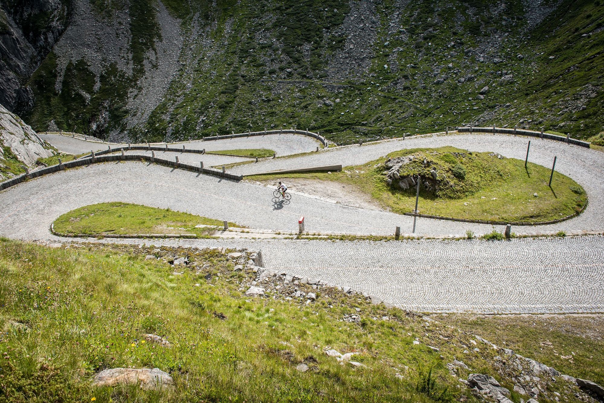
Three passes, three cantons and 3100 metres of elevation gain

© MySwitzerland
© Region Luzern-Vierwaldstättersee - Schweiz Tourismus
© Region Luzern-Vierwaldstättersee - Schweiz Tourismus
© Region Luzern-Vierwaldstättersee - Schweiz Tourismus
© Region Luzern-Vierwaldstättersee - Schweiz Tourismus
© Region Luzern-Vierwaldstättersee - Schweiz Tourismus
© Region Luzern-Vierwaldstättersee - Schweiz Tourismus

© Region Luzern-Vierwaldstättersee - Schweiz Tourismus

- Kratak opis
-
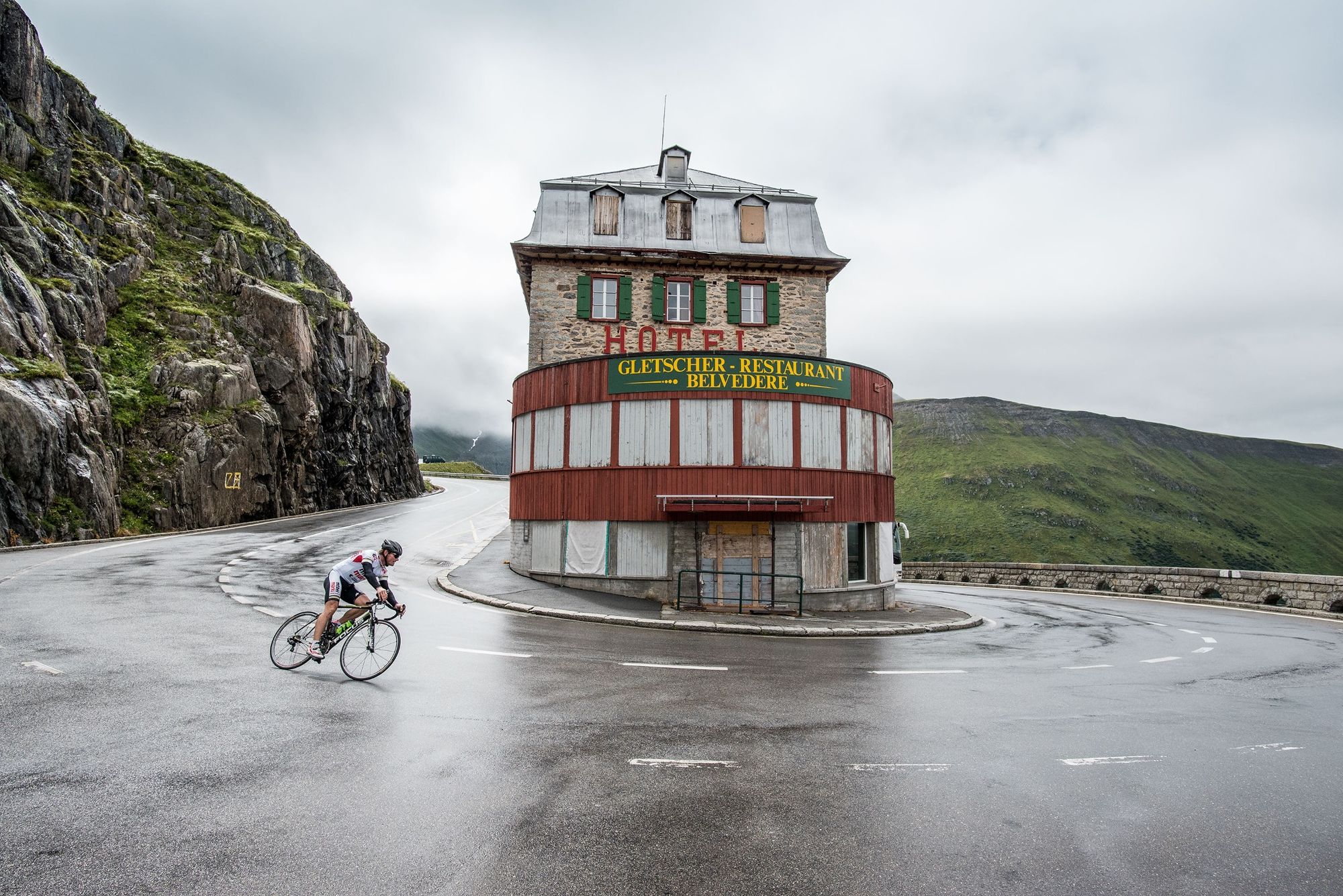
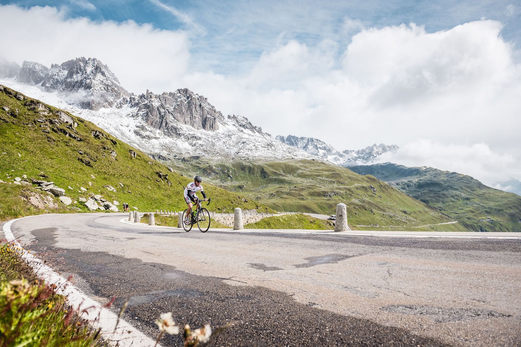
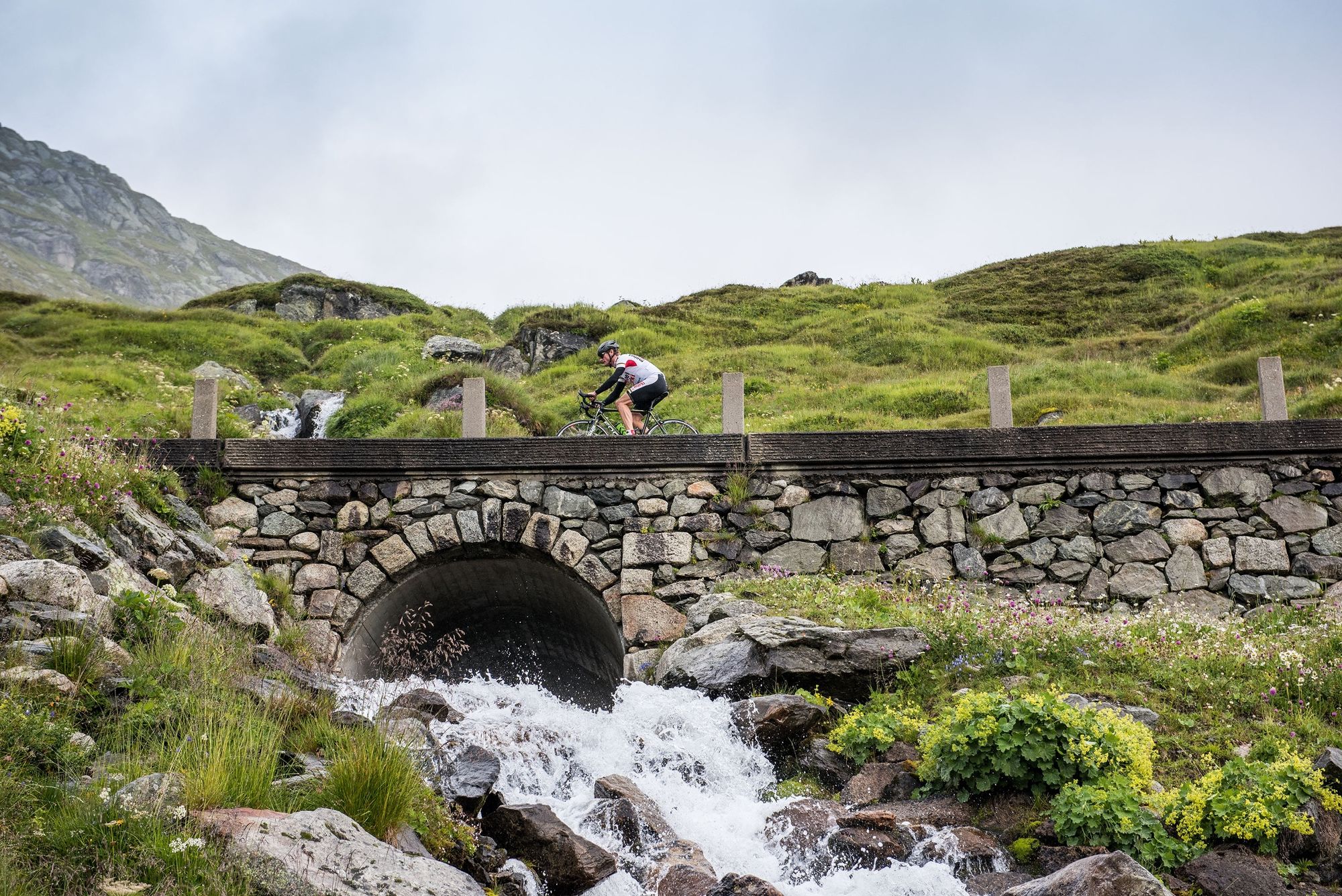
Around Andermatt are eight legendary alpine passes, all waiting to be crossed. The Gotthard Region offers fascinating alpine scenery, Swiss history, civil engineering masterpieces – and a wealth of bends!
- Teškoća
-
teška
- Vrednovanje
-
- Wegverlauf
-
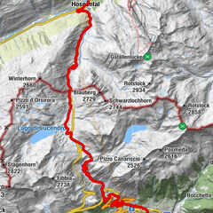
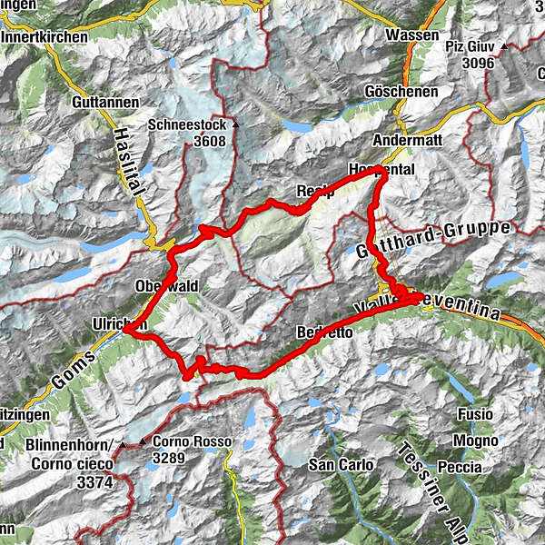
ObergadmenHospental (1.493 m)GüetliCentral0,0 kmZum Dörfli2,3 kmRealp (1.538 m)5,4 kmPfarrkirche Heilig Kreuz5,5 kmTiefenbach11,5 kmFurka16,0 kmRestaurant Furkablick16,0 kmGletsch (1.757 m)26,8 kmGletsch (1.759 m)27,0 kmRhonequelle29,9 kmSt. Niklaus31,9 kmOberwald (1.377 m)33,1 kmKirche Heilig Kreuz33,1 kmBinelti33,2 kmPizzeria al Ponte33,2 kmFurka33,3 kmObergesteln (1.355 m)36,3 kmHubertus36,3 kmUlrichen (1.346 m)37,7 kmWalser37,9 kmWeid38,7 kmNufenen-Passhöhe49,9 kmAll'Acqua60,8 kmCioss Prato61,5 kmSelva62,7 kmBedretto (1.402 m)64,5 kmVilla Bedretto65,2 kmOssasco66,7 kmBombel67,8 kmFontana68,6 kmCioss di Dentro69,6 kmCioss di Fuori70,8 kmAirolo (1.142 m)73,3 kmAirolo (1.175 m)73,4 kmSan Carlo73,8 kmFondo del Bosco75,8 kmScima du Bòsc'77,9 kmMotto Bartola78,0 kmTramiòra82,8 kmSan Gottardo85,4 kmScuderia85,6 kmAlte Sust85,6 kmOspizio del San Gottardo (2.091 m)85,6 kmGotthardpass 2106m86,2 kmMätteli91,2 kmGüetli94,5 kmObergadmen95,2 kmCentral95,2 kmHospental (1.493 m)95,3 km
- Beste Jahreszeit
-
sijveljožutrasvilipsrpkolrujlisstupro
- Höchster Punkt
- 2.478 m
- Zielpunkt
-
Hospenthal
- Höhenprofil
-
 © outdooractive.com


-

-
AutorDie Tour Three passes, three cantons and 3100 metres of elevation gain wird von outdooractive.com bereitgestellt.
GPS Downloads


Opće informacije
Einkehrmöglichkeit
Kulturell/Historisch
Aussichtsreich