© Oststeiermark Tourismus - Tourismusverband Oststeiermark

© Unbekannt - Maria Zingl

© Oststeiermark Tourismus - TV Joglland Waldheimat
- Kratak opis
-
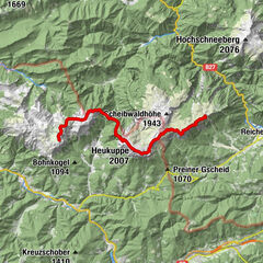
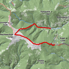
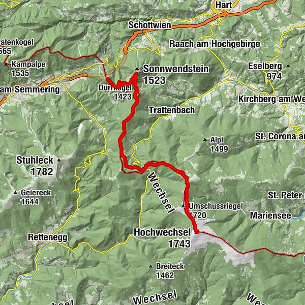
alpannonia is a 100 - 120 km long (depending on the variant chosen) long, continuously marked and signposted high-altitude and panoramic trail. Numerous feeder stations along the entire route make it easier to get started and also enable individual day tours. The entire route leads in five to six daily stages, initially from the alpine area of Peter Rosegger's forest home or from Semmering through the East Styrian Joglland to the Hochwechsel. We continue into the wooded low mountain ranges of the Buckligen Welt as well as the Bernstein and Günser Mountains to the vineyards near Köszeg. Stage 1: Semmering - Hochwechsel Length: 19.5 km Rising time: 6 hours
- Teškoća
-
srednje
- Vrednovanje
-
- Wegverlauf
-
Erzkogel (1.504 m)3,7 kmPoirhöhe (1.374 m)7,1 kmFanklbauerhöhe (1.304 m)8,7 kmFröschnitzsattel (1.273 m)9,3 kmKönigsbrünnlein10,0 kmSt.Wolfgangs-Kapelle10,1 kmKranichberger Schwaig15,5 kmDreiländereck15,9 kmHochwechsel (1.743 m)19,5 kmWetterkoglerhaus19,6 km
- Beste Jahreszeit
-
sijveljožutrasvilipsrpkolrujlisstupro
- Höchster Punkt
- 1.733 m
- Zielpunkt
-
Hochwechsel - Wetterkoglerhaus
- Höhenprofil
-


- Autor
-
Die Tour alpannonia stage Semmering - Hochwechsel wird von outdooractive.com bereitgestellt.
GPS Downloads


Opće informacije
Einkehrmöglichkeit
Heilklima
Kulturell/Historisch
Aussichtsreich
Weitere Touren in den Regionen
-
Hochsteiermark
4084
-
Semmering - Rax
2316
-
Trattenbach - Feistritzsattel
672