© Arbeitsgemeinschaft Biologischer Umweltschutz im Kreis Soest e.V - Michael Breitsprecher

Podaci o ruti
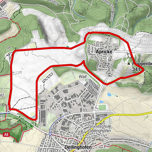
6,49km
276
- 330m
63hm
64hm
01:40h

- Kratak opis
-
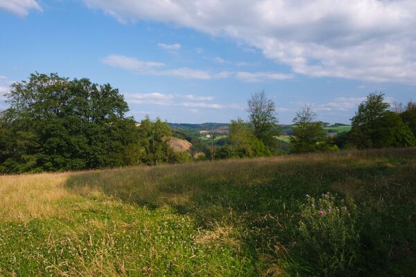
The former military training area is now a large area of pastureland grazed by herds of wild cattle, horses, goats and sheep. The flower-covered rough pastures are habitats and refuge for endangered plant and bird species.
- Teškoća
-
lagano
- Vrednovanje
-
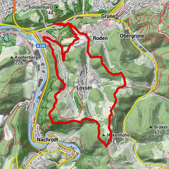
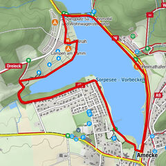
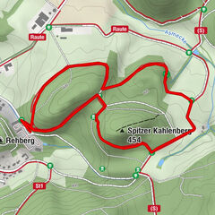
- Wegverlauf
-
IserlohnHemer (210 m)0,1 kmHoppenberg (341 m)3,0 km
- Beste Jahreszeit
-
sijveljožutrasvilipsrpkolrujlisstupro
- Höchster Punkt
- 330 m
- Zielpunkt
-
car park called "Eingang Deilinghofer Straße des Sauerlandparks Hemer" next to the sports ground.
- Höhenprofil
-
 © outdooractive.com


- Autor
-
Die Tour Apricke – pasture on the outskirts of Hemer wird von outdooractive.com bereitgestellt.
GPS Downloads


Opće informacije
Kulturell/Historisch
Flora
Fauna
Aussichtsreich