© Unbekannt - ADRT23

- Kratak opis
-
The "tour de Creuse" by bike is 100% discovery and the assurance of not being bored on a varied itinerary, adapted to all types of practitioners, families or experienced sportsmen. There is something for everyone!
- Teškoća
-
srednje
- Vrednovanje
-
- Wegverlauf
-
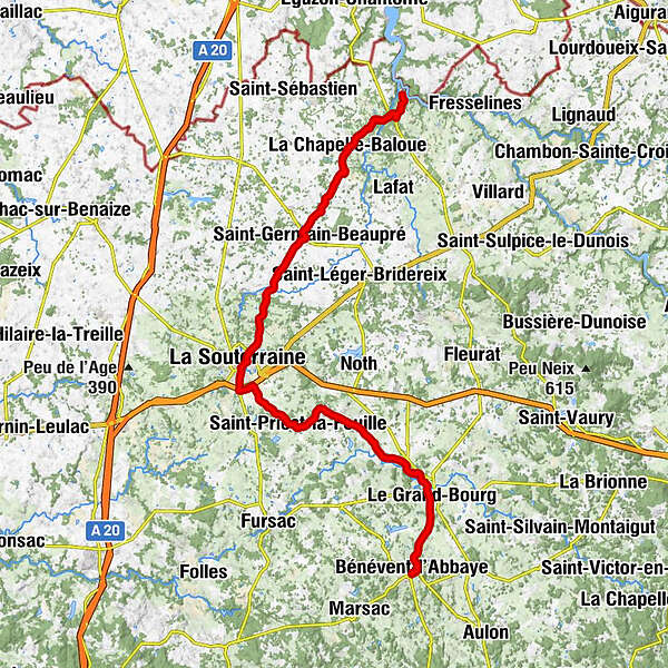
CrozantLes Granges0,6 kmPont Charraud2,2 kmLa Grange du Bois3,1 kmLes Coublins4,1 kmJosnon4,3 kmLe Goux4,8 kmBel-Air5,8 kmLa Chapelle-Baloue6,5 kmÉglise Notre-Dame de Lorette6,5 kmCorps de Garde6,7 kmPot Bouché8,4 kmLa Maisonbraud12,3 kmSaint-Germain-Beaupré13,5 kmL'Étang13,7 kmLe Bouchardon17,3 kmSaint-Agnant-de-Versillat17,9 kmMel Lou17,9 kmL'Aumône19,8 kmLa Souterraine23,4 kmSagnemoussouse27,6 kmLa Villeaubert28,8 kmÉglise Saint-Laurent30,3 kmSaint-Priest-la-Feuille30,4 kmAuberge des 4 Vents30,4 kmLa Feuille30,5 kmMaumas36,2 kmNibouleix38,1 kmChalibat39,5 kmLe Moulin du Pont39,9 kmSalagnac40,2 kmLa Grange42,3 kmLe Grand-Bourg42,4 kmLa Tuilerie43,6 kmLes Granges46,2 kmLe Petit Murat46,9 kmBénévent-l'Abbaye47,6 kmRagazza47,7 kmAu Bar Do47,7 km
- Beste Jahreszeit
-
sijveljožutrasvilipsrpkolrujlisstupro
- Höchster Punkt
- 484 m
- Zielpunkt
-
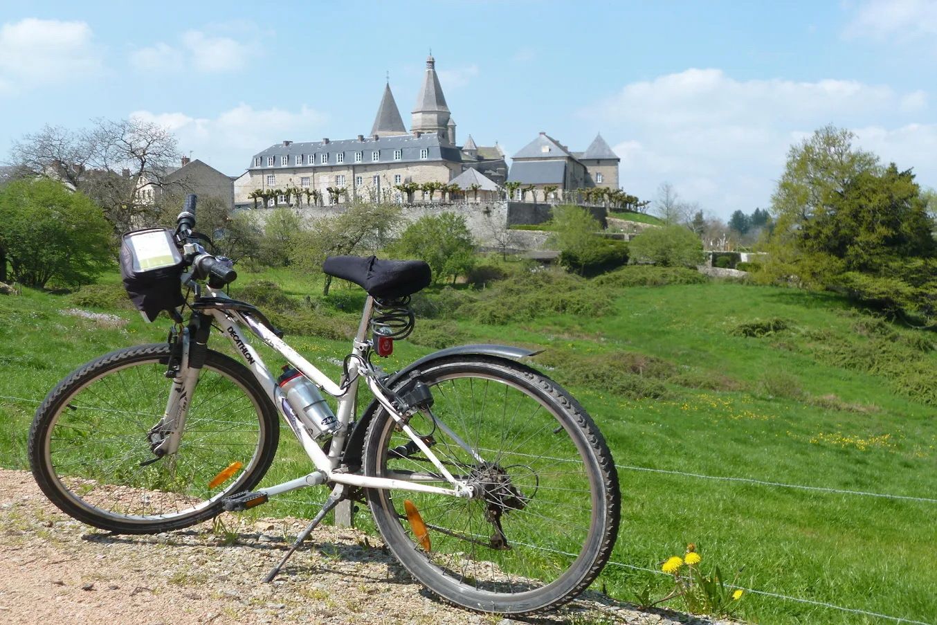
Bénévent l'Abbaye
- Höhenprofil
-
 © outdooractive.com
-

-
AutorDie Tour Tour de Creuse : Crozant > Bénévent l'Abbaye wird von outdooractive.com bereitgestellt.
GPS Downloads


Opće informacije
Einkehrmöglichkeit
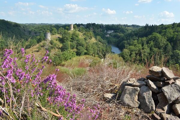
Kulturell/Historisch