© Tourismusverband Steyr Nationalpark Region - Schweighuber Renate

© Tourismusverband Steyr Nationalpark Region - Schweighuber Renate

© Tourismusverband Steyr Nationalpark Region - Schweighuber Renate

© Tourismusverband Steyr Nationalpark Region - Schweighuber Renate

- Kratak opis
-
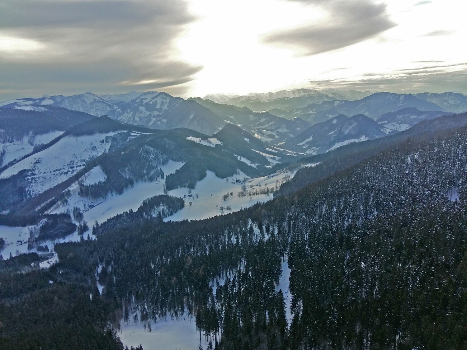
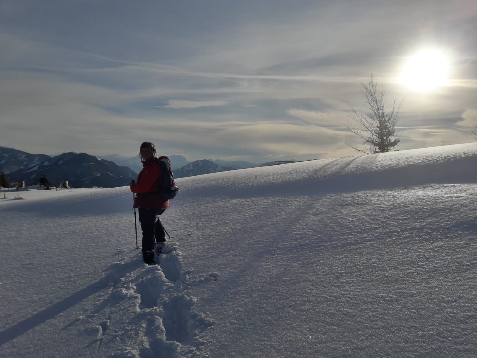
Summit circular trail starting from the snack station Hochramskogel with magnificent views over the Danube valley to the Mühlviertel, from the Tote Gebirge to the Haller Mauern and the Sengsengebirge.
- Teškoća
-
lagano
- Vrednovanje
-
- Wegverlauf
-
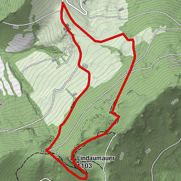
Lindaumauer (1.103 m)1,6 kmLindauerhöhle1,8 kmHeuriger Zöttl - Hochramskogler3,3 km
- Beste Jahreszeit
-
kolrujlisstuprosijveljožutrasvilipsrp
- Höchster Punkt
- 1.084 m
- Zielpunkt
-
Lindaumauer
- Höhenprofil
-


- Autor
-
Die Tour Lindaumauer from Gaflenz via Hochramskogel wird von outdooractive.com bereitgestellt.
GPS Downloads


Opće informacije
Aussichtsreich
Weitere Touren in den Regionen
-
Traunviertel
20
-
Moststraße
6
-
Maria Neustift
5