© TV Nationalpark Region Steyrtal

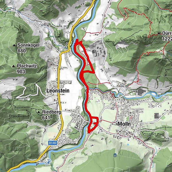
© Carto.at

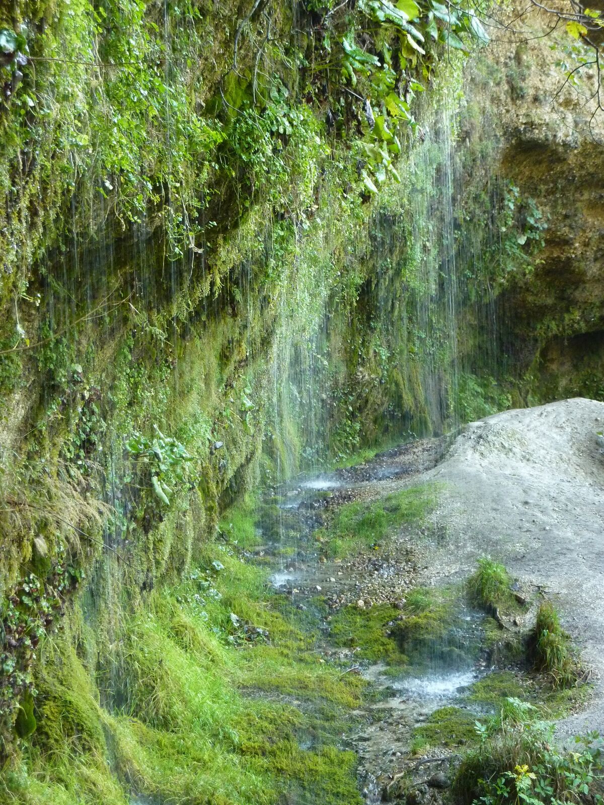
© Reinthaler

© Tman

- Kratak opis
-
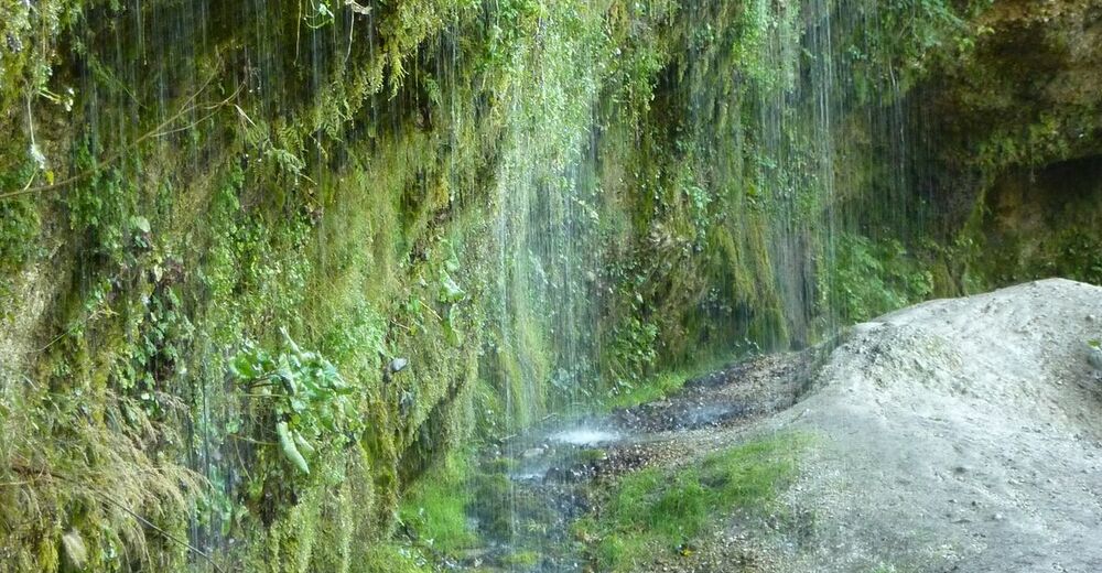
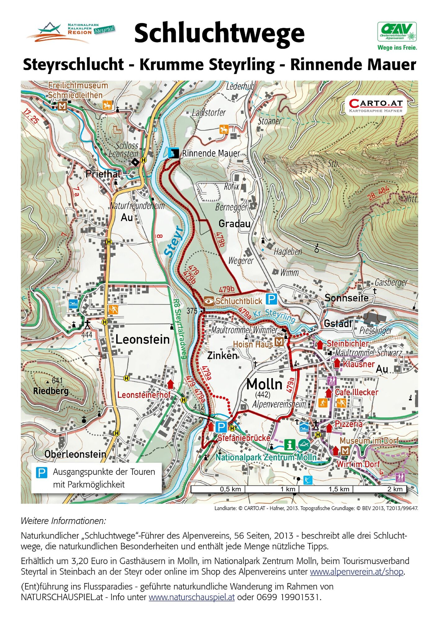
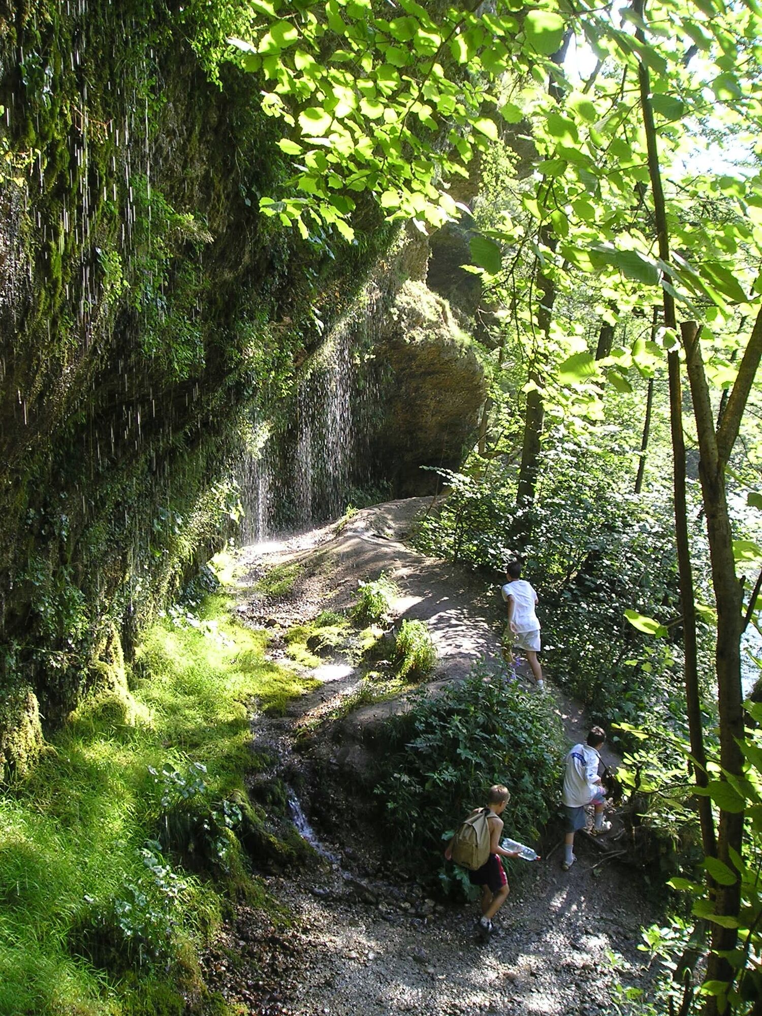
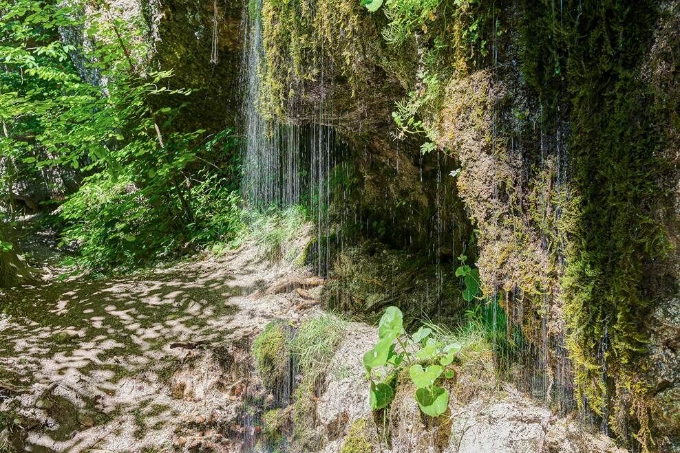
Trail in the Steyrschlucht nature reserve along the Steyr near the river below often overhanging conglomerate walls and at the top of the gorge with a magnificent view of the crystal-clear green Steyr.
- Teškoća
-
srednje
- Vrednovanje
-
- Wegverlauf
-
Pizzeria Restaurant Dolce Vita - Stefaniebrücke0,1 kmRinnende Mauer3,5 km
- Beste Jahreszeit
-
sijveljožutrasvilipsrpkolrujlisstupro
- Höchster Punkt
- 420 m
- Zielpunkt
-
Molln/Stefaniebrücke
- Höhenprofil
-

- Autor
-
Die Tour Rinnende Mauer - Schluchtweg wird von outdooractive.com bereitgestellt.
GPS Downloads


Opće informacije
Flora
Weitere Touren in den Regionen
-
Traunviertel
1940
-
Tourismusregion Bad Hall
770
-
Molln
374