


A fantastic hike that encompasses Collioure and Port-Vendres with their historical treasures (castle and defense system).
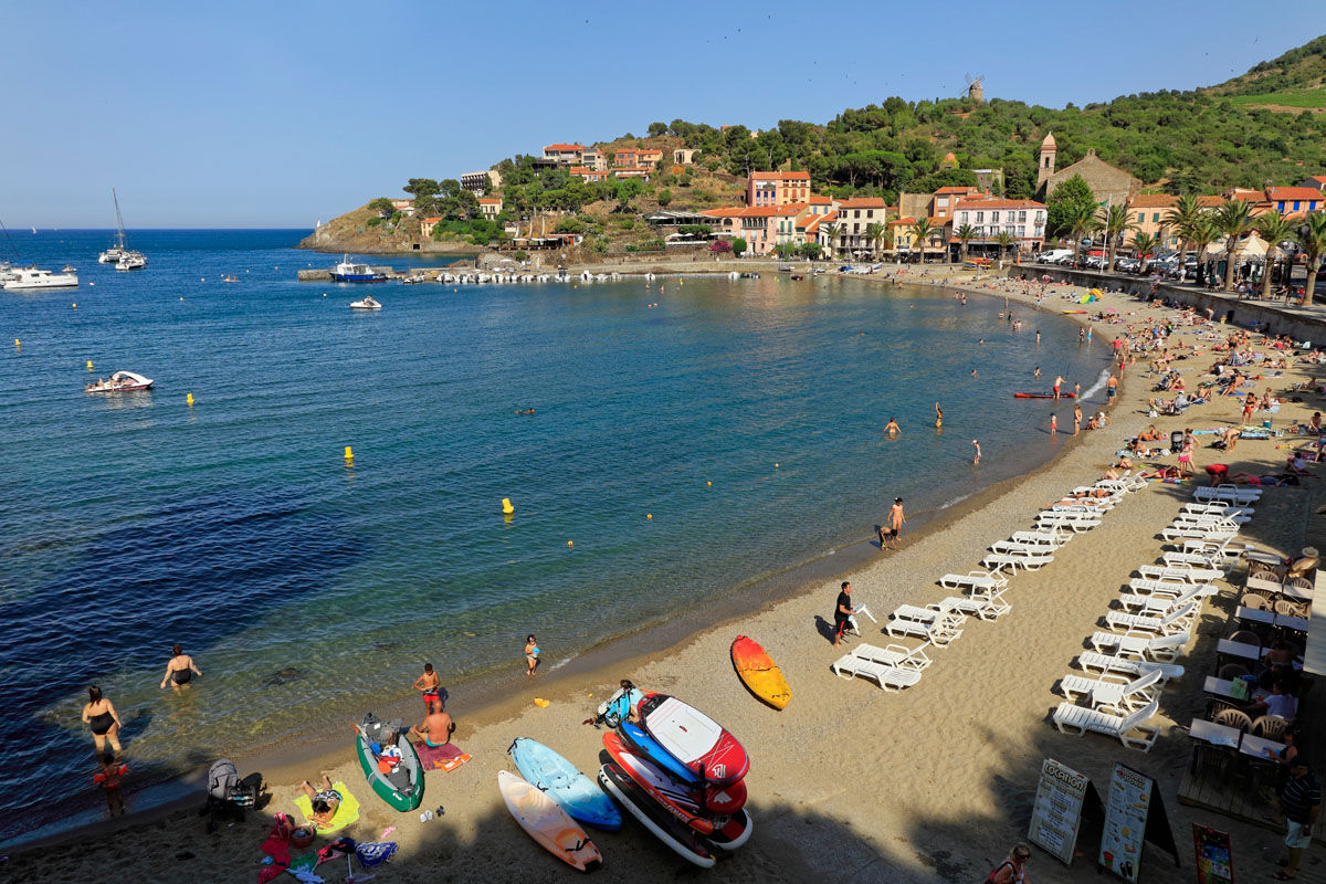
Start from the beach behind the Tourist Office and head towards the Royal Castle. Cross the bridge, then take the promenade that runs along the castle towards the Faubourg district.
Turn left towards the square and walk along the beach.
After the parking lot, turn left towards the Modern Art Museum and the cooperative winery, Le Cellier des Dominicains.
Gently climb the street to the left until you reach the windmill, then follow the path to Fort Saint-Elme. For more information, click here.
Head back right onto the Coll de Mala Cara path, walk 150 meters, and then take the lower path towards Val de Pinte. Arrive in Port-Vendres via the Strategic Road.
At this point, turn left and descend towards Place de la Castellane, then head towards the port, passing in front of the Tourist Information Office. Continue on Quai Forgas to the left.
Turn right to walk along the port.
Take the hairpin turn onto Rue Mitjaville to the left, then the first right and go straight on the coastal path. You’ll pass in front of the Fort de la Mauresque.
Continue following the marked coastal path towards Collioure. It runs along the Port-Vendres road (D114).
Arrive in Collioure and walk along Anse de la Baleta to retrace your steps back to the path you took earlier. Return to the Tourist Office.
En cas d'urgence, composez le 112
D914, D114
Bus 1€
Glacis Parking
Bring water, a cap or hat, walking shoes, and a snack. Respect nature. Take your litter with you.
Popular tours in the neighbourhood
-
Hauts des Forts Trail (Long Version)
mediumTrailrunning 21,8 km -
[Connection] Elne-Argelès-sur-Mer
mediumCestovni bicikl 12,3 km -
Rallye-enquête : Le linteau millénaire de Saint-Genis-des-Fontaines
mediumCestovni bicikl 28,6 km -
Madeloc
mediumPješačenje 8,83 km -
GR10 Pyrenäenweg Etappe 55
mediumDaljinska planinarska staza 23,2 km -
[Stroll] "the balconies" of Cosprons
lightMountainbike 6,77 km -
Catalan Getaway in the Pyrenees Mediterranean
mediumCestovni bicikl 62,4 km -
From Lavail to Valmy via the Tour de la Massane
mediumPješačenje 10,3 km -
"La Retirada" and the paths of exile
mediumPješačenje 5,26 km -
orienteering course of Laroque-des-Albères
lightTrailrunning 3,71 km
bergfex Tours


Ne propustite ponude i inspiraciju za vaš sljedeći odmor
Your e-mail address has been added to the mailing list.