© Heidiland Tourismus - Sereina Jost

© Heidiland Tourismus - Sereina Jost

© Heidiland Tourismus - Sereina Jost

- Kratak opis
-
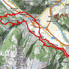
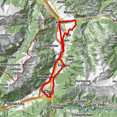
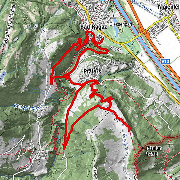
This tour climbs the Tamina bridge and the St. Margrethenberg plateau on a traffic-free road. With a wonderful view of the Bündner Rheintal you return to the valley.
- Teškoća
-
lagano
- Vrednovanje
-
- Wegverlauf
-
Bad Ragaz (516 m)0,7 kmPfäfers (820 m)5,2 kmTristeli9,3 kmSt. Margrethenberg10,8 kmSkilift Tristeli11,1 kmÄlpli11,7 kmPfäfers (820 m)14,0 kmGasthaus Gardona14,1 kmBad Ragaz (516 m)17,7 km
- Beste Jahreszeit
-
sijveljožutrasvilipsrpkolrujlisstupro
- Höchster Punkt
- 1.237 m
- Zielpunkt
-
E-Bike Station Bad Ragaz
- Höhenprofil
-
 © outdooractive.com


- Autor
-
Die Tour E-Bike St. Margrethenberg wird von outdooractive.com bereitgestellt.
GPS Downloads


Opće informacije
Einkehrmöglichkeit
Kulturell/Historisch
Flora
Fauna
Aussichtsreich