


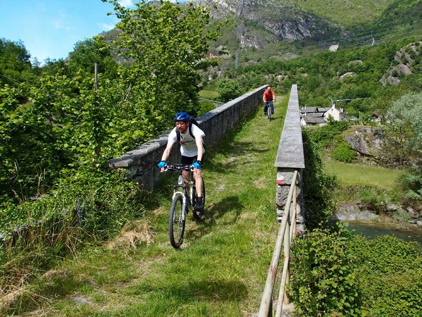
The proposed itinerary can only be done with mountain bikes and goes up the Antigorio Formazza Valley along tracks, mule tracks and secondary roads with low traffic. The route continues along the valley...
The proposed itinerary can only be done with mountain bikes and goes up the Antigorio Formazza Valley along tracks, mule tracks and secondary roads with low traffic. The route continues along the valley floor, crossing various towns and places of scenic and historical-artistic interest. The numerous accommodation and catering options along the valley allow you to choose the length of the stages depending on your level of preparation.

Yes
Pay attention to the traffic conditions on the state/provincial road.
Pay attention to the unpaved road at high altitude, which can only be partially cycled.
BIKE RENT
Cross Country Center / Cross Country Ski Club Riale c/o Hotel Aalts DorfLoc. Riale - 28863 Formazza VBTel. 380 3100773
Valmaggia sportsLoc. Valdo – 28863 Formazza VBMobile tel. +39 333 9168986
For descriptive reasons we have divided the route from Crevoladossola to Passo San Giacomo into three separate excursions:
Crevoladossola Lake Tana - Premia
Difference in altitude: 600 m uphill, 125 m downhill
Maximum altitude reached: 780 m above sea level (Premia)
Length: 18.0 km (one way)
Difficulty: Medium
Cyclability: TOTAL
Note: you cycle the hairpin bends of the Casse which, with the opening of the Fondovalle tunnel, are almost never travelled by car
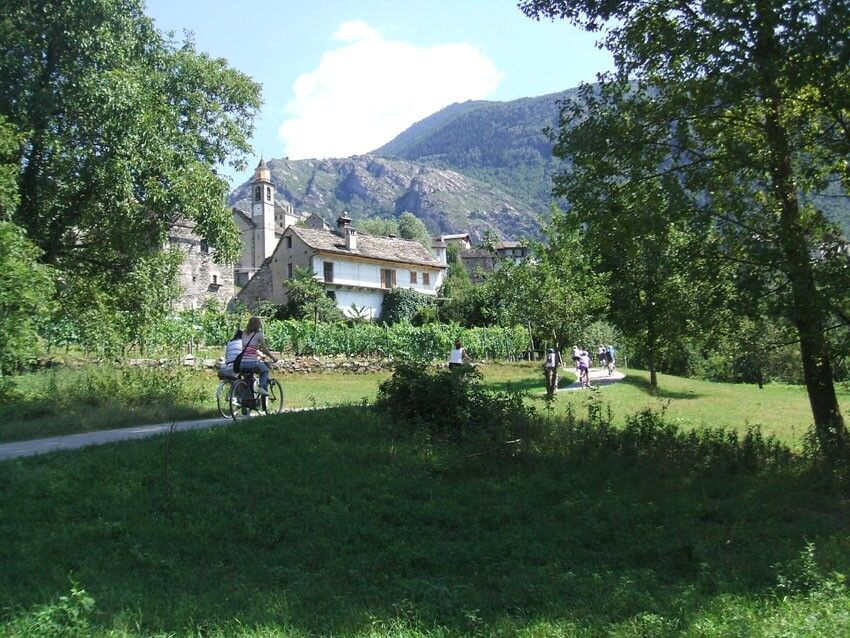
Points of interest: Natural area of Lake Tana, stone architecture in Oira and Pontemaglio, Visitor Center of the Veglia Devero Park in Crodo, ‘Marmitte dei giganti’ of Maiesso, Orridi di Uriezzo
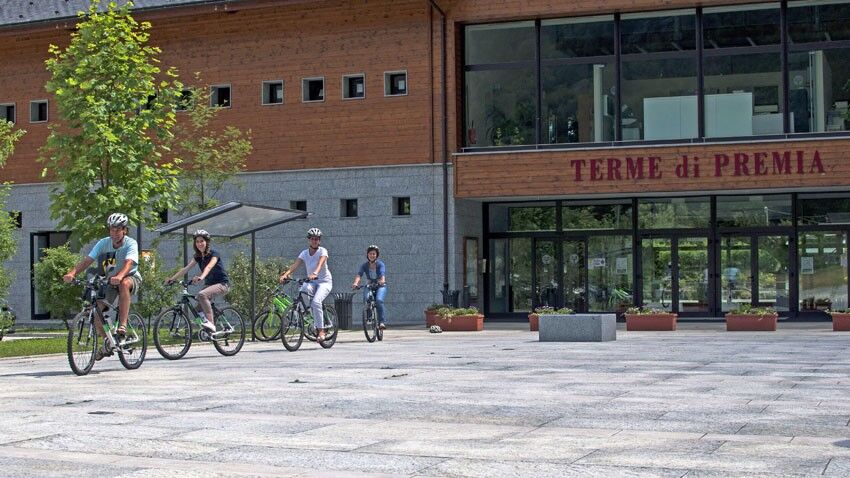
Premia - Bridge (Formazza)
Difference in altitude: 600 m uphill, 85 m downhill
Maximum altitude reached: 1286 m above sea level (Bridge)
Length: 18.0 km (one way)
Difficulty: Medium
Cyclability: Partial
Points of interest: Traditional stone architecture, Terme di Premia, Walser culture in Formazza, Casa Forte di Ponte
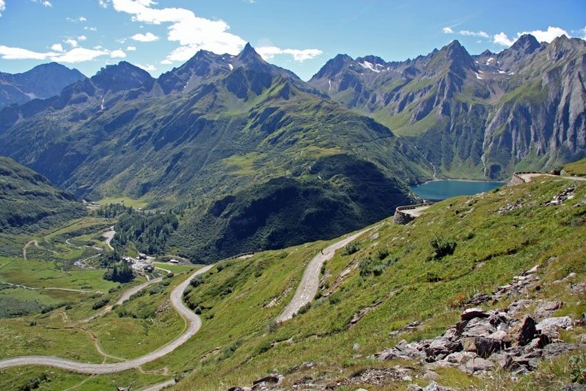
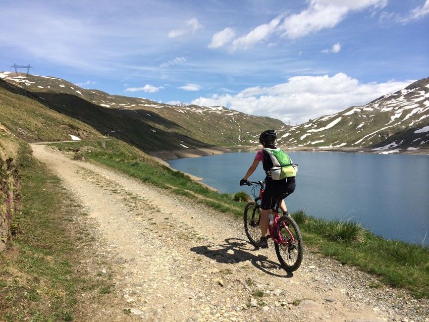
Bridge (Formazza) - San Giacomo Pass
Difference in altitude: 1060 m uphill, 35 m downhill
Maximum altitude reached: 2313 m above sea level (Passo San Giacomo)
Length: 16.2 km (one way)
Difficulty: Difficult
Cyclability: Partial
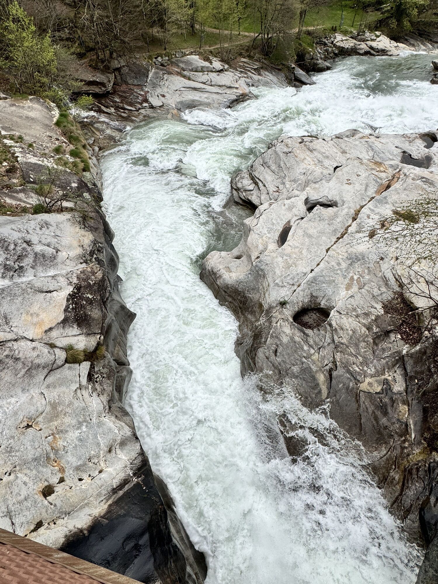
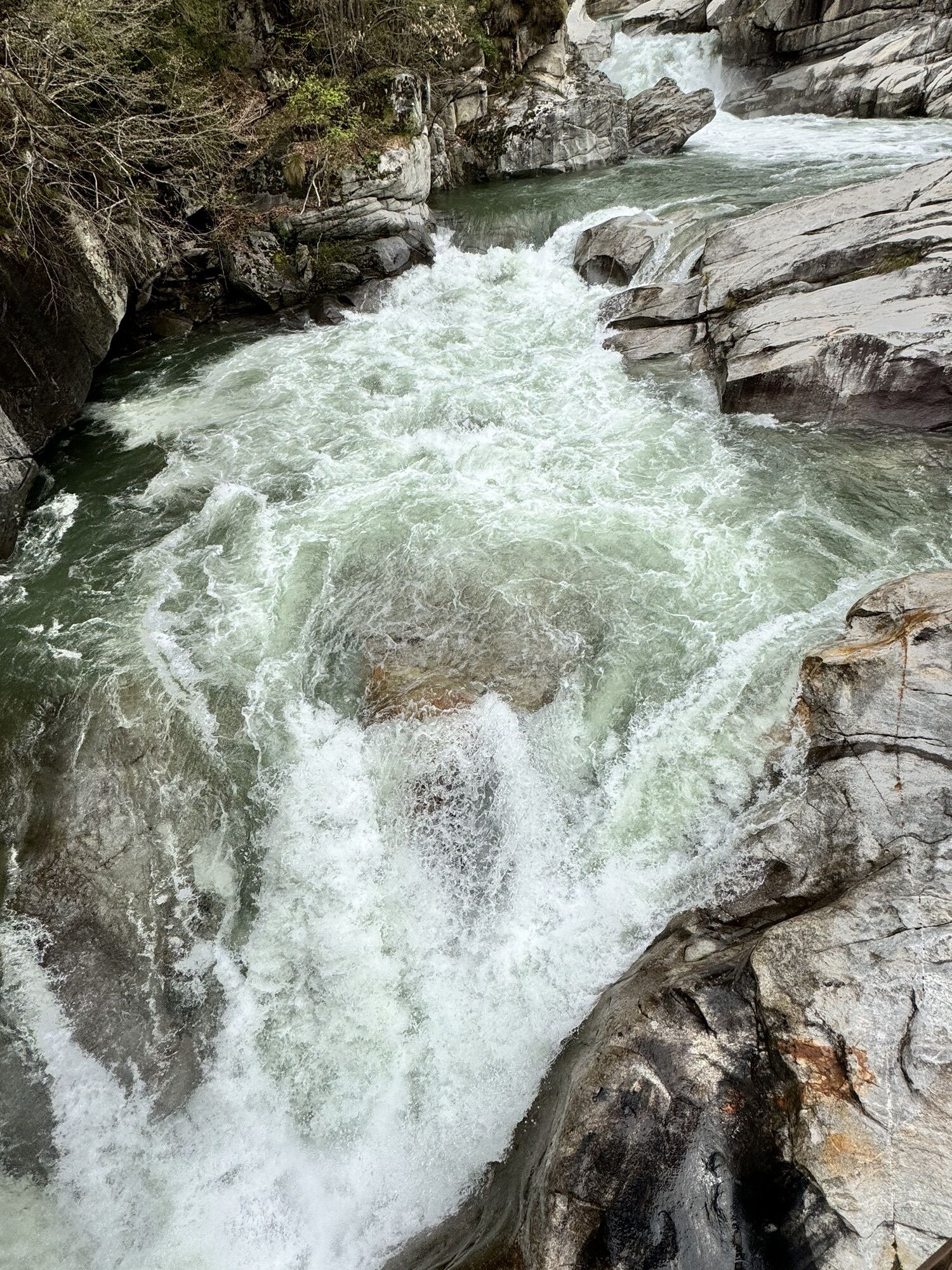
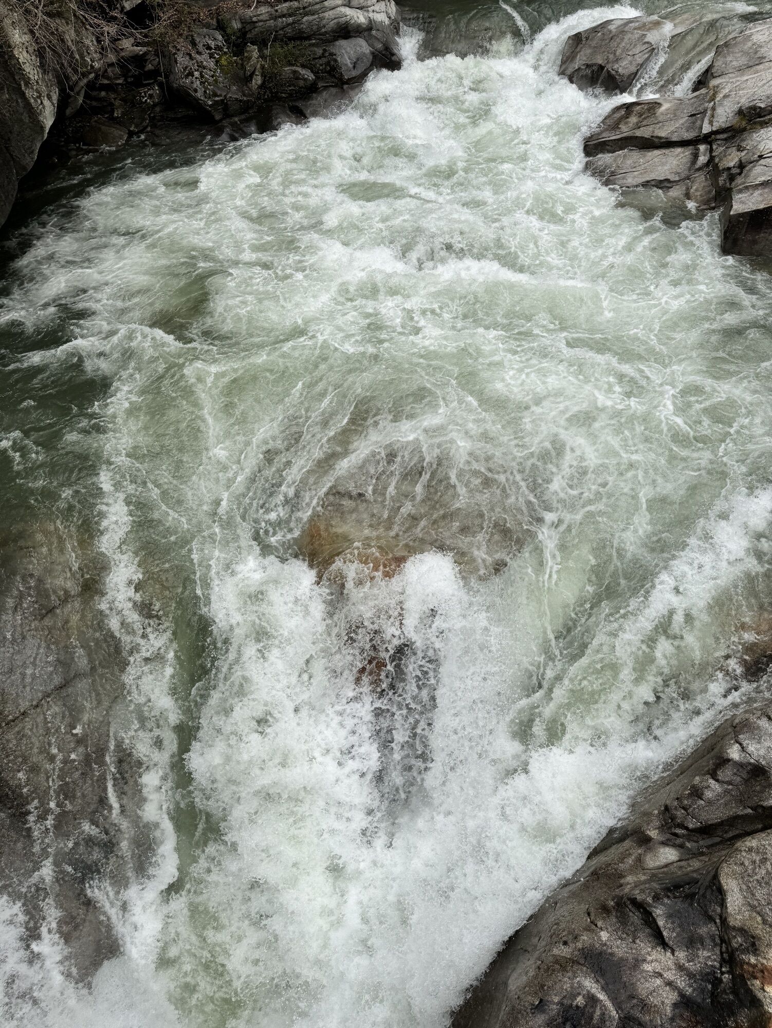
Points of interest: Toce Waterfall, Walser Culture in Formazza, Casa Forte di Ponte, Val Formazza Lakes
Popular tours in the neighbourhood
-
4,0
Foroglio-Calnègia-Foroglio
mediumPješačenje 8,37 km -
5,0
Bosco Gurin-Lago Melo-Lago Pero-Bosco Gurin
mediumPješačenje 10,6 km -
Tour Blinnenhorn
heavyPješačenje 106,6 km -
Tour Blinnenhorn
mediumDaljinska planinarska staza 109,5 km -
5,0
TESSIN | Foroglio
mediumPješačenje 3,86 km -
5,0
Cimalmotto-Alpe Magnello-Cimalmotto
mediumPješačenje 8,82 km -
Linescio-Campo Vallemaggia
mediumPješačenje 10,1 km -
Rundweg: Binn - Kaffeestaffel - Hockebode - Grossi Twäre - Giessen - Binn
mediumPješačenje 9,60 km -
Percorso Campo Vallemaggia (SwitzerlandMobility 965)
mediumSnježne krplje 4,85 km -
4,0
Val Bavona: Foroglio-Calnègia-Foroglio
mediumTematska staza 8,46 km
bergfex Tours


Ne propustite ponude i inspiraciju za vaš sljedeći odmor
Your e-mail address has been added to the mailing list.