Hôtel Saint-Roch - Église Saint-François d'Assise - Chapelle Saint-Pierre-ès-Liens - Refuge des Fonts de Cervières
heavy
Navigate
Navigate
Get this tour on your mobile
Hôtel Saint-Roch - Église Saint-François d'Assise - Chapelle Saint-Pierre-ès-Liens - Refuge des Fonts de Cervières
heavy
Cestovni bicikl
89,31
km
Scan the QR code and start navigation in the bergfex app

Hiking & Tracking


Distance
89,31
km
Duration
05:06
h
Ascent
2.415
m
Sea level
1.076 -
2.047
m
Track download
Hôtel Saint-Roch - Église Saint-François d'Assise - Chapelle Saint-Pierre-ès-Liens - Refuge des Fonts de Cervières
heavy
Cestovni bicikl
89,31
km


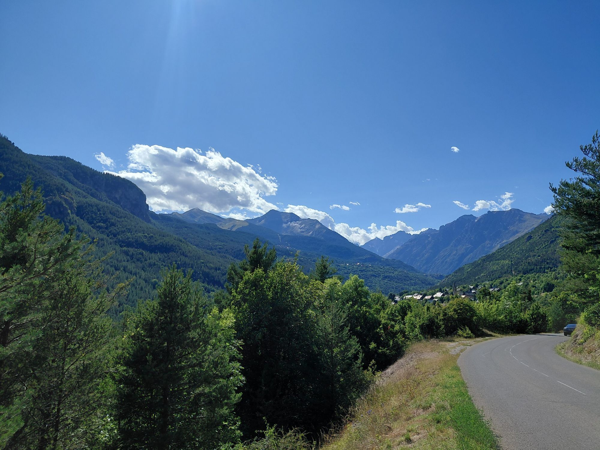
Route
Chapelle Saint-Roch
(1.397 m)
Place of worship
0,2 km
Chapelle Saint-Genest
(1.145 m)
Place of worship
5,6 km
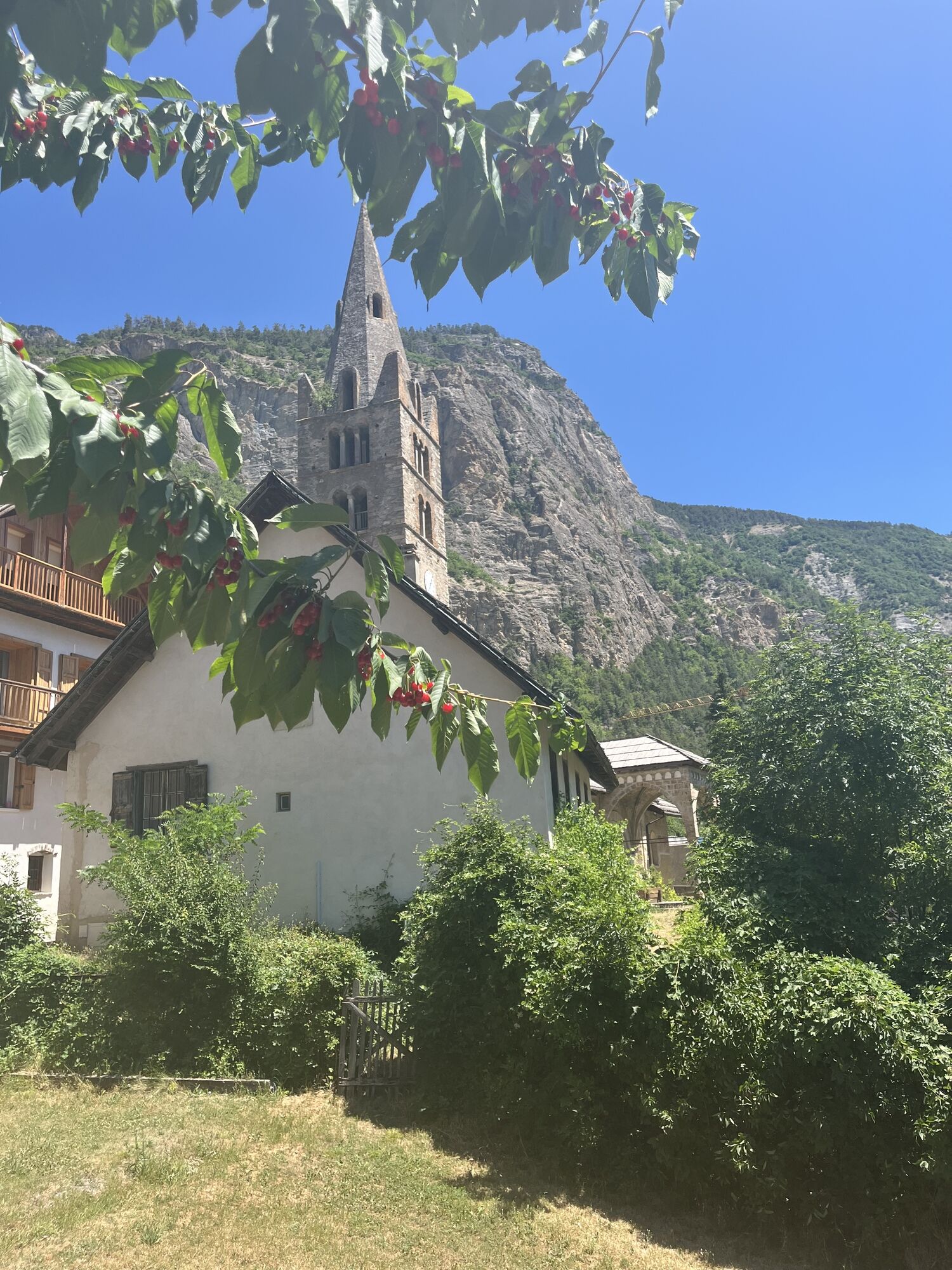
Église Saint-François d'Assise
(1.610 m)
Place of worship
34,2 km
Chapelle Saint-Pierre-ès-Liens
(1.971 m)
Place of worship
44,2 km
Refuge des Fonts de Cervières
(2.040 m)
Shelter
46,2 km
Chapelle Saint-Pierre-ès-Liens
(1.971 m)
Place of worship
48,2 km
Église Saint-François d'Assise
(1.610 m)
Place of worship
58,2 km
Route
Hôtel Saint-Roch - Église Saint-François d'Assise - Chapelle Saint-Pierre-ès-Liens - Refuge des Fonts de Cervières
heavy
Cestovni bicikl
89,31
km
Hôtel Saint-Roch
(1.410 m)
Restaurant
0,0 km
Chapelle Saint-Roch
(1.397 m)
Place of worship
0,2 km
Les Alberts
(1.377 m)
Settlement
0,4 km
Puy-Saint-Vincent
(1.407 m)
Village
0,6 km
Le Puy
(1.391 m)
Settlement
1,3 km
L'Aigliere
(1.378 m)
Restaurant
1,8 km
Cascade de la Pisette
(1.214 m)
Waterfall
3,6 km
Chapelle Saint-Genest
(1.145 m)
Place of worship
5,6 km
Petit Parcher
(1.150 m)
Settlement
6,6 km
Les Clots
(1.123 m)
Corridor/terrain
6,7 km
Les Vigneaux
(1.105 m)
Village
10,3 km
La Sagne
(1.080 m)
Settlement
12,4 km
Villard Meyer
(1.199 m)
Settlement
14,1 km
Chapelle Saint-Antoine
(1.208 m)
Place of worship
14,2 km
Prelles
(1.171 m)
Settlement
17,9 km
Le Villaret
(1.199 m)
Village
19,4 km
Église Saint-Blaise
(1.176 m)
Place of worship
21,4 km
Saint-Blaise
(1.186 m)
Settlement
21,6 km
Chamandrin
(1.182 m)
Settlement
22,1 km
Les Sagnes
(1.198 m)
Corridor/terrain
24,1 km
Les Gravières
(1.201 m)
Corridor/terrain
24,2 km
Les Mounières
(1.298 m)
Corridor/terrain
26,1 km
Briançon
(1.308 m)
City
26,2 km
Cros du Cabre Gueyt
(1.317 m)
Corridor/terrain
26,3 km
Font Christianne
(1.342 m)
Settlement
26,7 km
Église Saint-François d'Assise
(1.610 m)
Place of worship
34,2 km
Cervières
(1.619 m)
Village
34,9 km
La Chau
(1.908 m)
Settlement
39,4 km
Plaine du Bourget
(1.897 m)
Corridor/terrain
40,8 km
Le Bourget
(1.876 m)
Settlement
41,3 km
L'Étroit
(1.913 m)
Corridor/terrain
42,6 km
Pra Fauchier
(1.921 m)
Corridor/terrain
42,8 km
Gravière
(1.927 m)
Corridor/terrain
42,9 km
Dessous Pra Fauchier
(1.924 m)
Corridor/terrain
43,1 km
Pra Fauchier
(1.942 m)
Corridor/terrain
43,1 km
La Font
(1.931 m)
Corridor/terrain
43,3 km
Pied des Chalps
(1.964 m)
Corridor/terrain
43,7 km
Les Chalps
(1.973 m)
Settlement
44,1 km
Chapelle Saint-Pierre-ès-Liens
(1.971 m)
Place of worship
44,2 km
Fin des Chalps
(1.979 m)
Corridor/terrain
44,3 km
La Taque
(1.976 m)
Restaurant
44,5 km
Dessous Lavie
(1.991 m)
Corridor/terrain
44,8 km
Le Clottet
(2.015 m)
Settlement
44,9 km
Clottet
(2.021 m)
Corridor/terrain
45,0 km
La Sagne
(2.042 m)
Corridor/terrain
46,1 km
Refuge des Fonts de Cervières
(2.040 m)
Shelter
46,2 km
Les Fonts
(2.044 m)
Settlement
46,2 km
Clot de Louise
(2.021 m)
Corridor/terrain
47,0 km
Clottet
(2.021 m)
Corridor/terrain
47,3 km
Le Clottet
(2.015 m)
Settlement
47,5 km
Dessous Lavie
(1.991 m)
Corridor/terrain
47,5 km
La Taque
(1.976 m)
Restaurant
47,9 km
Fin des Chalps
(1.979 m)
Corridor/terrain
48,1 km
Chapelle Saint-Pierre-ès-Liens
(1.971 m)
Place of worship
48,2 km
Les Chalps
(1.973 m)
Settlement
48,3 km
Pied des Chalps
(1.964 m)
Corridor/terrain
48,7 km
La Font
(1.931 m)
Corridor/terrain
49,1 km
Pra Fauchier
(1.942 m)
Corridor/terrain
49,2 km
Dessous Pra Fauchier
(1.924 m)
Corridor/terrain
49,2 km
Gravière
(1.927 m)
Corridor/terrain
49,3 km
Pra Fauchier
(1.921 m)
Corridor/terrain
49,5 km
L'Étroit
(1.913 m)
Corridor/terrain
49,6 km
Le Bourget
(1.876 m)
Settlement
51,0 km
Plaine du Bourget
(1.897 m)
Corridor/terrain
51,4 km
La Chau
(1.908 m)
Settlement
53,0 km
Cervières
(1.619 m)
Village
57,5 km
Église Saint-François d'Assise
(1.610 m)
Place of worship
58,2 km
Font Christianne
(1.342 m)
Settlement
65,7 km
Cros du Cabre Gueyt
(1.317 m)
Corridor/terrain
66,1 km
Briançon
(1.308 m)
City
66,2 km
Les Mounières
(1.298 m)
Corridor/terrain
66,3 km
Les Toulousanes
(1.202 m)
Corridor/terrain
68,3 km
Villar-Saint-Pancrace
(1.233 m)
Village
70,3 km
Bastardy
(1.239 m)
Corridor/terrain
72,0 km
Saint-Jean
(1.244 m)
Corridor/terrain
72,3 km
Les Bessées de Saint-Jean
(1.224 m)
Corridor/terrain
72,7 km
Le Villaret
(1.199 m)
Village
73,3 km
Saint-Martin-de-Queyrières
(1.175 m)
Village
76,0 km
Prelles
(1.171 m)
Settlement
77,0 km
Chapelle Saint-Antoine
(1.208 m)
Place of worship
80,6 km
Villard Meyer
(1.199 m)
Settlement
80,7 km
La Sagne
(1.080 m)
Settlement
82,4 km
Les Vigneaux
(1.105 m)
Village
84,5 km
Les Alberts
(1.377 m)
Settlement
88,9 km
Puy-Saint-Vincent
(1.407 m)
Village
88,9 km
Chapelle Saint-Roch
(1.397 m)
Place of worship
89,1 km
Hôtel Saint-Roch
(1.410 m)
Restaurant
89,3 km
No reviews yet
Popular tours in the neighbourhood
-
Claviere - Fort Chaberton
heavyPlaninarenje 17,6 km -
Cima dormillouse
lightSkijaška tura 18,7 km -
CESANA T.SE Bousson - Black Lake
mediumSnježne krplje 4,68 km -
5,0
CESANA - CLAVIERE Mount Chaberton 3,131 m
heavyPješačenje 8,41 km -
Chaberton Tour: Stage 2 Cesana Torinese - Claviere
heavyPješačenje 30,1 km -
GR® 5 La grande traversée des Alpes
mediumPješačenje 95,5 km -
Monti della Luna trail (Cesana T.se)
mediumMountainbike 28,1 km -
MTB ring tour "Cesana - Sgnalonga - Fonte Tana - Lago Nero"
lightMountainbike 22,0 km -
Lake Ginoux / "of the 7 colors"
heavyPješačenje 7,44 km -
Trail Sentiero Balcone: Stage 7 Cesana Torinese - Sauze di Cesana
mediumPješačenje 30,5 km
bergfex Tours

Over 550.000 tour suggestions, detailed maps and an intuitive route planner make the app a must-have for all nature enthusiasts.

Ne propustite ponude i inspiraciju za vaš sljedeći odmor
Subscribe to the newsletter
Error
An error has occurred. Please try again.
Thank you for your registration
Your e-mail address has been added to the mailing list.
Tours throughout Europe
Austrija
Švicarska
Njemačka
Italija
Slovenija
Francuska
Nizozemska
Belgija
Poljska
Lihtenštajn
Češka
Slovačka
Španija
Hrvatska
Bosna i Hercegovina
Luksemburg
Andora
Portugal
Island
Ujedinjeno Kraljevstvo
Irska
Grčka
Albanija
Sjeverna Makedonija
Malta
Norveška
Crna Gora
Moldova
Kosovo
Mađarska
San Marino
Rumunjska
Estonija
Latvija
Bjelorusija
Cipar
Litva
Srbija
Bugarska
Monako
Danska
Švedska
Finska