© EVAdinarica Project - EVA dinarica

© EVAdinarica Project - EVA dinarica
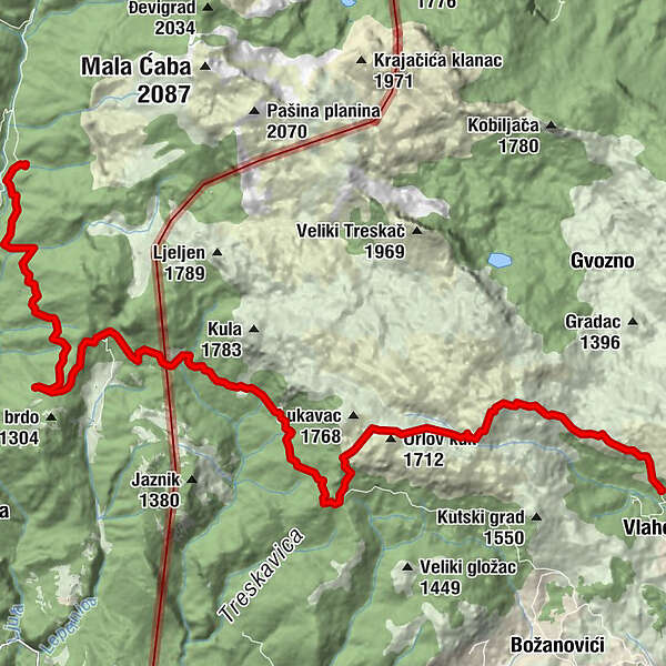

- Kratak opis
- Höchster Punkt
- 1.702 m
- Höhenprofil
-
 © outdooractive.com
-

-
AutorDie Tour Vlaholje - Ljuta (Via Dinarica day 26) wird von outdooractive.com bereitgestellt.