© https://500px.com/AdnanBubalo - adnan bubalo

© Terra Dinarica - Adnan Bubalo

© http://bit.ly/1WWFRr5 - Adnan Bubalo

© Terra Dinarica - Adnan Bubalo

© Terra Dinarica - Adnan Bubalo

© Terra Dinarica - Adnan Bubalo

© Terra Dinarica - Adnan Bubalo

© Terra Dinarica - Adnan Bubalo

© Terra Dinarica - Adnan Bubalo

© Terra Dinarica - Olja Latinovic


- Kratak opis
-
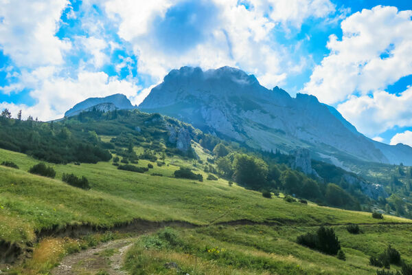
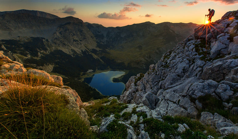
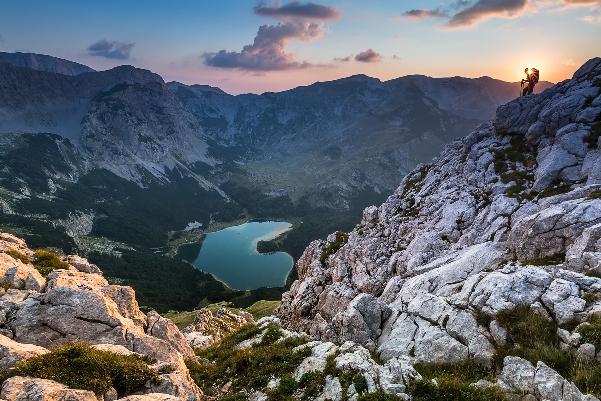
Challenging mountain hike to the highest summit of Bosnia and Herzegovina. Includes scrambling all the way up to Maglić ridge, but it's worth the view!
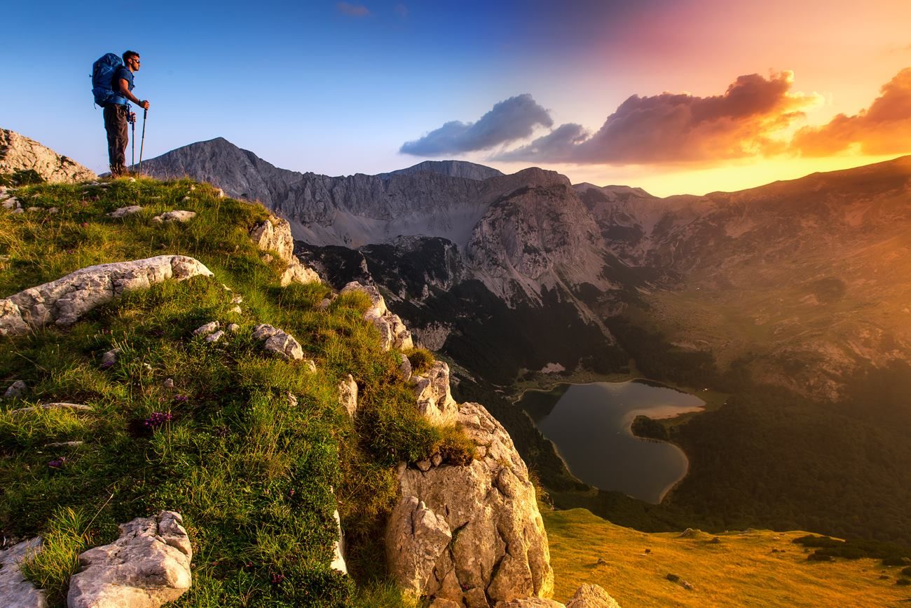
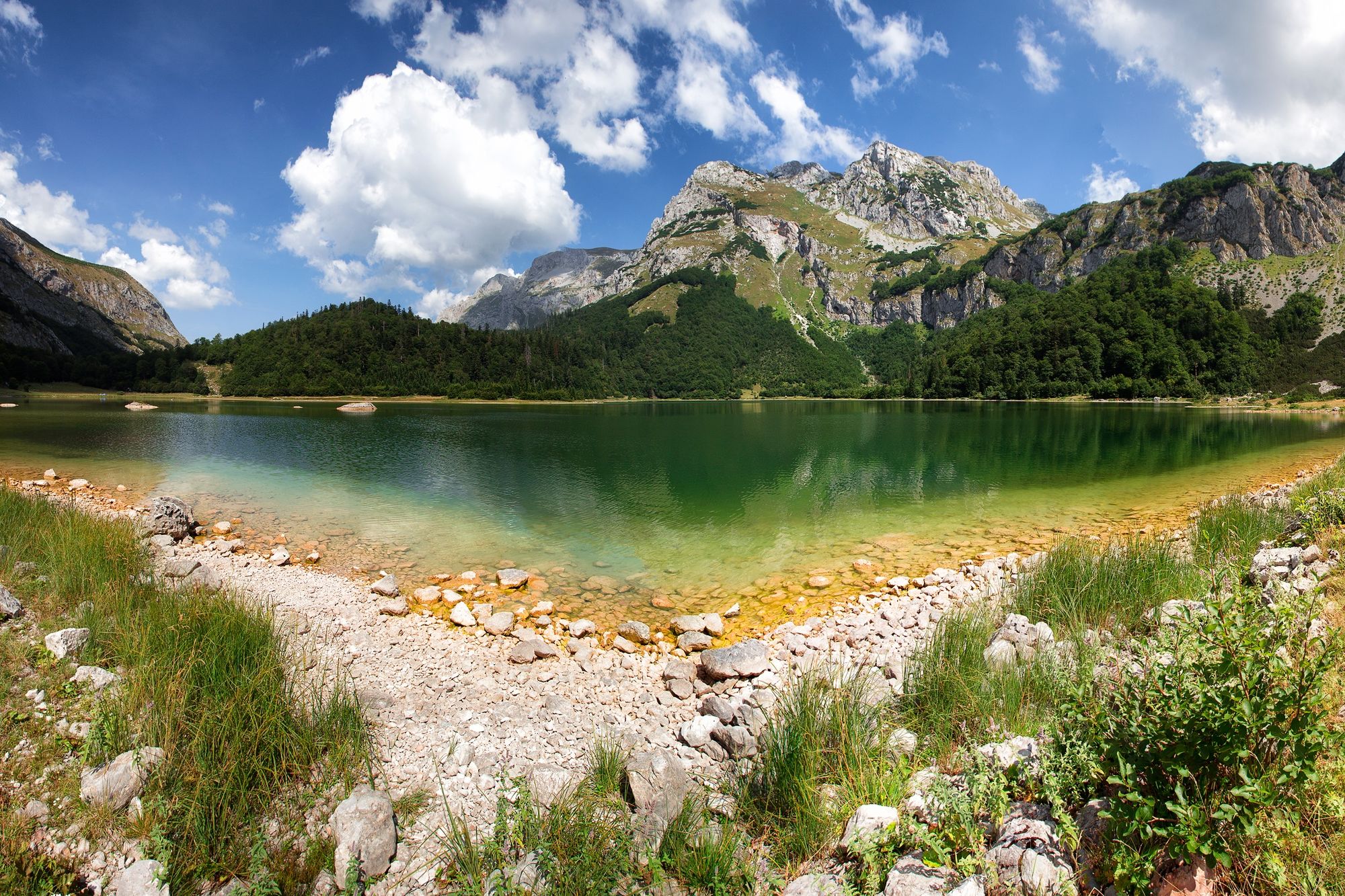
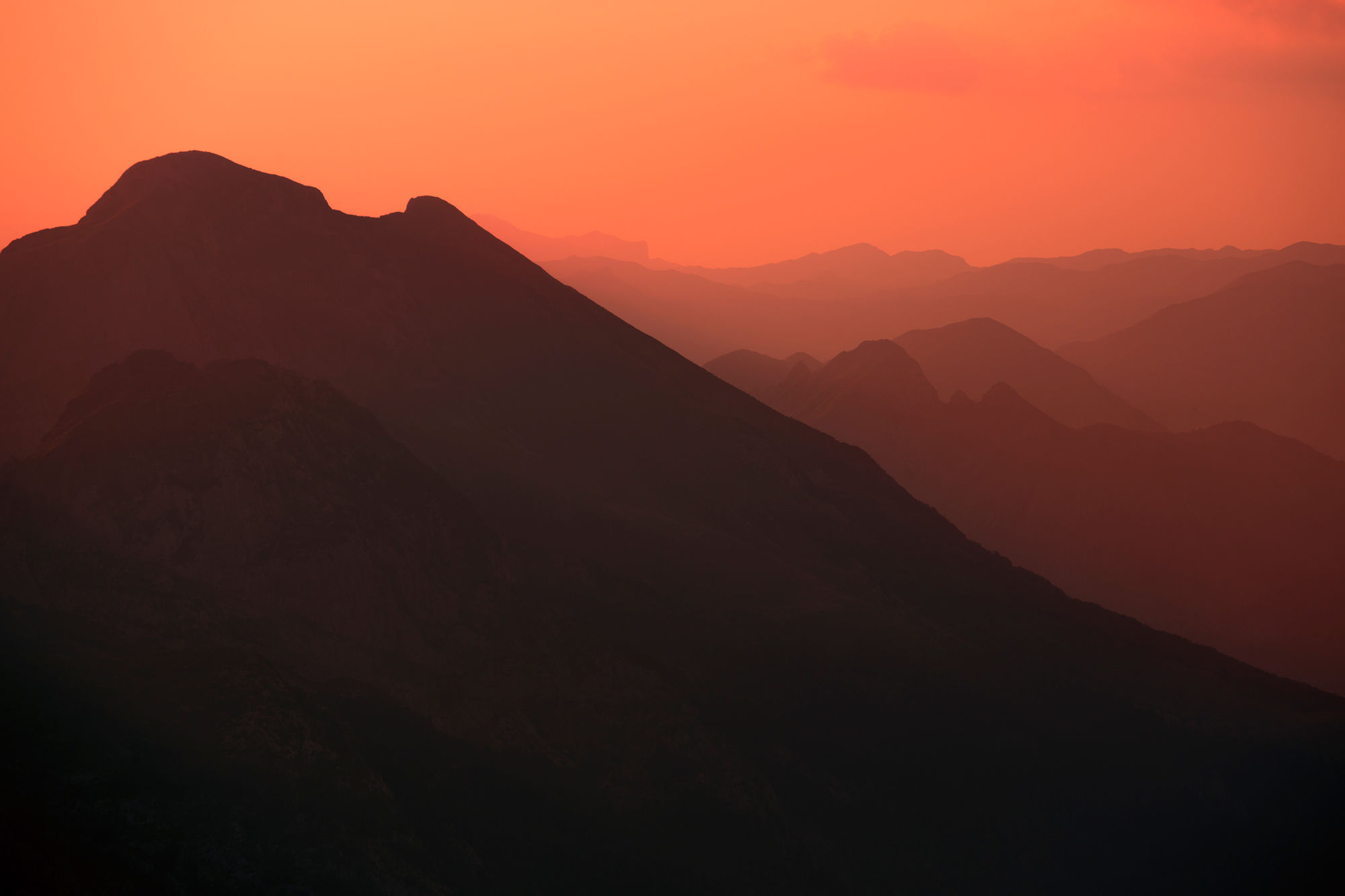
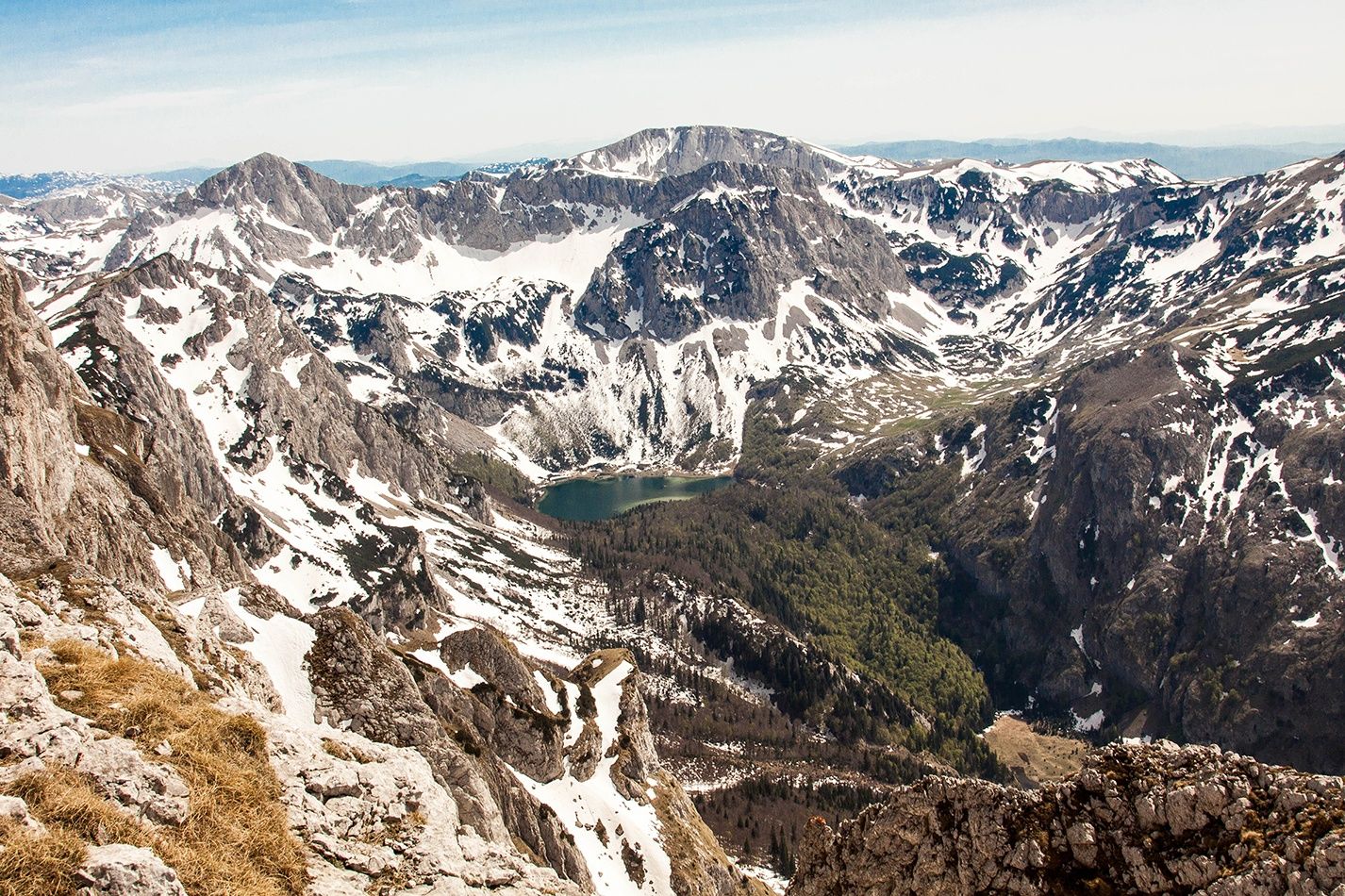
There are spectacular views of Volujak, Bioč, Zelengora, Trnovački Durmitor and the heart-shaped Trnovačko lake.
- Teškoća
-
teška
- Vrednovanje
-
- Wegverlauf
-
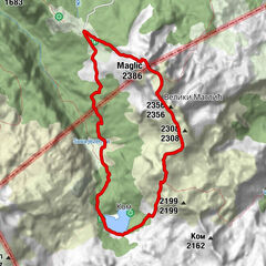
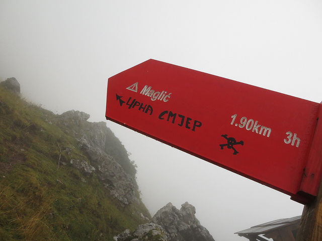
Maglić (2.386 m)2,0 kmVeliki Maglić (2.389 m)2,7 km2356 (2.356 m)3,1 km2232 (2.232 m)4,9 kmCarev Do5,3 km
- Beste Jahreszeit
-
sijveljožutrasvilipsrpkolrujlisstupro
- Höchster Punkt
- 2.353 m
- Zielpunkt
-
Prijevor
- Höhenprofil
-
 © outdooractive.com


-

-
AutorDie Tour Maglić from Prijevor to Trnovačko Lake wird von outdooractive.com bereitgestellt.
GPS Downloads


Opće informacije
Aussichtsreich