


The cross-border Glan-Blies Cycle Route runs for 130 km from Sarreguemines in Lorraine through the Bliestal valley and the Kuseler Musikantenland along the Glan to Staudernheim (Nahe). The route’s proximity...
The cross-border Glan-Blies Cycle Route runs for 130 km from Sarreguemines in Lorraine through the Bliestal valley and the Kuseler Musikantenland along the Glan to Staudernheim (Nahe). The route’s proximity to the rivers gives it a flat profile and also offers a unique range of very diverse landscapes. For long stretches, the path follows disused railway tracks, or runs parallel with the draisine railway line, away from busy roads. The route is therefore particularly suitable for families with children.
The Glan-Blies Cycle Route connects to the Saarland network in the south-west and merges onto the Nahe Cycle Route in the north. Between Waldmoor and Altenglan, it shares a section of the Rhineland-Palatinate Cycle Route.


Sarreguemines – Blieskastel, approx. 34 km
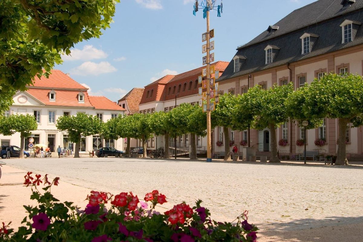
The town of Sarreguemines is located at the point where the Blies river flows into the Saar and is famous for its ceramics industry. We recommend a visit to the casino, which enjoys an idyllic location on the banks of the Saar. You pedal through the Bliesgau Biosphere Reserve until you reach Gersheim, which has a huge orchid plantation. Continuing along the idyllic Blies, you soon arrive at your overnight destination of Blieskastel. The city is part of the Saar-Palatinate Baroque Route and is a Kneipp spa resort. You will love the picturesque old town with its fountains, courtyards and Baroque buildings.
Blieskastel – Waldmohr, approx. 34 km
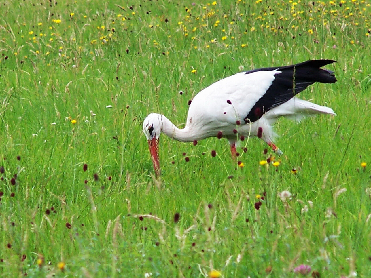
After a very short time in the saddle, you reach Schwarzenacker Roman Museum. You pass through Beeden, famous for its sizeable stork population, before reaching Homburg, where the Schlossberghöhlen Caves, Hohenburg Castle Ruins and Karlsberg Castle are well worth a visit. The fisherman’s hut at Mohrmühlweiher pond near Waldmohr is a great place to stop for a break, and is located directly on the cycle path.
Waldmohr – Altenglan, approx. 30 k
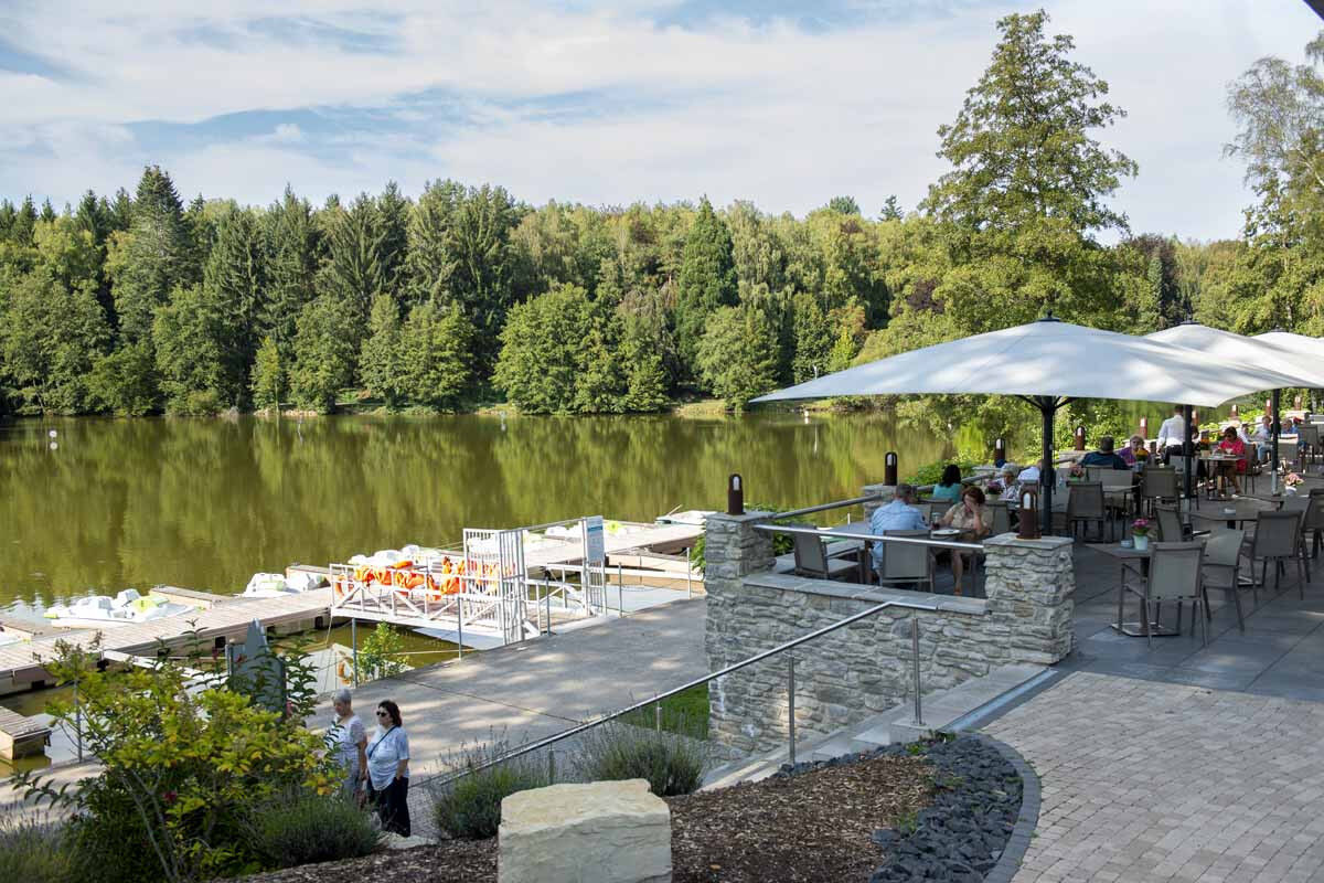
Varied landscapes and paths. From Waldmohr, the route continues along the former Glan Valley Railway. After Schönenberg-Kübelberg, it is worth taking a detour to Lake Ohmbachsee and the Diamond-Cutting Museum (alternative route 1). Here you can enjoy views of a natural area that has been untouched for many years. This cycle route is characterised by pretty towns, direct access to restaurants along the route, and quiet side streets with no traffic.
Altenglan - Staudernheim, approx. 40 km
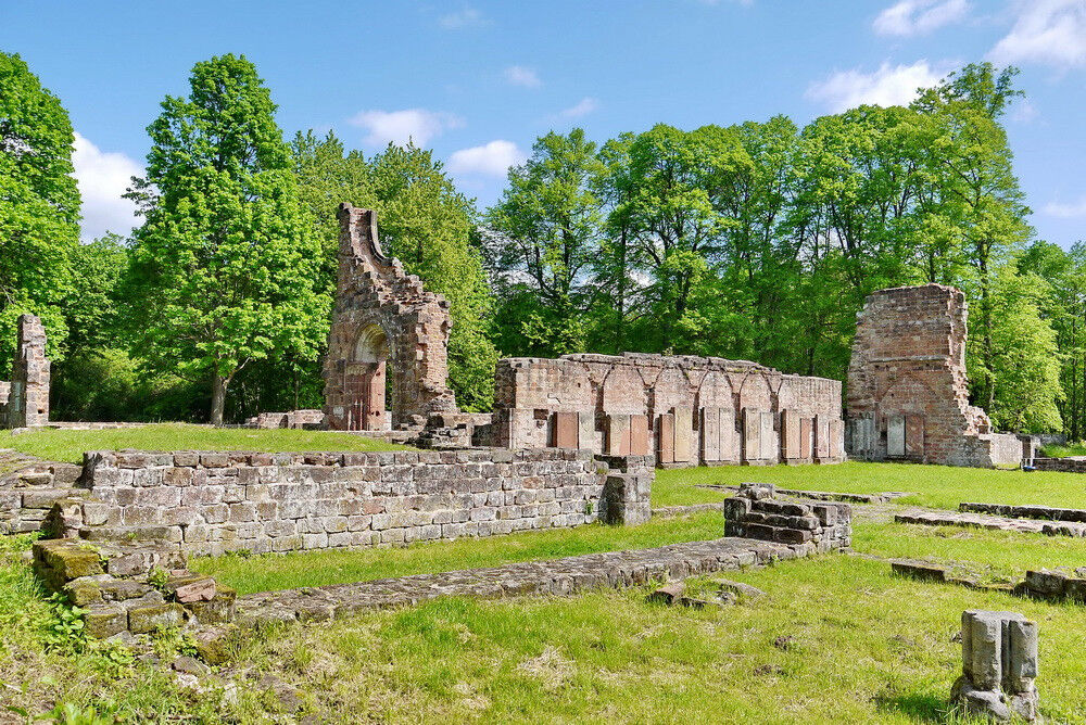
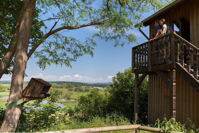
From Altenglan, the cycle route runs largely parallel to the draisine railway line. The beautiful landscape contains a wealth of hidden gems for the cyclist to discover. The bike almost seems to coast along by itself through the Glan river valley. Anyone who fancies a little climb can pedal their way up the alternative route past Hirsauer Kapelle church. (Alternative route 2) There is plenty of hustle and bustle at Lauterecker train station – change onto the draisine railway line (reservation required), pick up the Lauter Valley Cycle Route or stop for some cool refreshment. The cycle route follows the Glan through the fields, where there is magic in the air. The next stop on the route is Meisenheim: the historic old town is well worth a detour. The mouth of the Nahe is already in sight as you reach the ruined monastery of Disibodenberg, where Hildegard von Bingen lived and worked. The Glan-Blies Cycle Route joins the Nahe Cycle Route at the draisine railway line booking office in Staudernheim.
Yes
Fahrradhelm, Reparaturmaterial u.v.m. finden Sie in unserer Packliste auf der Internetseite.
Nur sehr wenige Streckenabschnitte sind nicht asphaltiert. Feine Waldböden oder auch geschotterte Wege bilden dort neben den asphaltierten Wegen die Beschaffenheit der Rad-Tour. Nur sehr wenige Steigungen sind auf der Tour zu finden. Eventuelle Umleitungen finden Sie in unseren „Bedingungen“ in der Kartengrundlage.
Der Glan-Blies-Weg eignet sich ideal um mit Bahn und Bus anzureisen, oder den ÖPNV für den Rücktransfer nach einer Streckenetappe zu nutzen.
Am südlichen End-/Startpunkt in Sarreguemines besteht über die Saarbahn-Linie S1 ein stündlicher Anschluss ab Lebach oder Saarbrücken. Am Homburger Hauptbahnhof besteht unter anderem Anschluss an die Regionalbahnen aus Richtung Neunkirchen/St. Wendel sowie aus Saarbrücken, Kaiserslautern/Mannheim. Im Verlauf des Glan-Blies-Weges zwischen Sarreguemines und Homburg fährt der täglich und stündlich verkehrende „Biosphärenbus“ der Linie 501 überwiegend parallel zur Radroute, sodass hier ein flexibles Ein- und Aussteigen möglich ist.
Zwischen Homburg und Staudernheim bestehen weitere Bahnanschlüsse Richtung Kaiserslautern über die Regionalbahnen RB 66 und RB 67. Der nördliche End-/ Startpunkt des Glan-Blies-Weges ist über die Bahnlinien RE3 (Saarbrücken-Frankfurt) sowie die RB 33 (Mainz-Idar-Oberstein) und RB 34 (Baumholder-Bad Kreuznach) erreichbar.
Die Fahrradmitnahme in Bussen und Bahnen ist im SaarVV unter der Woche ab 9:00 Uhr und am gesamten Wochenende kostenlos. Räder können nur bei ausreichender Platzkapazität mitgenommen werden.
Der kostenlose Parkplatz am Bahnhof in Sarreguemines bietet den optimalen Einstieg in die Tour. Wenn Sie ab Reinheim oder Blieskastel radeln möchten, sind die kostenfreien Parkplätze am Europäischen Kulturpark, in der Florianstraße in Blieskastel sowie am Lautzkircher Bahnhof optimal.
Wenn Sie ab Staudernheim fahren möchten, bietet sich der Parkplatz am Bahnhof zum Parken an.
Saarpfalz-Touristik
Paradeplatz 4
66440 Blieskastel
Tel. +49 (0) 6841 - 104-7174
Haben Sie einen Mangel auf der Tour entdeckt? Dann melden Sie diesen mit Hilfe unseres Mängelmelders: https://bit.ly/MaengelmelderBliesgau. Vielen Dank für Ihre Mithilfe.
Tourismus Zentrale Saarland
Tel.: 0681 - 9 27 20 - 0
Tourist–Information Pfälzer Bergland
Tel.: 06381 / 42 42 70
Naheland-Touristik GmbH
Tel.: 06752 / 13 76 10
Einkehrmöglichkeiten finden sich in Sarreguemines sowie entlang der Strecke im Biosphärenreservat Bliesgau zwischen Reinheim und Homburg. Ebenso die Innenstädte von Blieskastel und Homburg haben einige Einkehrmöglichkeiten zu bieten. Die Nachbarn in Rheinland-Pfalz locken mit Betrieben in Waldmohr und Schönenberg-Kübelberg bis nach Ulmet, Meisenheim und Staudernheim.
Entlang der Strecke finden sich verschiedene Unterkunftsbetriebe zum Übernachten. So steht einer abwechslungsreichen Tour nichts im Wege.
Info: www.glan-blies-weg.de
Popular tours in the neighbourhood
-
Bruchmühlbach-Miesau - Sagenhafter Waldpfad
mediumPješačenje 17,8 km -
3,0
Brücken - Traumtour Diamant
heavyPješačenje 15,2 km -
Kusel - Preußensteig
heavyPješačenje 25,6 km -
Flower Garden Loop
mediumVozi bicikl 34,0 km -
4,0
Börsborn - Von-der-Leyen-Weg
mediumTematska staza 12,2 km -
Breitenbach - Panoramaweg
mediumTematska staza 11,7 km -
Bruchmühlbach-Miesau - Beetle Safari
lightTematska staza 7,04 km -
Waldmohr - Rundweg Verladerampe
lightPješačenje 6,40 km -
Altenkirchen - Kirschenland-Weg (Rundweg - 22,6 km)
mediumTematska staza 22,5 km -
Börsborn - Muhleichenweg
mediumPješačenje 11,3 km
bergfex Tours


Ne propustite ponude i inspiraciju za vaš sljedeći odmor
Your e-mail address has been added to the mailing list.