- Teškoća
-
srednje
- Vrednovanje
-
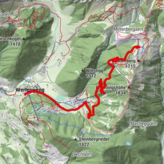
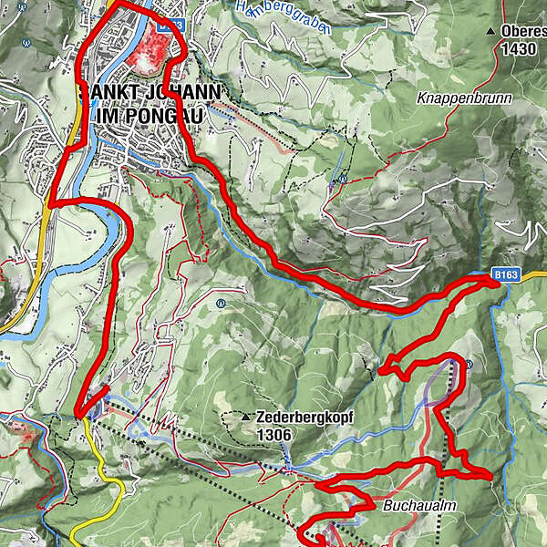
- Wegverlauf
-
Gondl Stubn0,0 kmVoralpe0,1 kmObergaßalm0,3 kmBuchau Saletti5,4 kmVorderbuchau5,4 kmGasthof Grubhöhe9,7 kmSankt Johann im Pongau12,3 kmPfarrkirche St. Johann12,4 kmEvang. Annakapelle12,4 kmSt. Johann im Pongau14,8 kmReinbach15,6 kmCafe-Restaurant Bacher15,9 kmHalldorf15,9 kmReitlehen17,9 kmAlpendorf19,0 km
- Beste Jahreszeit
-
sijveljožutrasvilipsrpkolrujlisstupro
- Höchster Punkt
- 1.565 m
- Höhenprofil
-

-

-
AutorDie Tour Gondel Bergstation-Buchau-Wagrain-Alpendorf wird von outdooractive.com bereitgestellt.
GPS Downloads


Weitere Touren in den Regionen