


- Kratak opis
-
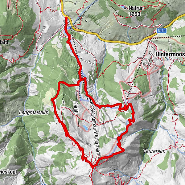
Experience the culinary hike "Almkraft" weekly daily except Tuesday and Wednesday. The culinary tour takes you around the Natrun from one regional delicacy to the next.
- Teškoća
-
teška
- Vrednovanje
-
- Wegverlauf
-
Schönanger1,2 kmLangegg (1.899 m)7,0 kmBergstadl7,0 kmKröllalm10,7 kmAbergalm11,8 kmChristernreith12,5 kmSchönanger13,3 kmUnterberg14,4 km
- Beste Jahreszeit
-
sijveljožutrasvilipsrpkolrujlisstupro
- Höchster Punkt
- 1.891 m
- Zielpunkt
-
Valley station of the Natrun cable railroad
- Höhenprofil
-


- Autor
-
Die Tour Culinary tour HIKE "Almkraft" wird von outdooractive.com bereitgestellt.
GPS Downloads


Opće informacije
Einkehrmöglichkeit
Aussichtsreich


