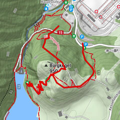

- Kratak opis
-
short walking trail on the Maiskogel
- Teškoća
-
lagano
- Vrednovanje
-
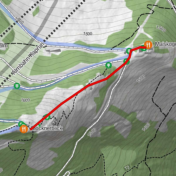
- Wegverlauf
-
Glocknerblick0,4 kmMaiskogelalm1,1 km
- Höchster Punkt
- 1.640 m
- Höhenprofil
-


-

-
AutorDie Tour Walking path to the Glocknerblick wird von outdooractive.com bereitgestellt.
GPS Downloads


Weitere Touren in den Regionen