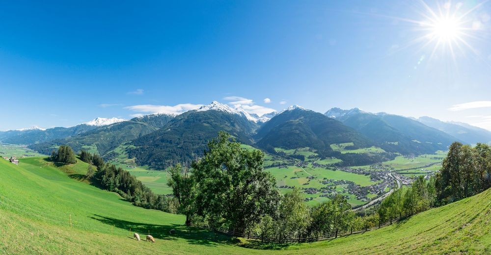
Niedernsill: Naglköpfweg zum Kraftplatz vom Wanderinfopoint

© (c) Tourismusverband Piesendorf Niedernsill, Foto Harry Liebmann - Tourismusverband Piesendorf Niedernsill

© Piesendorf Niedernsill - Harry Liebmann
- Kratak opis
-
A hike of a special kind: halfway up the mountain, the trail leads to the magical place of power at Naglköpfl, from where you enjoy a fascinating views.
- Teškoća
-
lagano
- Vrednovanje
-
- Wegverlauf
-
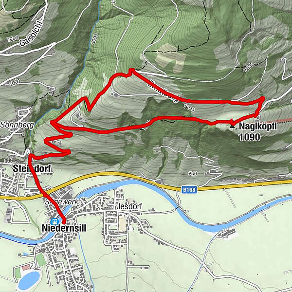
NiedernsillSteindorf0,5 kmEmaten1,4 kmNaglköpfl (1.090 m)3,5 kmJausenstation Nagelbauer3,6 kmEmaten6,7 kmSteindorf7,5 kmNiedernsill8,0 km
- Beste Jahreszeit
-
sijveljožutrasvilipsrpkolrujlisstupro
- Höchster Punkt
- 1.171 m
- Zielpunkt
-
Hiking info point Niedernsill
- Höhenprofil
-


-

-
AutorDie Tour Niedernsill: Naglköpfweg zum Kraftplatz vom Wanderinfopoint wird von outdooractive.com bereitgestellt.
GPS Downloads


Opće informacije
Einkehrmöglichkeit
Aussichtsreich
Weitere Touren in den Regionen


