

© Piesendorf Niedernsill - Harry Liebmann
- Kratak opis
-
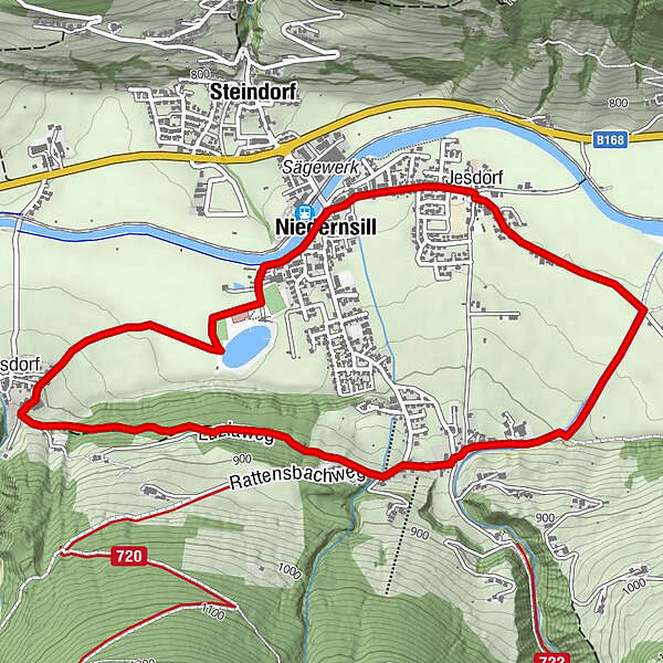
On this leisurely tour you hike - with only a slight gradient - through the districts around Niedernsill.
- Teškoća
-
lagano
- Vrednovanje
-
- Wegverlauf
-
Jesdorf0,4 kmAisdorf4,3 kmPfarrkirche hl. Luzia5,8 kmNiedernsill6,0 km
- Beste Jahreszeit
-
sijveljožutrasvilipsrpkolrujlisstupro
- Höchster Punkt
- 869 m
- Zielpunkt
-
Hiking info point Niedernsill
- Höhenprofil
-


-

-
AutorDie Tour Niedernsill: Jesdorf - Mühlbach - Aisdorf wird von outdooractive.com bereitgestellt.
GPS Downloads


Weitere Touren in den Regionen


