© Erlebnisregion Thermen- & Vulkanland - TV Gnas-St. Peter am Ottersbach

© Erlebnisregion Thermen- & Vulkanland - TV Gnas-St. Peter am Ottersbach
© Erlebnisregion Thermen- & Vulkanland - TV Gnas-St. Peter am Ottersbach

© Erlebnisregion Thermen- & Vulkanland - TV Gnas-St. Peter am Ottersbach

© Erlebnisregion Thermen- & Vulkanland - TV Gnas-St. Peter am Ottersbach

© Erlebnisregion Thermen- & Vulkanland - Daniela Neubauer

© Erlebnisregion Thermen- & Vulkanland - Daniela Neubauer

© Erlebnisregion Thermen- & Vulkanland - Daniela Neubauer
- Kratak opis
-
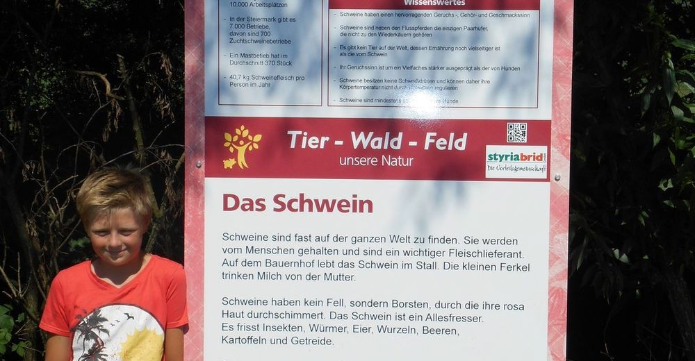
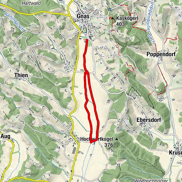
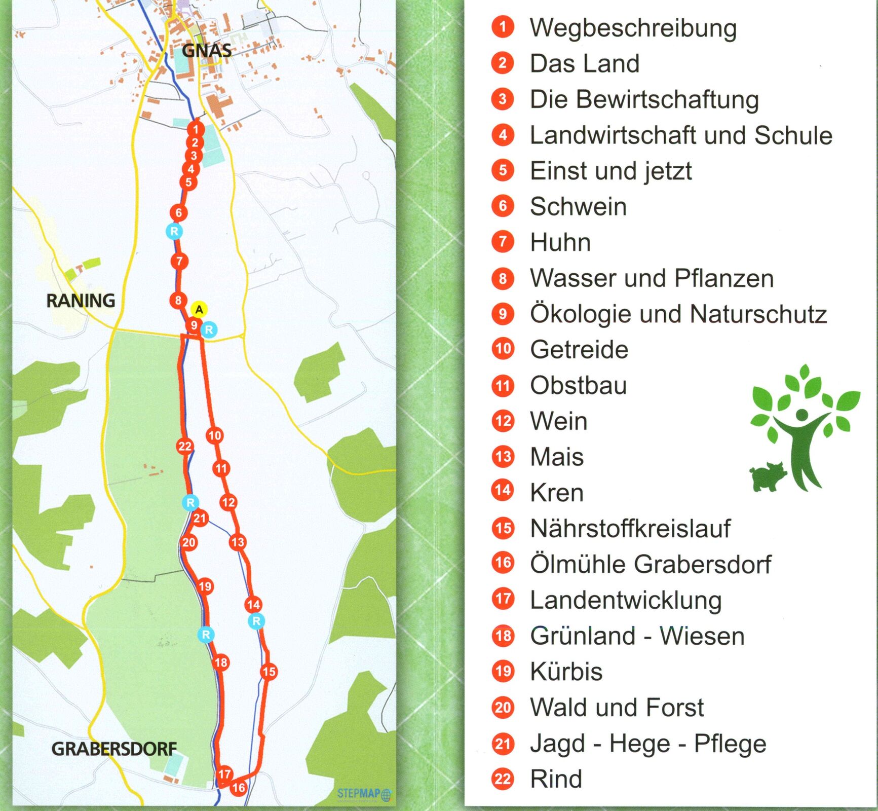
Let's experience the fascination of nature and learn interesting facts about the southeast Styrian landscape and agriculture! Beautiful path along the Gnasbach stream.
- Teškoća
-
lagano
- Vrednovanje
-
- Wegverlauf
-
Raning0,7 kmGrabersdorf3,3 kmRaning5,5 km
- Beste Jahreszeit
-
sijveljožutrasvilipsrpkolrujlisstupro
- Höchster Punkt
- 272 m
- Zielpunkt
-
Sportplatz Gnas
- Höhenprofil
-


- Autor
-
Die Tour Tier-Wald-Feld - Landwirtschaftlicher Themenweg wird von outdooractive.com bereitgestellt.
GPS Downloads


Weitere Touren in den Regionen
-
Oststeiermark
2126
-
Bad Gleichenberg
372
-
Gnas
141