© Lugano Region - All rights reserved – Milo Zanecchia
© Lugano Region - All rights reserved - Davide Adamoli

© Lugano Region - All rights reserved – Davide Adamoli

© Lugano Region - All rights reserved – Davide Adamoli

© Lugano Region - All rights reserved – Milo Zanecchia

- Kratak opis
-
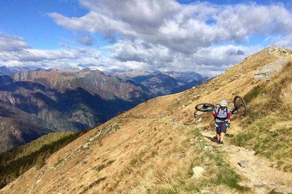
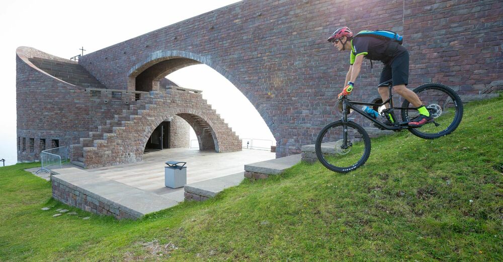
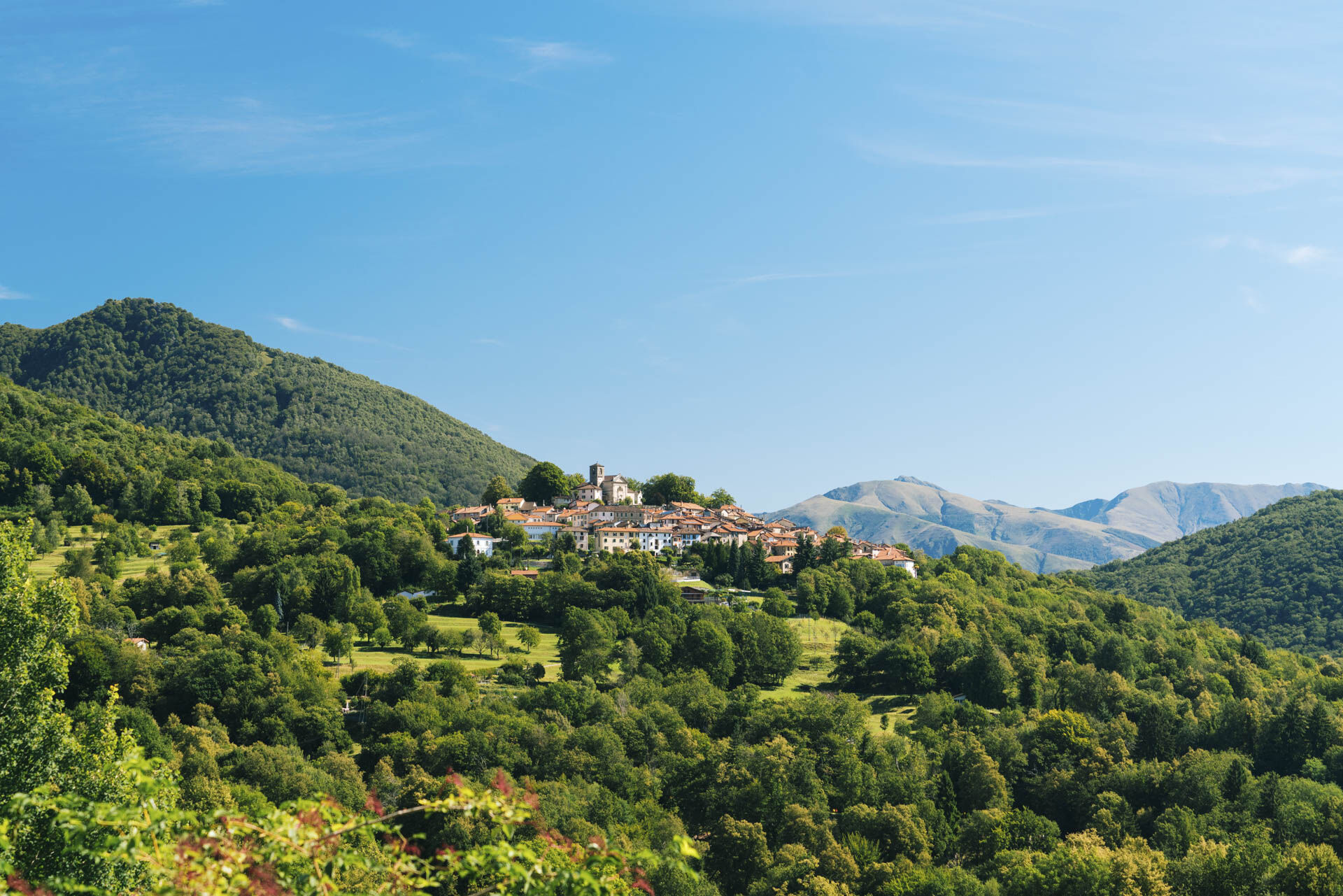
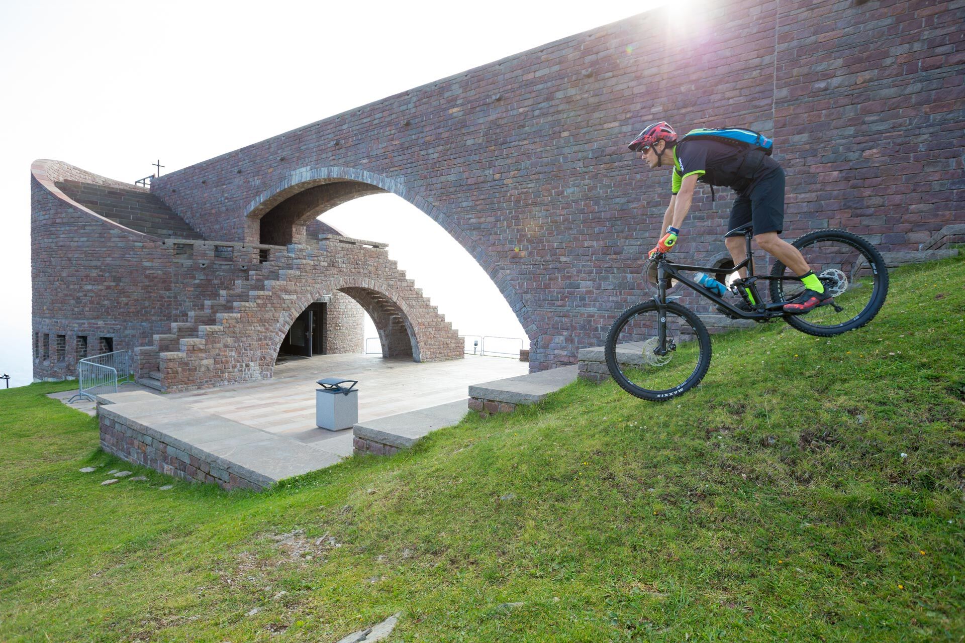
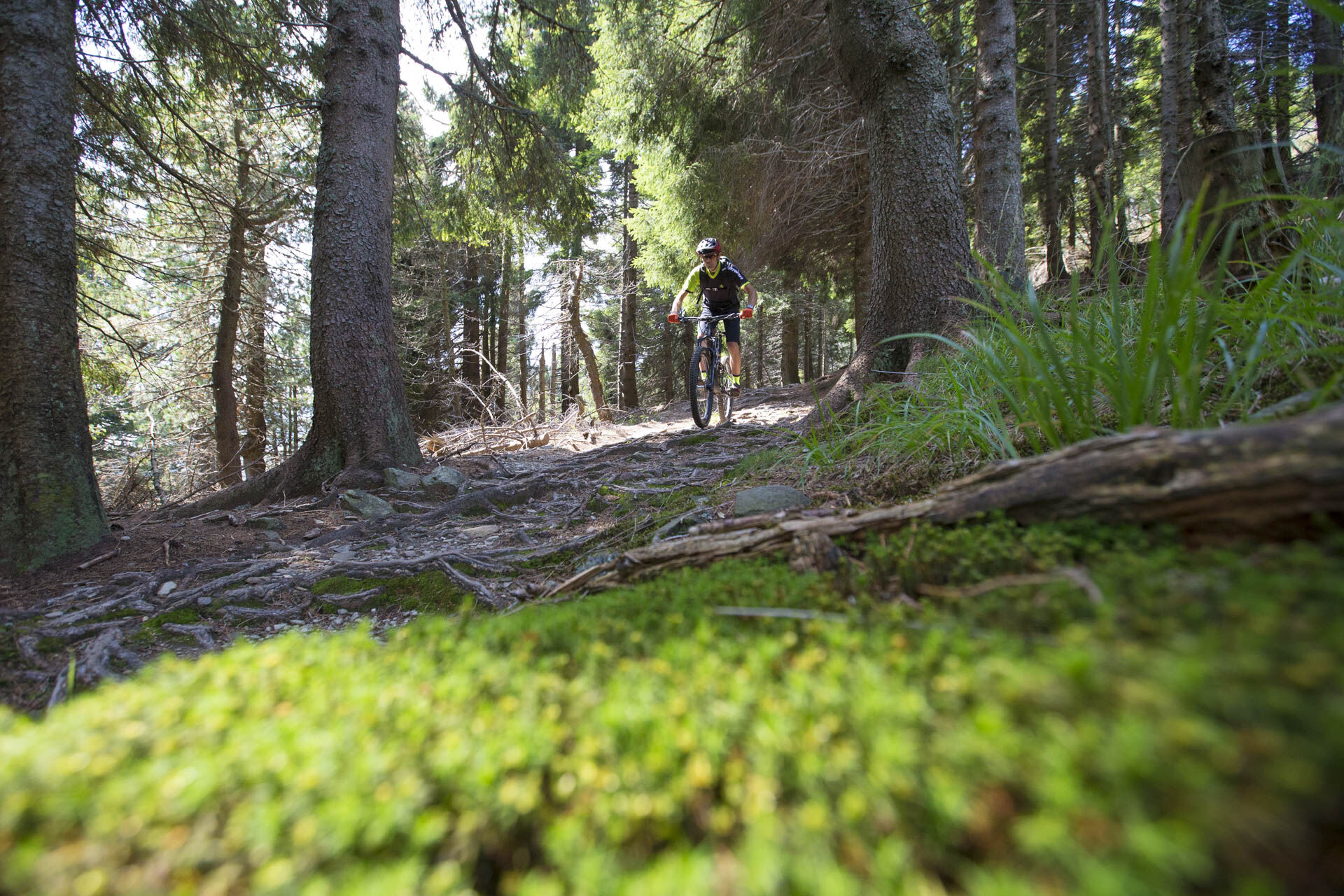
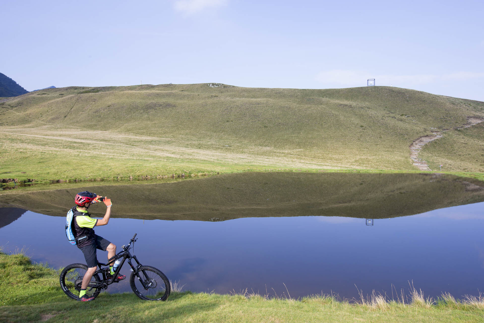
While riding this circular route, you’ll be struck by the extensive chestnut forests and the epic appeal of majestic Monte Tamaro with its breath-taking panorama. You’ll also be full of admiration for nature’s handiwork which in the Maglio del Malcantone area is particularly enthralling.
- Teškoća
-
teška
- Vrednovanje
-
- Wegverlauf
-
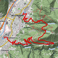
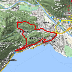
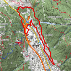
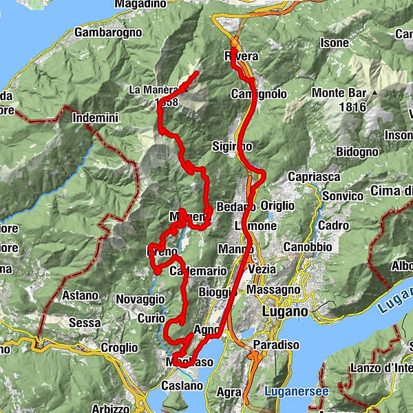
Alpe Foppa0,0 kmRistorante Alpe Foppa0,0 kmLa Manèra (1.858 m)2,3 kmCapanna Tamaro2,6 kmMotto Rotondo (1.928 m)3,1 kmBassa di Indemini (1.723 m)4,4 kmAlpe di Pozzo6,8 kmLa Bassa (1.367 m)9,6 kmAlpetto13,0 kmAlpe Barco13,2 kmTèra d'Sóra15,5 kmArosio (864 m)15,9 kmArosio di Sotto15,9 kmTèra d'Sóra16,0 kmPiano di Piem16,7 kmMugena (815 m)17,7 kmAlto Malcantone (810 m)19,1 kmOratorio di Santa Maria delle Grazie di Sassello19,7 kmOsteria Busgnone19,8 kmVezio (782 m)19,9 kmFescoggia (837 m)21,7 kmLod22,3 kmAl Cioss22,6 kmBreno (799 m)24,4 kmLa Bolla25,1 kmRivee25,4 kmVello28,4 kmTorciòn29,2 kmLisone30,8 kmMonte San Bernardo (898 m)32,1 kmMonte Calangelo (810 m)32,9 kmCimo (557 m)33,4 kmOratorio San Rocco34,1 kmIseo (684 m)34,4 kmAl Portico38,0 kmVernate (546 m)38,0 kmGuasti39,1 kmNeggio (389 m)40,4 kmSanta Maria Annunciata40,4 kmDa Renato41,4 kmMagliaso (290 m)41,7 kmCasale della Vite41,7 kmMagliaso (287 m)42,2 kmCassina d'Agno43,2 kmAgno (280 m)44,0 kmOratorio Madonna delle Grazie46,1 kmLugano (273 m)46,8 kmCadempino (315 m)49,4 kmBedano (387 m)51,0 kmTorricella-Taverne (427 m)52,8 kmSigirino (470 m)56,0 kmMezzovico (460 m)56,8 kmCamignolo (449 m)58,7 kmBironico (465 m)59,8 kmSorencino60,2 kmCapidogno60,7 kmChiesa dello Spirito Santo61,0 kmOratorio di Santa Maria delle Grazie61,3 kmOsteria Grotto Leoni61,3 kmSoresina61,4 kmRivera (554 m)61,8 km
- Beste Jahreszeit
-
sijveljožutrasvilipsrpkolrujlisstupro
- Höchster Punkt
- 1.888 m
- Zielpunkt
-
Rivera
- Höhenprofil
-
 © outdooractive.com

-

-
AutorDie Tour Monte Tamaro – Chestnuts trail wird von outdooractive.com bereitgestellt.
GPS Downloads


Opće informacije
Einkehrmöglichkeit
Flora
Aussichtsreich
Weitere Touren in den Regionen