


Photos from our users
You start at the parking lot at the Saale bridge or at the snack bar "Saaleblick" in Ziegenrück. The path then leads you through the Otter Bay to Altenroth. Here you take the ferry from Altenroth across...
You start at the parking lot at the Saale bridge or at the snack bar "Saaleblick" in Ziegenrück. The path then leads you through the Otter Bay to Altenroth. Here you take the ferry from Altenroth across the Hohenwarte Reservoir to Linkenmühle. We recommend stopping at the inns "Vorwerk" in Altenroth or "in der Linkenmühle." After a refreshment, follow the Hohenwarte Reservoir Trail on the other side of the Saale back to Ziegenrück. This path takes you through the Linkenmühle campsite directly along the reservoir. At a fork, you can choose to go via the Devil's Pulpit or the Panoramic View (marked by a red dot on a white square). There you have a great view of the Saale loop. At the end of the hike, you will be rewarded with a nice view of Ziegenrück. On the way back to the parking lot, we recommend a stop at the Ziegenrück boat station. End the afternoon there with a short pedal boat ride and coffee with cake. (Route recommended from April to October)
Ferry times:
From April to September from 9 to 18 o'clock
More information can be found at: www.kombus-online.eu/angebote/Faehre/information
(weather dependent - no guarantee on information)

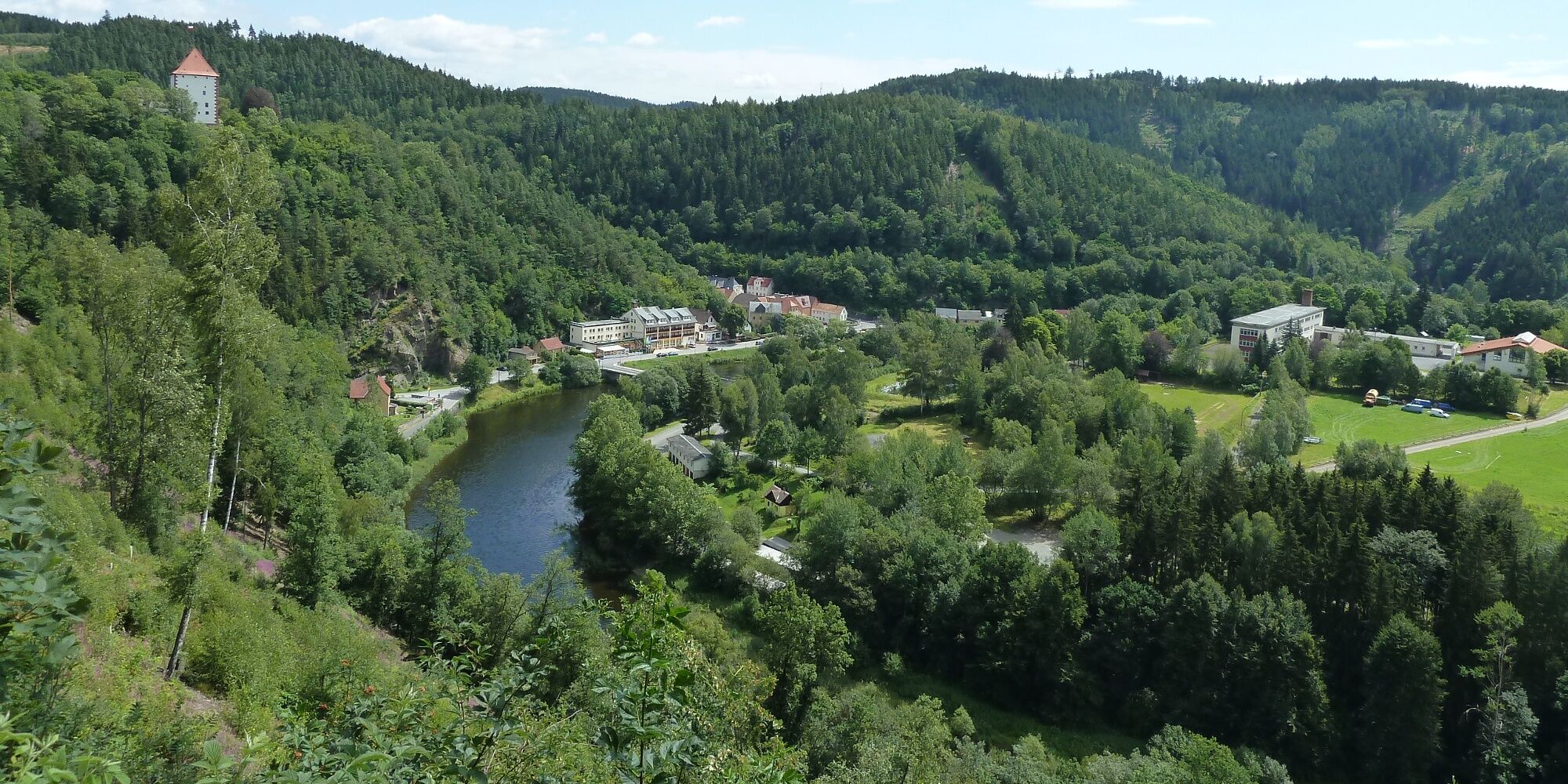
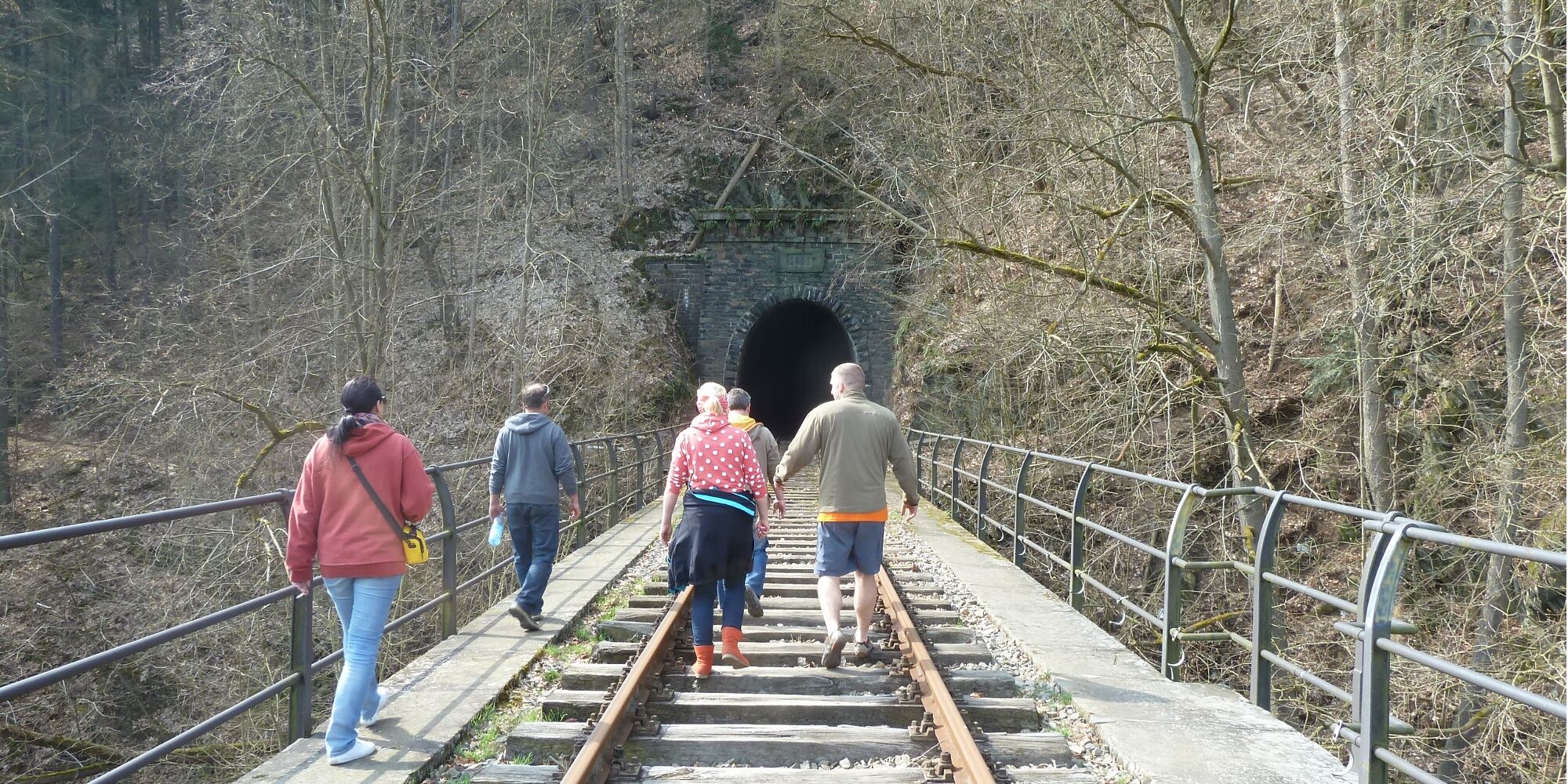
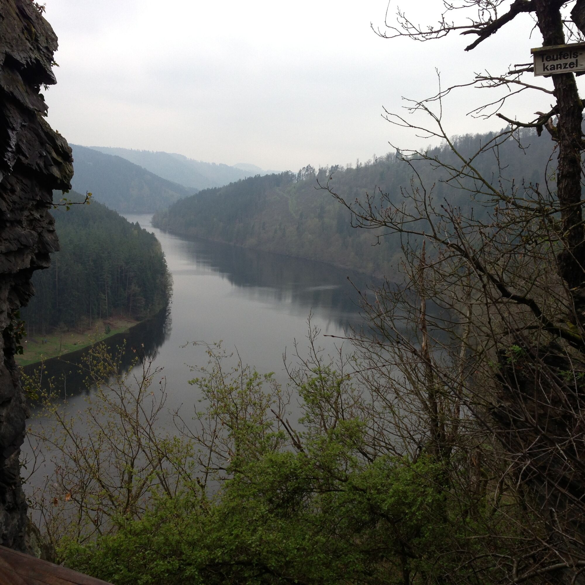
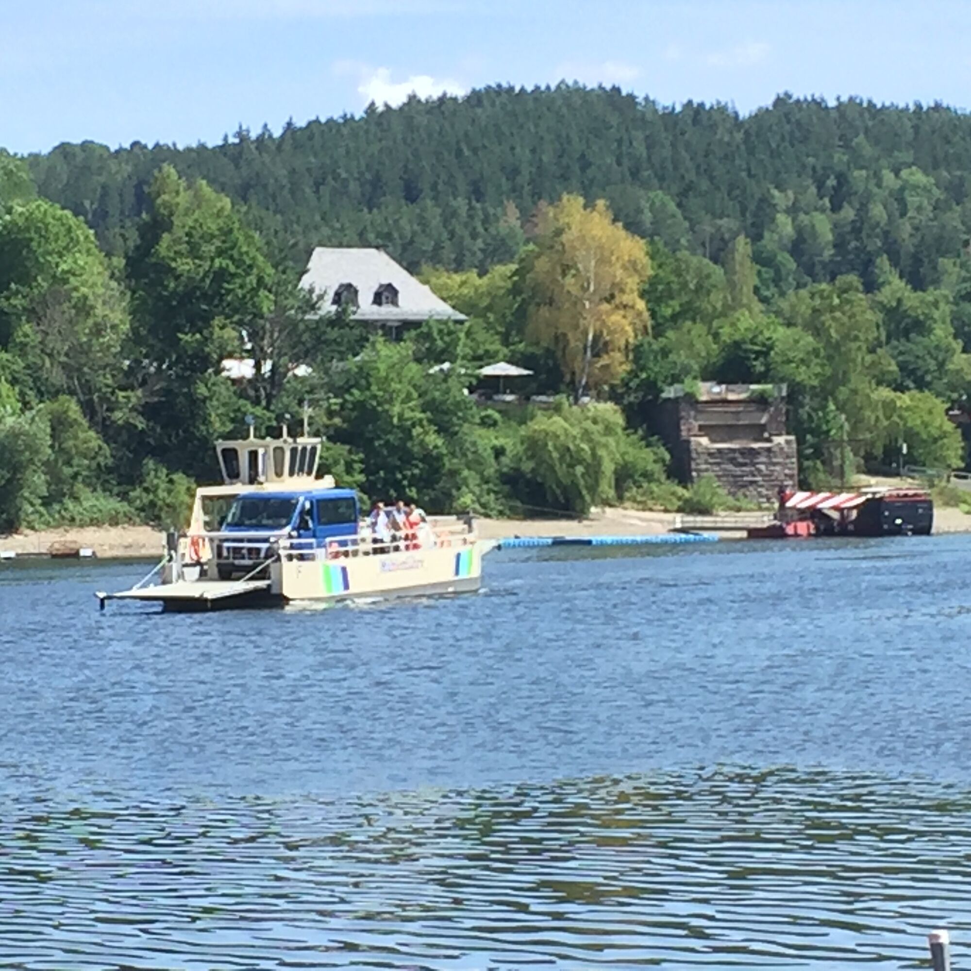
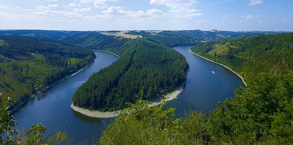
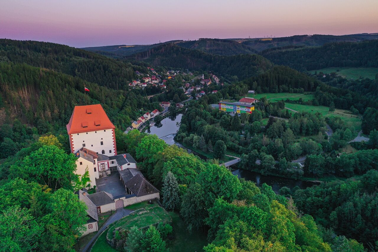
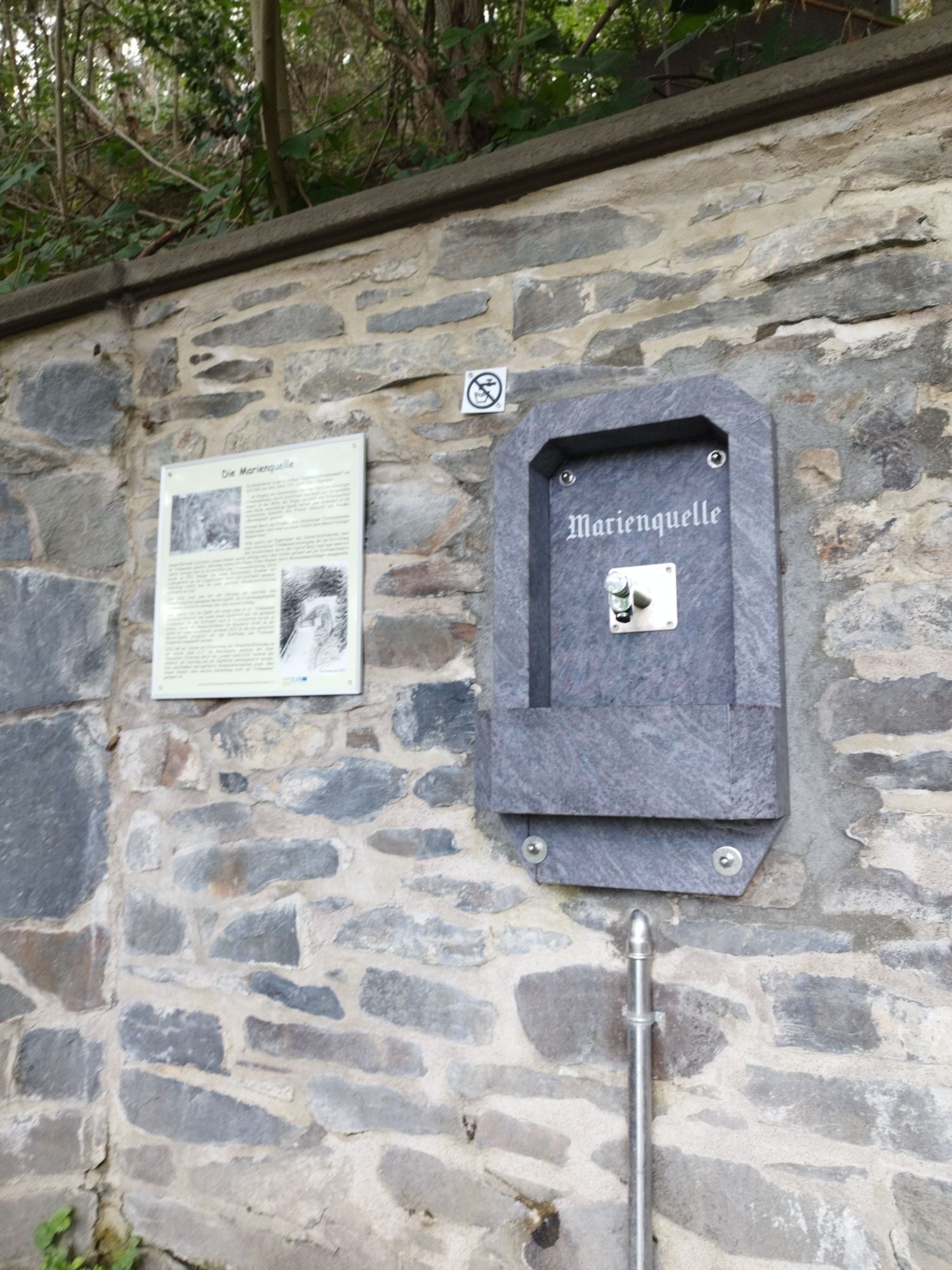
From Ziegenrück, follow the Hohenwarte Reservoir Trail along the left side of the Saale. Part of the path can be walked on the old railway tracks and viaducts. The path then leads you through the Otter Bay to Altenroth. Here you take the ferry from Altenroth across the Hohenwarte Reservoir to Linkenmühle. Bicycles and cars are also transported. We recommend stopping at the inns "Fuhrwerk" in Altenroth or "in der Linkenmühle." After a refreshment, follow the Hohenwarte Reservoir Trail on the other side of the Saale back to Ziegenrück. This path takes you through the Linkenmühle campsite directly along the reservoir. At a fork, you can choose to go via the Devil's Pulpit or the Panoramic View (marked by a red dot on a white square). There you have a great view of the Saale loop. At the end of the hike, you will be rewarded with fresh spring water from the Marienquelle and a nice view of Ziegenrück. On the way back to Naturcamping Plothental, we recommend a stop at the Kullak boat rental. End the afternoon here with a short pedal boat ride and coffee with cake.
Sturdy footwear
Rainwear
First aid kit
GPS navigation device or smartphone
Be aware of the typical dangers of the forest! Walking is at your own risk! Avoid stepping on moss-covered stones and rocks due to the risk of slipping and watch out for deadwood, branches, and fallen trees.
Parking lot at the clubhouse: Google NAV point
Yes
With the Thuringian Sea hiking bus, you can explore the Hohenwarte Reservoir Trail from Saalfeld on Thursdays, Fridays, Saturdays, as well as Sundays and holidays from May 1 to October 31 2017. You can easily complete a selected stage or all four stages - the Thuringian Sea hiking bus brings you in the morning to the start of the stage and back to your starting point after your hike.
More information about the hiking bus: http://www.kombus-online.eu/wanderbusthueringermeer
The KomBus Mühlen Ferry on the Hohenwarte Reservoir is Thuringia's only car ferry and connects the landing stages Altenroth and Linkenmühle. Find out more about our ferry, ferry times, and prices here: http://www.kombus-online.eu/angebote/Faehre/
Tip: If your feet are already tired at Linkenmühle, use the Kombus hiking bus.
Popular tours in the neighbourhood
-
4,7
Circular hiking route - H3 "The Bird's Eye View" - Thuringian Forest
mediumPješačenje 8,76 km -
4,7
Circular hiking trail - H5 "The Water Route" - Thuringian Forest
mediumPješačenje 6,58 km -
4,0
Rundwanderung - "Wichtelweg" - Wilhelmsdorf
lightTematska staza 2 km -
Circular hiking trail - Mushroom Experience Trail Gräfenwarth - Thuringia
mediumPješačenje 5,48 km -
Rund um Schloss Burgk
lightPješačenje 7,04 km -
5,0
Hohenwarte Reservoir Way - Section 2 - Camping Wilhelmsdorf Portenschmiede → Ziegenrück
mediumPješačenje 18,3 km -
Children's trail in Leutenberg "On the trail of the fire salamander
mediumPješačenje 5,36 km -
MTB Saalfeld 13: Hohenwarte Reservoir Circular Route
mediumMountainbike 46,4 km -
Hike - Hohenwarte Reservoir Path - Thuringian Forest
mediumPješačenje 78,0 km -
Der Wutschental-Weg „Mit dem Zaunkönig und den Wasserdetektiven unterwegs“
mediumPješačenje 11,9 km
bergfex Tours


Ne propustite ponude i inspiraciju za vaš sljedeći odmor
Your e-mail address has been added to the mailing list.