Untertannendorf - Idahöhe - Teufelskanzel - Klingenstein
heavy
Navigate
Navigate
Get this tour on your mobile
Untertannendorf - Idahöhe - Teufelskanzel - Klingenstein
heavy
Pješačenje
21,48
km
Scan the QR code and start navigation in the bergfex app

Hiking & Tracking


Distance
21,48
km
Duration
05:37
h
Ascent
471
m
Sea level
242 -
420
m
Track download
Untertannendorf - Idahöhe - Teufelskanzel - Klingenstein
heavy
Pješačenje
21,48
km


Route
Untertannendorf
(273 m)
Neighbourhood
0,0 km
Neustadt
(261 m)
Neighbourhood
0,5 km
Greiz
(265 m)
City
1,3 km
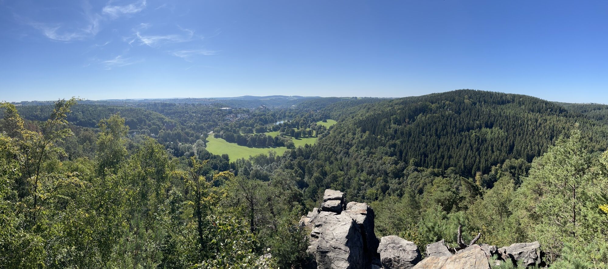
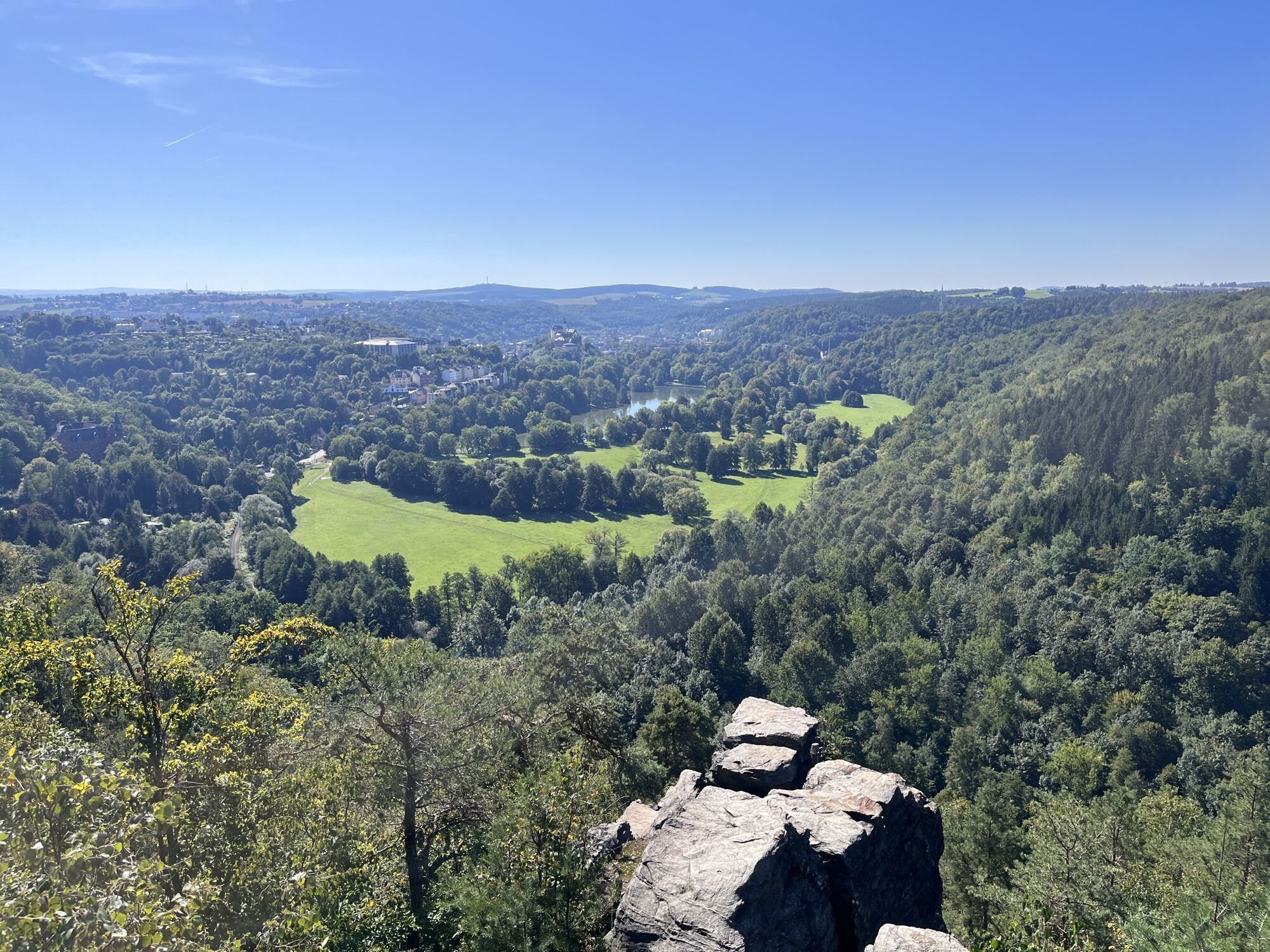
Idahöhe
(320 m)
Summit
2,7 km
Klingenstein
(405 m)
Summit
3,8 km
Neumühle/Elster
(250 m)
Village
12,3 km
Herz Jesu
(263 m)
Place of worship
20,6 km
Route
Untertannendorf - Idahöhe - Teufelskanzel - Klingenstein
heavy
Pješačenje
21,48
km
Untertannendorf
(273 m)
Neighbourhood
0,0 km
Neustadt
(261 m)
Neighbourhood
0,5 km
Altstadt
(267 m)
Neighbourhood
1,2 km
Greiz
(265 m)
City
1,3 km
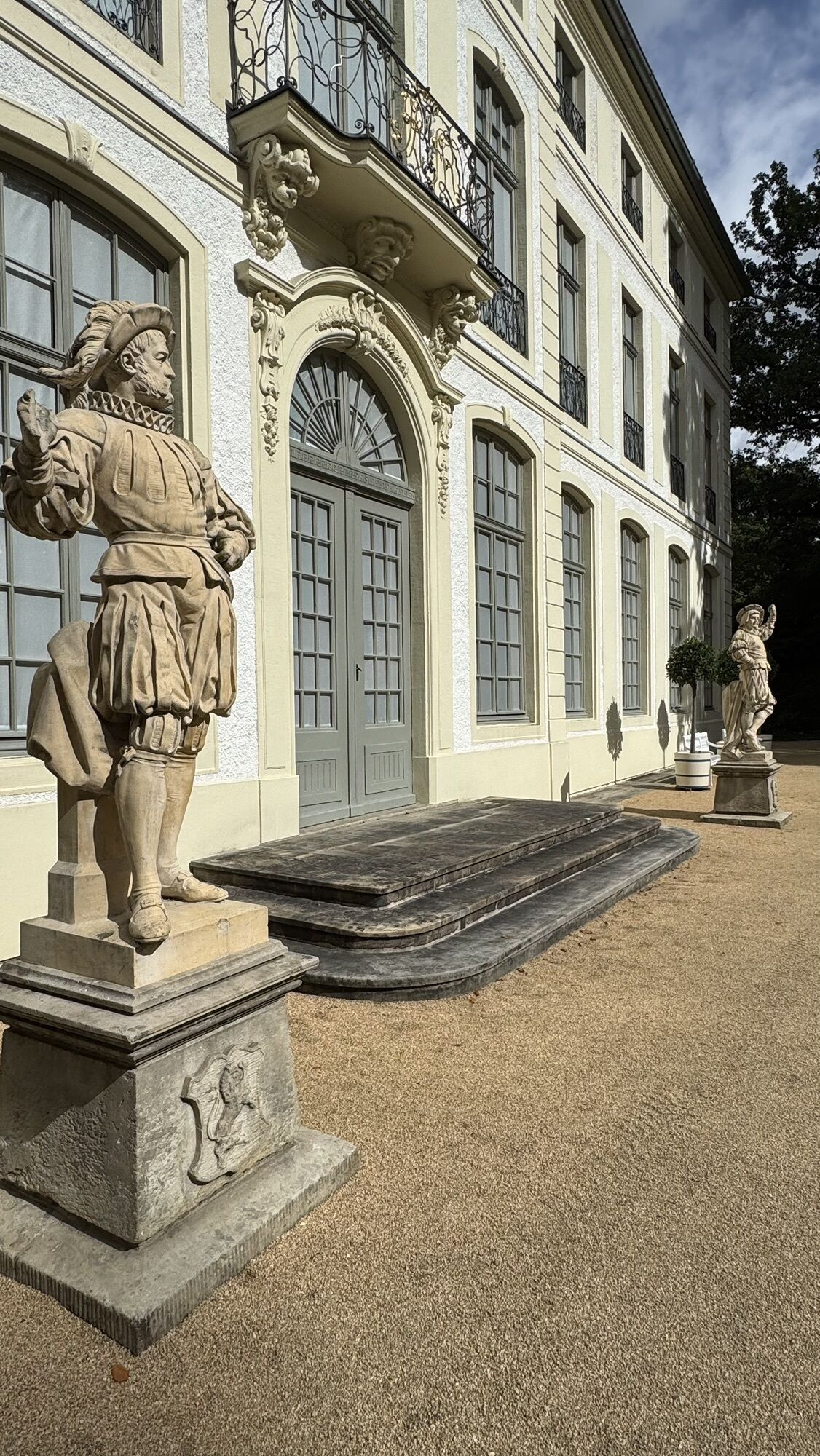
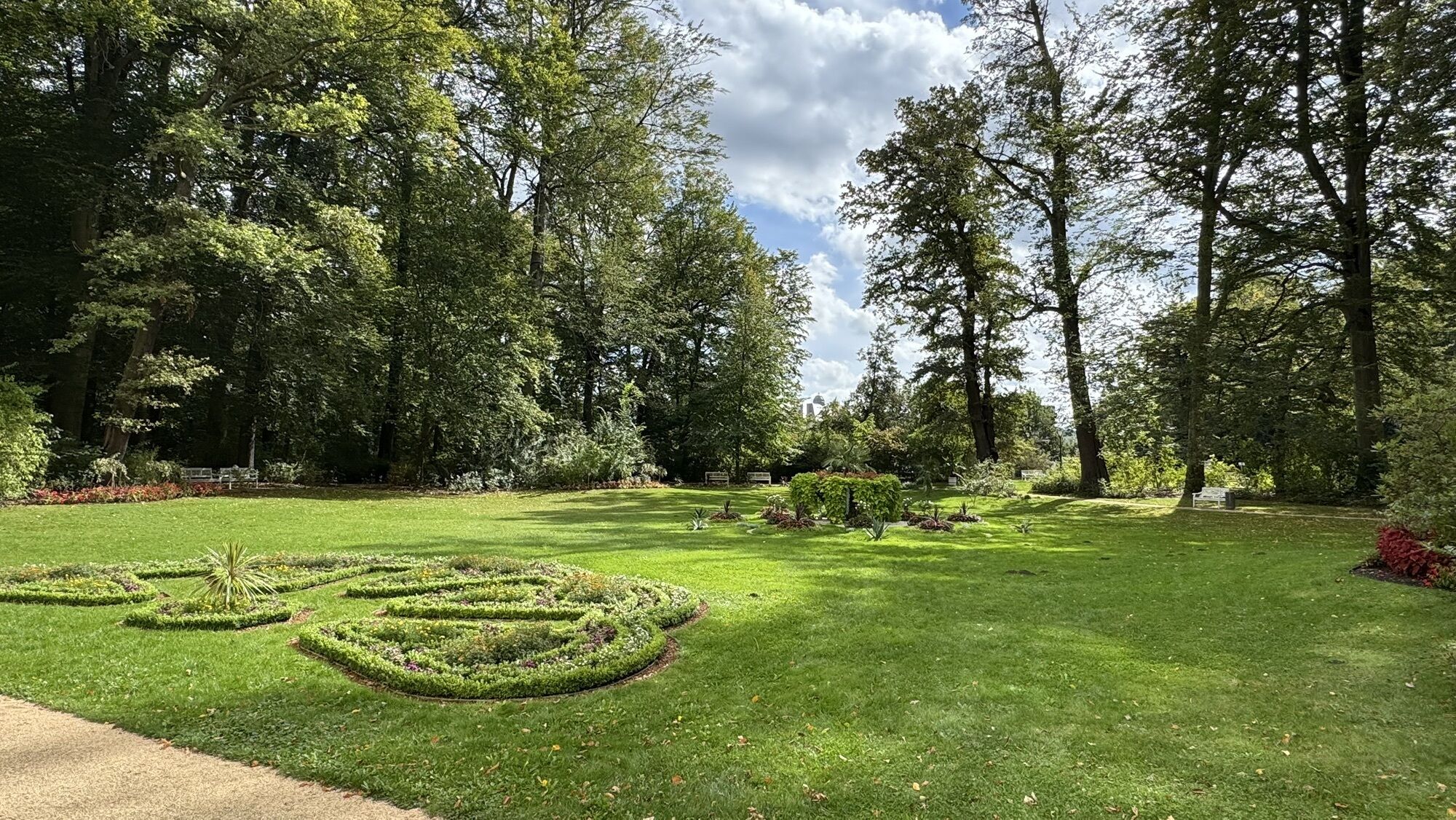
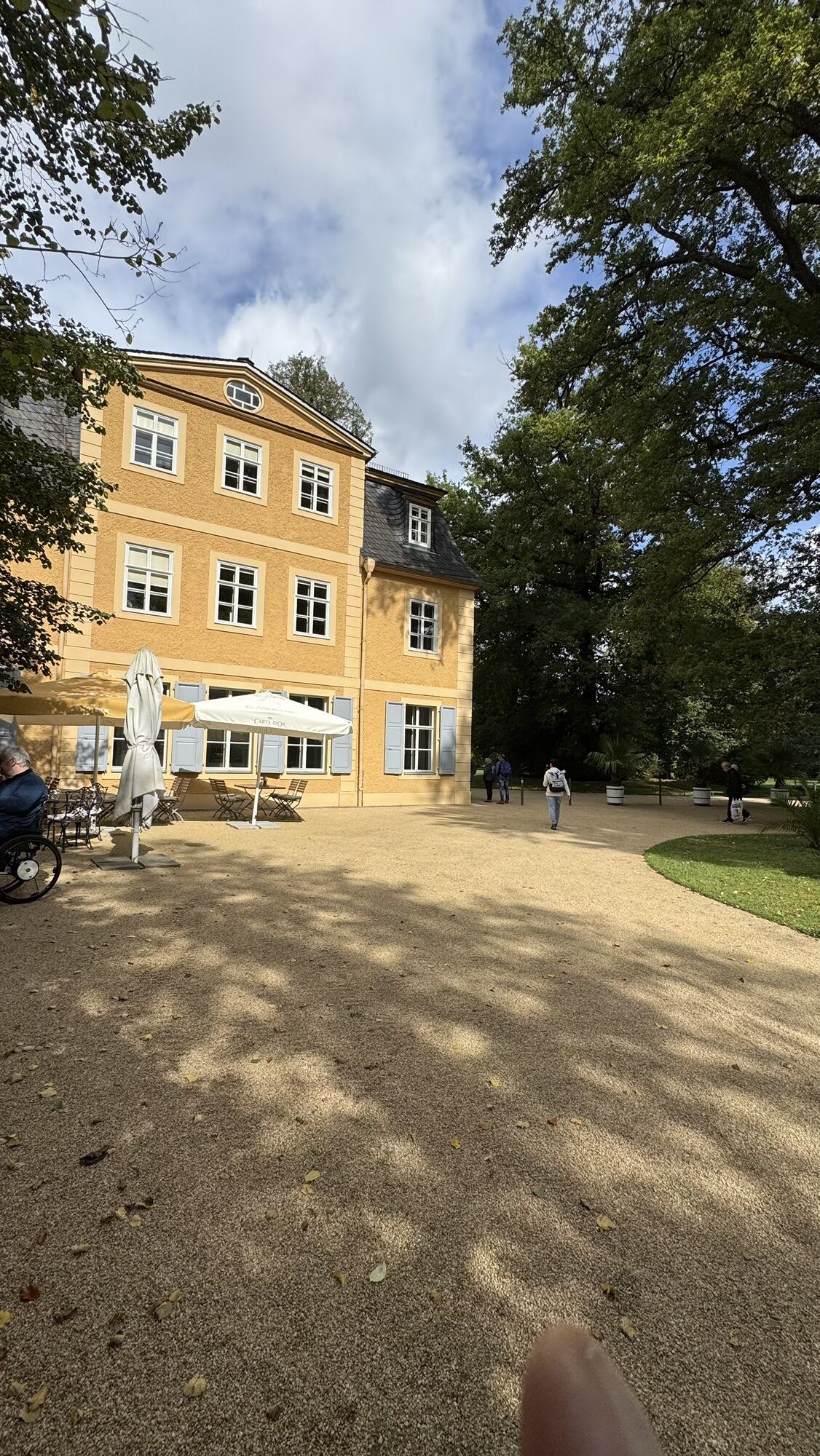
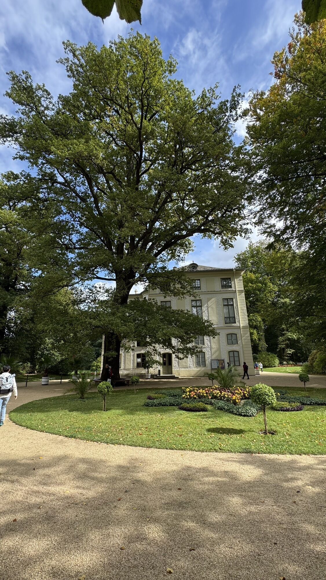
Sommerpalais im Greizer Park
(260 m)
Corridor/terrain
1,6 km
Idahöhe
(320 m)
Summit
2,7 km
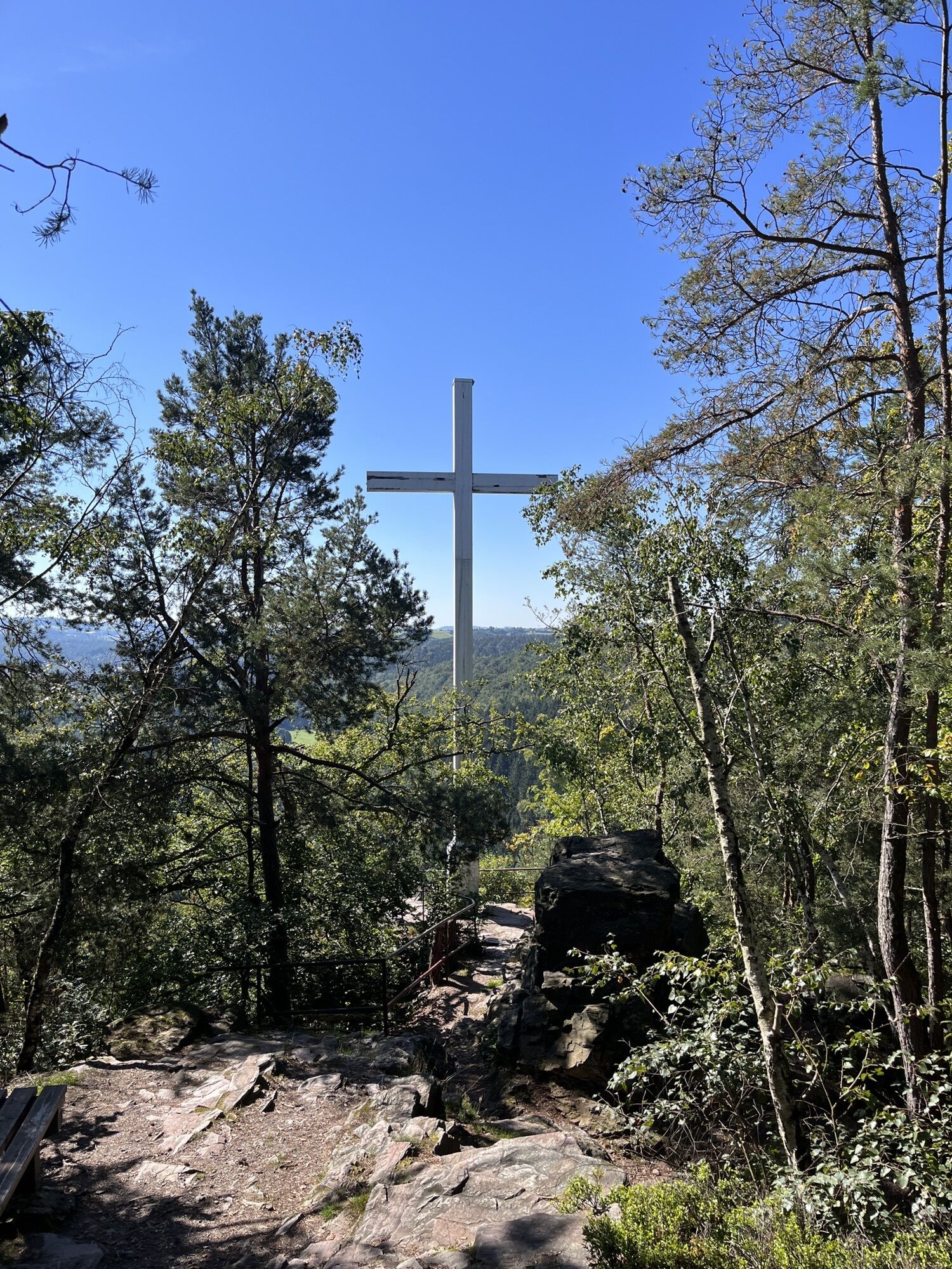
Teufelskanzel
(370 m)
Summit
3,5 km
Klingenstein
(405 m)
Summit
3,8 km
Gommla
(418 m)
Village
6,6 km
Neumühle/Elster
(250 m)
Village
12,3 km
Knottengrund
(261 m)
Settlement
12,6 km
Sommerpalais im Greizer Park
(260 m)
Corridor/terrain
19,0 km
Altstadt
(267 m)
Neighbourhood
19,7 km
Greiz
(265 m)
City
19,8 km
Stadtkirche St. Marien
(268 m)
Place of worship
19,9 km
Herz Jesu
(263 m)
Place of worship
20,6 km
Neustadt
(261 m)
Neighbourhood
20,9 km
Untertannendorf
(273 m)
Neighbourhood
21,5 km
No reviews yet
Popular tours in the neighbourhood
-
Talsperre Pöhl-Triebtal-Elstertalbrücke
lightPješačenje 8,76 km -
Mühlenkreisel - Wasserläufer 6
mediumPješačenje 10,6 km -
Promenadenweg am Zeulenrodaer Meer (barrierefrei)
lightPješačenje 3,39 km -
5,0
ElsterWasserWeg - Elstersteigen
mediumPješačenje 11,2 km -
3,0
Euregio Egrensis cycle route
heavyMeđugradska biciklistička staza 237,8 km -
Rundwanderung Burgleite Elsterberg - Elstersteigen
Pješačenje 9,09 km -
Rundwanderung "Heinrichweg" - Elstersteigen
Pješačenje 10,3 km -
Hofladenroute
mediumVozi bicikl 44,9 km -
Rennradtour 100 Kilometer Vogtland Nord-Süd
heavyCestovni bicikl 99,9 km -
Rennrad-Runde: Vogtland komplett zwischen Gera und Bad Brambach
heavyCestovni bicikl 267,8 km
bergfex Tours

Over 550.000 tour suggestions, detailed maps and an intuitive route planner make the app a must-have for all nature enthusiasts.

Ne propustite ponude i inspiraciju za vaš sljedeći odmor
Subscribe to the newsletter
Error
An error has occurred. Please try again.
Thank you for your registration
Your e-mail address has been added to the mailing list.
Tours throughout Europe
Austrija
Švicarska
Njemačka
Italija
Slovenija
Francuska
Nizozemska
Belgija
Poljska
Lihtenštajn
Češka
Slovačka
Španija
Hrvatska
Bosna i Hercegovina
Luksemburg
Andora
Portugal
Island
Ujedinjeno Kraljevstvo
Irska
Grčka
Albanija
Sjeverna Makedonija
Malta
Norveška
Crna Gora
Moldova
Kosovo
Mađarska
San Marino
Rumunjska
Estonija
Latvija
Bjelorusija
Cipar
Litva
Srbija
Bugarska
Monako
Danska
Švedska
Finska