

© Tourismusverband Region Hall-Wattens - Hall Wattens

- Kratak opis
-
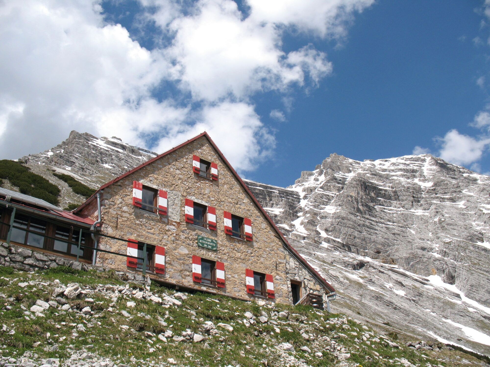
The Bettelwurf - no other mountain dominates the Hall-Wattens region so dramatically as the Bettelwurf massif.
- Teškoća
-
teška
- Vrednovanje
-
- Wegverlauf
-
Bergerkapelle0,7 kmBettelwurfeck2,0 kmJakobibründlquelle2,1 kmKohlanger3,0 kmJausenstation St. Magdalena (1.287 m)3,3 kmErzherzogberg (1.424 m)4,7 kmHerrenhäuser (1.490 m)5,2 kmRuppertikapelle5,2 kmIssjöchl (1.668 m)6,4 kmKohlstatt (1.978 m)8,6 kmBettelwurfhütte (2.077 m)13,0 kmKleiner Bettelwurf (2.650 m)14,4 kmGroßer Bettelwurf (2.725 m)15,2 kmEisengattergrat16,1 kmBettelwurfhütte (2.077 m)17,2 kmBeim Juchezer18,5 kmGamsgufel20,0 kmUntere Bettelwurfreise20,2 kmBergerkapelle21,8 km
- Beste Jahreszeit
-
sijveljožutrasvilipsrpkolrujlisstupro
- Höchster Punkt
- 2.700 m
- Zielpunkt
-
Bettelwurf
- Höhenprofil
-

-

-
AutorDie Tour Through the Halltal to the peak of the Bettelwurf wird von outdooractive.com bereitgestellt.
GPS Downloads


Opće informacije
Einkehrmöglichkeit
Aussichtsreich
Weitere Touren in den Regionen
-
Ferienregion Hall - Wattens
1475
-
Absam
344


