- Kratak opis
-
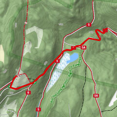
Perfect couple-hours walk immersed in nature and cuddled by the sound of the flowing water.
- Teškoća
-
lagano
- Vrednovanje
-
- Beste Jahreszeit
-
sijveljožutrasvilipsrpkolrujlisstupro
- Höchster Punkt
- 1.472 m
- Zielpunkt
-
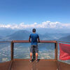
Rifugio Carlettini
- Höhenprofil
-
 © outdooractive.com

-
-
AutorDie Tour Walk - The water's path (Sentiero dell'acqua) wird von outdooractive.com bereitgestellt.
GPS Downloads


Opće informacije
Kulturell/Historisch
Geheimtipp
Flora
Fauna
Weitere Touren in den Regionen