
Podaci o ruti
43,49km
8
- 48m
131hm
141hm
10:30h

Spanisches Fremdenverkehrsamt
- Kratak opis
-
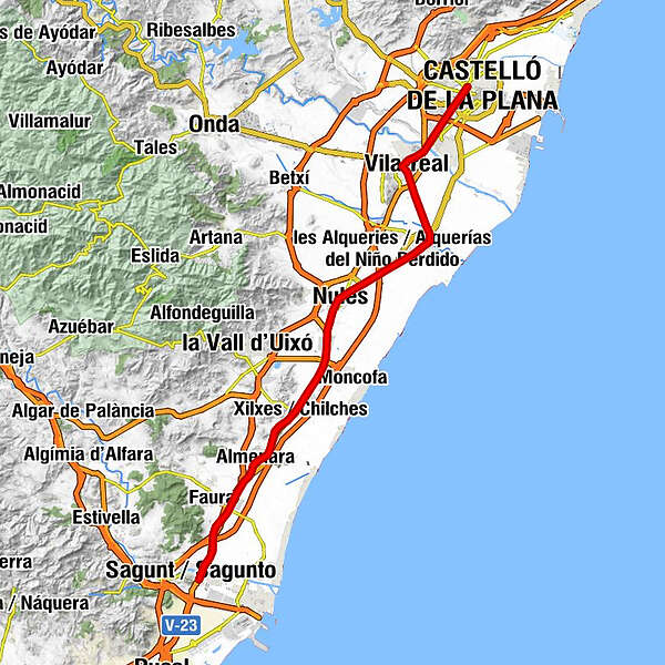
Strecke: Sagunto (Valencia) - Castellón de la Plana
Provinzen: Valencia und Castellón
Kilometerstand: ca. 44 km.
Empfohlene Tage: 1 Tag
Verbindet sich mit: Die Eroberung von Valencia durch Sagunto.
- Teškoća
-
srednje
- Vrednovanje
-
- Wegverlauf
-
Sagunto (49 m)Almenara (23 m)9,0 kmAbric de les Cinc (49 m)9,9 kmel Pla del Motor de Sant Felip10,9 kmla Llosa (22 m)11,2 kmChilches (7 m)13,5 kmSimba15,1 kmNules (13 m)21,6 kmMascarell (15 m)23,2 kmel Baró25,0 kmBurriana (13 m)28,1 kmVillarreal (43 m)35,2 kmAlmazora (35 m)37,9 kmPartida Ramonet (45 m)39,1 kmParroquia San José Obrero41,1 kmCastelló41,4 kmCastelló de la Plana (34 m)41,9 km
- Höchster Punkt
- 48 m
- Zielpunkt
-
Castellón de la Plana
- Höhenprofil
-
 © outdooractive.com
- Autor
-
Spanisches FremdenverkehrsamtDie Tour Camino del Cid. Fahrrad. Variante Castellón wird von outdooractive.com bereitgestellt.