

© The Land of Venice - Archivio Regione Veneto

© The Land of Venice - Archivio Regione Veneto
- Kratak opis
-
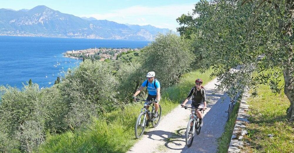
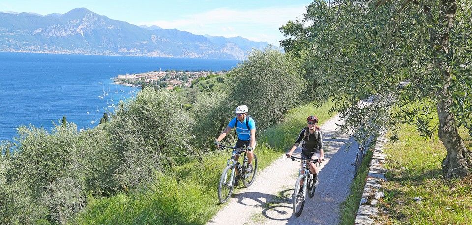
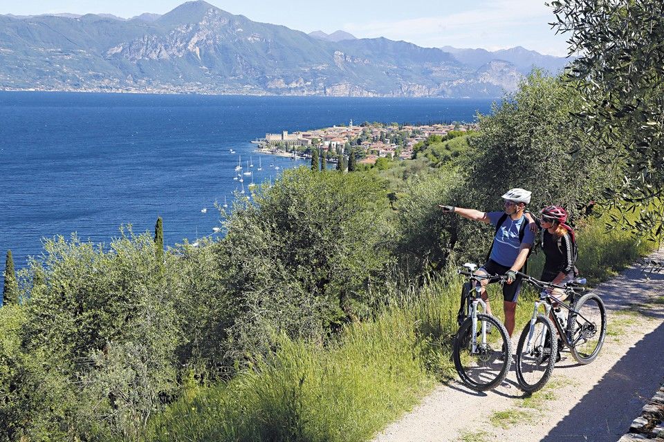
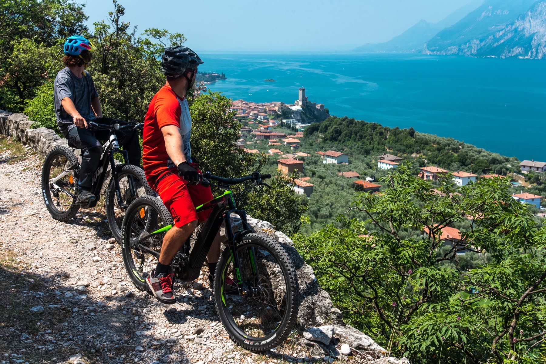
Bardolino, Malcesine, Lazise
- Teškoća
-
srednje
- Vrednovanje
-
- Wegverlauf
-
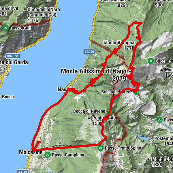
Malcesine0,4 kmFunivia Monte Baldo0,7 kmAgriturismo San Michele - Ca' del Tocio1,9 kmStazione Monte Baldo4,7 kmMonte Baldo (1.738 m)4,7 kmRifugio Graziani10,6 kmLa Sella12,8 kmBusa Brodeghera (1.990 m)13,7 kmMonte Varagna (1.778 m)17,1 kmDosso dei Roveri (1.065 m)24,1 kmDosso Spirano (875 m)25,2 kmNavene31,0 kmCampagnola32,6 kmRistorante Da Bianca32,6 kmCampagnola33,0 kmParagliding Landing Spot33,2 kmMalcesine35,7 km
- Beste Jahreszeit
-
sijveljožutrasvilipsrpkolrujlisstupro
- Höchster Punkt
- 2.054 m
- Zielpunkt
-
Monte Baldo
- Höhenprofil
-
 © outdooractive.com
- Autor
-
Die Tour Lake Garda - Malcesine - Monte Baldo wird von outdooractive.com bereitgestellt.
GPS Downloads


Opće informacije
Flora
Aussichtsreich
Weitere Touren in den Regionen
-
Gardasee / Lombardei
84
-
Garda Trentino
143
-
Malcesine
31