Podaci o ruti
25,29km
397
- 417m
10hm
7hm
06:25h

- Kratak opis
-
Hiking from Amsterdam to the Balkans. This is the the first day in Austria where I hike towards the Via Alpina Red Trail.
- Teškoća
-
lagano
- Vrednovanje
-
- Wegverlauf
-
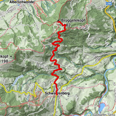
Bregenz (427 m)0,1 kmHard3,3 kmFußach6,4 kmLorettokapelle11,5 kmLustenau (404 m)12,5 kmPfarrkirche "St. Peter und Paul"12,5 kmZum Guten Hirten14,0 kmWalhalla Stüble15,1 kmAm Rohr16,0 kmMeierhof17,9 kmHohenems (432 m)20,6 kmMandarin21,3 kmKapellefeld22,7 kmBauern22,7 kmPetersbünt22,7 kmNepomukkapelle22,8 kmUntere Witzge22,9 kmIsel23,1 kmBütze24,0 km
- Beste Jahreszeit
-
sijveljožutrasvilipsrpkolrujlisstupro
- Höchster Punkt
- 417 m
- Höhenprofil
-
-

-
AutorDie Tour Towards the Alps: Bregenz - Altach (day 76) wird von outdooractive.com bereitgestellt.
GPS Downloads
Opće informacije
Einkehrmöglichkeit
Weitere Touren in den Regionen
-
St. Gallen - Bodensee
2067
-
Bodensee - Vorarlberg
1317
-
Lustenau
345


