
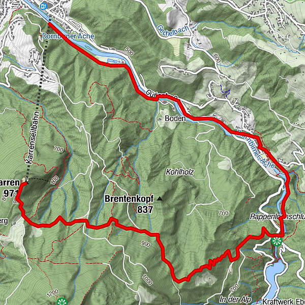
Podaci o ruti
6,8km
470
- 927m
22hm
418hm
03:00h
- Kratak opis
-
Waldlehrpfad
- Teškoća
-
srednje
- Vrednovanje
-
- Polazna točka
-
Bergstation Karren
- Wegverlauf
-
Panoramarestaurant KarrenIn der Alp2,9 kmRappenlochstadl4,1 kmGasthof Gütle4,3 kmGütle4,5 kmDornbirn (437 m)6,8 km
- Beste Jahreszeit
-
sijveljožutrasvilipsrpkolrujlisstupro
- Höchster Punkt
- 927 m
GPS Downloads


Wegbeschaffenheit
Asfalt
Šljunak
Livada
Šuma
Stijena
Istaknuto
Weitere Touren in den Regionen
-
St. Gallen - Bodensee
2066
-
Bodensee - Vorarlberg
1316
-
Dornbirn
449


