

© Tourismusagentur Ostbelgien - Dominik Ketz

© Tourismusagentur Ostbelgien - Dominik Ketz

- Kratak opis
-
Aussichtsreiche Radtour durch das Umland von St.Vith.
- Teškoća
-
srednje
- Vrednovanje
-
- Wegverlauf
-
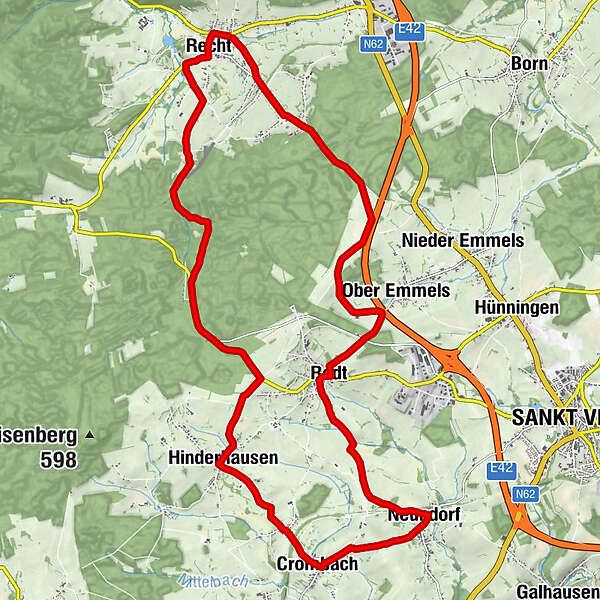
STI'NE0,0 kmRecht0,6 kmHinderhausen9,0 kmCrombach11,5 kmNeundorf13,5 kmRodt17,1 kmOber Emmels18,7 kmRecht25,0 km
- Beste Jahreszeit
-
sijveljožutrasvilipsrpkolrujlisstupro
- Höchster Punkt
- 567 m
- Zielpunkt
-
Ende in Recht - GPS-Koordinaten 50.337355, 6.044083
- Höhenprofil
-
 © outdooractive.com


- Autor
-
Die Tour Die St.Vither Land-Route wird von outdooractive.com bereitgestellt.
GPS Downloads


Weitere Touren in den Regionen


