


The Krumpendorfer Panoramarunde is marked as a circular route from the park pool. The approximately 16km | 400 hm route leads along country and forest roads, hiking trails and single trails, mostly along...
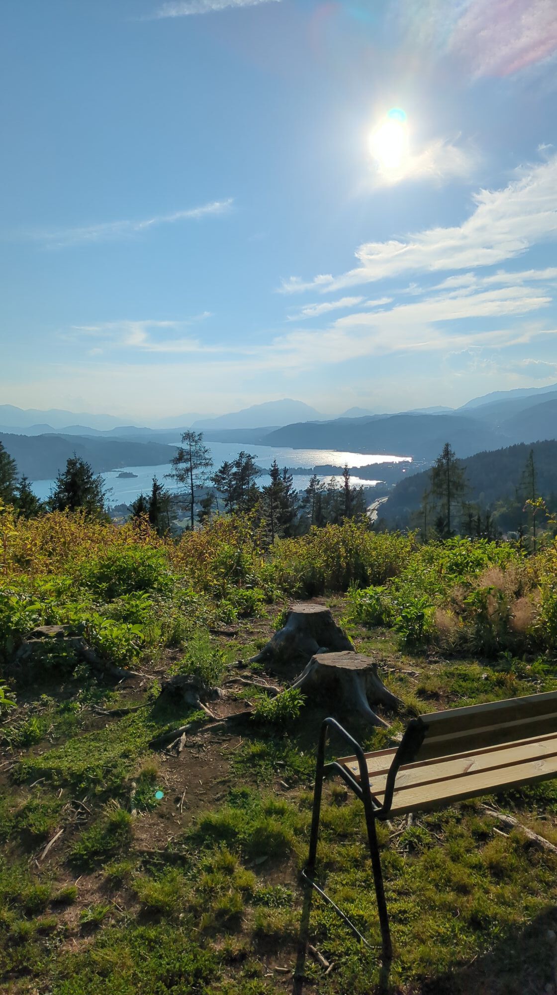
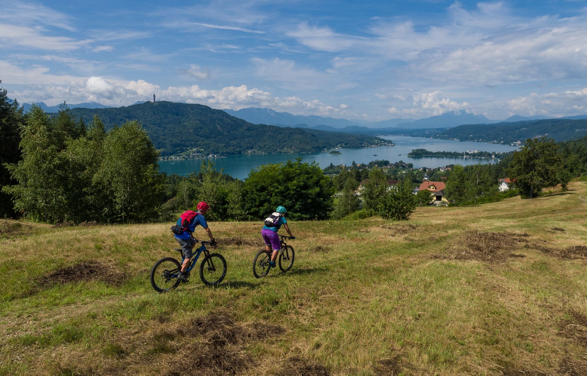
The Krumpendorfer Panoramarunde is marked as a circular route from the park pool. The approximately 16km | 400 hm route leads along country and forest roads, hiking trails and single trails, mostly along the Krumpendorf municipal borders.The starting point is at the Krumpendorf park pool. At the beginning, it goes along the cycle path and on an asphalt country road towards Görtschach. At the end of the village, when entering the forest, narrow forest and hiking trails begin to Nussberg. From there, after a sharp left turn, it goes a bit along the asphalt road towards Hohenfeld. A well-adapted forest path now leads through the forest to Hohenfeld. Please be a little careful here, because the main road has to be crossed shortly after the exit from the "Kollehof". Past the Wirtnigteich, it goes on a narrow field path to Pirk, from where the connecting path to the Pörtschacher Bannwaldtour is signposted. From Pirk, a well-traveled forest path leads towards Pirk. After a short, flat forest section - before the last stretch to the Pirkerkogel - you are rewarded with a wonderful view of Lake Wörthersee and the surrounding mountains. The last climb now leads to the Pirkerkogel. The route does not lead directly to the summit of the Kogel, but it is easily accessible with a small deviation and offers further views of the lake, the Maria Wörth peninsula and the Pyramidenkogel. Now it's time to use the brakes, because it's only downhill back towards Krumpendorf Ort. At the Bürger Mostpresse you come back onto the main road. At the traffic lights you go straight on over Kochstraße into Pamperlallee, back to the starting point Parkbad. Please watch out for hikers and walkers on the way! We wish you lots of strength and joy in your calves at Lake Wörthersee!


Please be careful of hikers and walkers along the way!
Auf der B83 nach Krumpendorf. Im Ort Richtung Parkbad
Arrival by bus, train or boat possible
Parking spaces available near the start
Popular tours in the neighbourhood
-
4,2
Lake Wörthersee Round Trip (Wörthersee - Keutschacher Seental)
mediumVozi bicikl 48,2 km -
3,9
Lake Wörthersee Circular Route
mediumVozi bicikl 41,2 km -
3,5
Forstsee Runde
lightPješačenje 4,26 km -
4,8
Vierbergelauf
mediumHodočasnička ruta 47,6 km -
4,4
Ulrichsberg
lightPješačenje 5,60 km -
4,2
Pyramidenkogel path Maria Wörth
mediumPješačenje 10,8 km -
4,7
Abenteuer-Wasser-Weg
mediumPješačenje 9,13 km -
4,3
Slow Trail Brahmsweg
mediumPješačenje 5,86 km -
5,0
Pyramidenkogelweg Keutschach
mediumPješačenje 13,8 km -
4,1
Slow Trail Swing Path (St. Margarethen Route)
mediumPješačenje 6,21 km
bergfex Tours


Ne propustite ponude i inspiraciju za vaš sljedeći odmor
Your e-mail address has been added to the mailing list.