


On this route, you can take advantage of the fishing spots on the river deltas and experience the enchantment of the scenery that inspired A.E. Järvinen. The route is part of the UKK route, where hikers...
On this route, you can take advantage of the fishing spots on the river deltas and experience the enchantment of the scenery that inspired A.E. Järvinen. The route is part of the UKK route, where hikers can encounter spruce forests along the Sorsajoki riverbank and the famous Sorsatunturi, which is the highest fell in Salla (and the original home of Santa!). This route gives you a taste of a long wilderness hike, where you can choose to take a longer break. It is possible to reserve the Vaarinkehuma cottage with its own sauna, and relax in the wilderness. Accommodation and food services are also available at the Tuntsa pub, where it is also possible to start the route.
Things to be be considered:
- The route is classified as demanding because of its demanding climbs, rocky terrain, and water crossings
- Waterproof equipment is needed for crossing the streams
- The route is marked with orange route markers

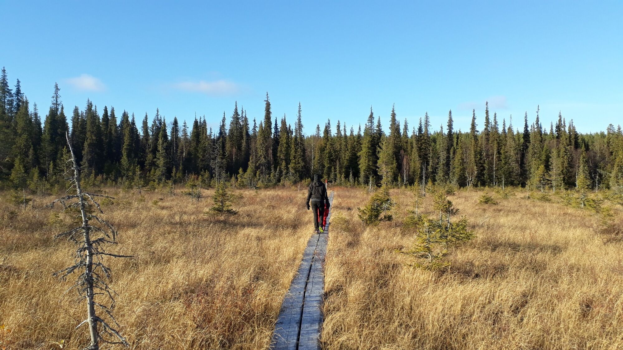

Services on the trail: The trail is marked by orange signposts. There is one campfire site along the trail and a bookable hut in Vaarinkehuma with a fireplace and a sauna. From the Naruskantie and Sorsajoki crossing there are signposts to the Tuntsa Pub (distance approx. 1 km), which provides lodging and restaurant services. There are many water sources along the trail as it follows the Naruskajoki and Sorsajoki rivers for most of its length, and there are also several streams to cross along the trail.
Outdoor activities for which the trail is suitable: Walking in the summer, skiing during the snowy season.
Trail conditions, related risks and recommended equipment: Starting from Naruskan Tammi, the trail goes along Naruskantie road to Sorsajoki. From there, there are signposts to Tuntsa Pub and Vaarinkehuma. The route then continues along the forest truck road to the edge of Aitatsivaara, and from there as a trail to Vaarinkehuma. The trail's level of difficulty is highly variable. The easiest sections are along Naruskantie and the forest truck road. From Aitatsivaara, the trail is mostly quite easy, consisting of dry and flat pine forests followed by moist mixed forest. The trail becomes more uneven and rocky as you approach Vaarinkehuma, and crossing Sorsakuusikko involves some very steep inclines and declines. There are also a few wet spots without duckboards and there is no bridge for crossing Sorsajoki River. Recommended footwear: in the summer season, waterproof high-cut hiking boots or rubber boots.
Description of the natural environment: The natural environment is very diverse. It includes both easy-to-traverse pine forests and more moist spruce stands and groves.
Description of the cultural environment: The diverse nature of Naruskajoki River and Sorsajoki River. Approaching Vaarinkehuma, the scenery becomes more majestic and wilderness-like.
Accessibility: Municipality: Salla. Located north of Naruska village and mostly to the east of Naruskajoki River. Not accessible by public transport. The starting points are accessible by car. Driving instructions for Naruskan Tammi: Drive about 30 kilometres from Salla towards Savukoski, then take a right on Naruskantie. Drive about 47 kilometres on Naruskantie, then turn left. Drive on for about 0.5 kilometres to reach Naruskan Tammi. After crossing the river, signposts and the trail are to the left of the road. You can also start the trail from Tuntsa Pub or after crossing Sorsajoki River, where the UKK Trail turns from Naruskantie towards Vaarinkehuma.
Find out more about the Tunsa Pub here
Find out more about booking the Vaarinkehuma wilderness hut here
Find out more about car rental services in Salla here
- High-cut waterproof hiking boots or rubber boots.
- Choose the route according to your physical fitness, skills, and circumstances.
- Follow markings and signposts.
- Always keep a map and a phone with you. You can also download the Salla routes to your phone via the CityNomadi app (maps pre-downloaded on your phone. These will also work in areas where there is no internet connection).
- Download the 112 app on your phone for any possible emergency situations. It is your obligation to stop and help if you notice someone needing assistance.
Please see the description.
The nearest airports are at Kuusamo (1.5 h) and Rovaniemi (2 h). There are shuttle buses connecting Kuusamo Airport and Salla, which serve almost every flight.
The nearest railway station is in Kemijärvi (1 h). There is a bus to Salla, which is timed to connect with the night train, Mon-Sat.
Free parking near starting point.
Please remember the rules of litter-free hiking; everything that is taken into nature should also be taken out. Hikers must not leave a trace in nature.
Let the most beautiful parts of the UKK-trail excite your sense of adventure!

bergfex Tours


Ne propustite ponude i inspiraciju za vaš sljedeći odmor
Your e-mail address has been added to the mailing list.