


INTERESTING POINTS ON THE WAY
Cultural life:
Nature(space) & Movement:
Golf course "Above...INTERESTING POINTS ON THE WAY
Cultural life:
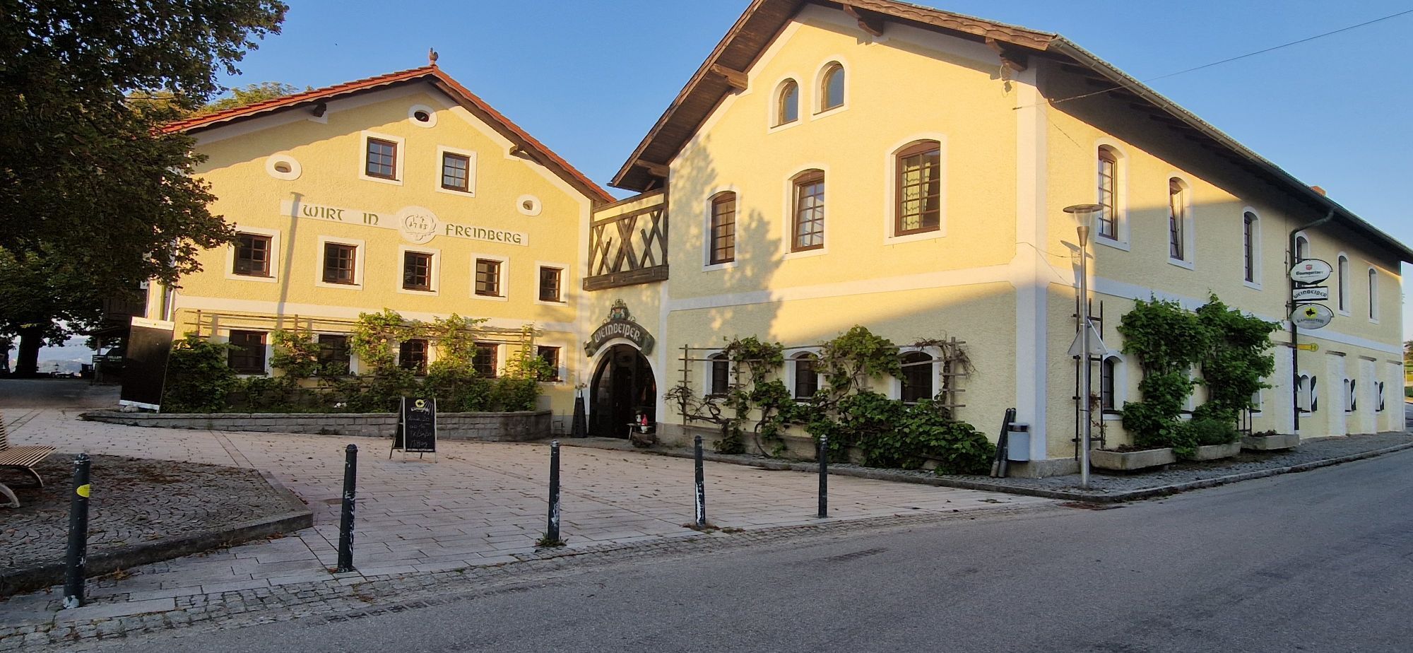
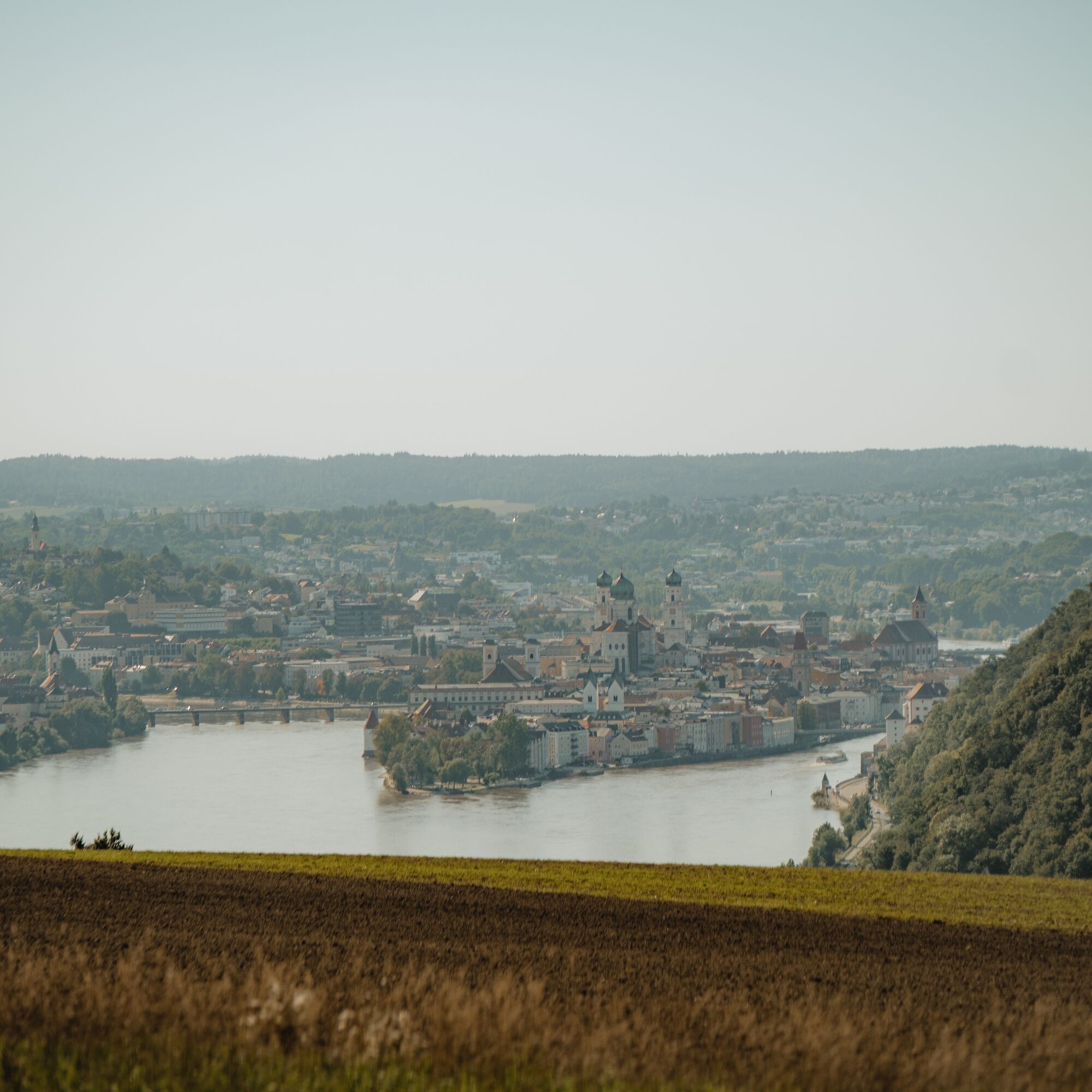
"Altes Forsthaus Freinberg" Parish church Freinberg Panoramic view from the inn "Weinbeißer" Inn Wirth z'Hareth
Nature(space) & Movement:
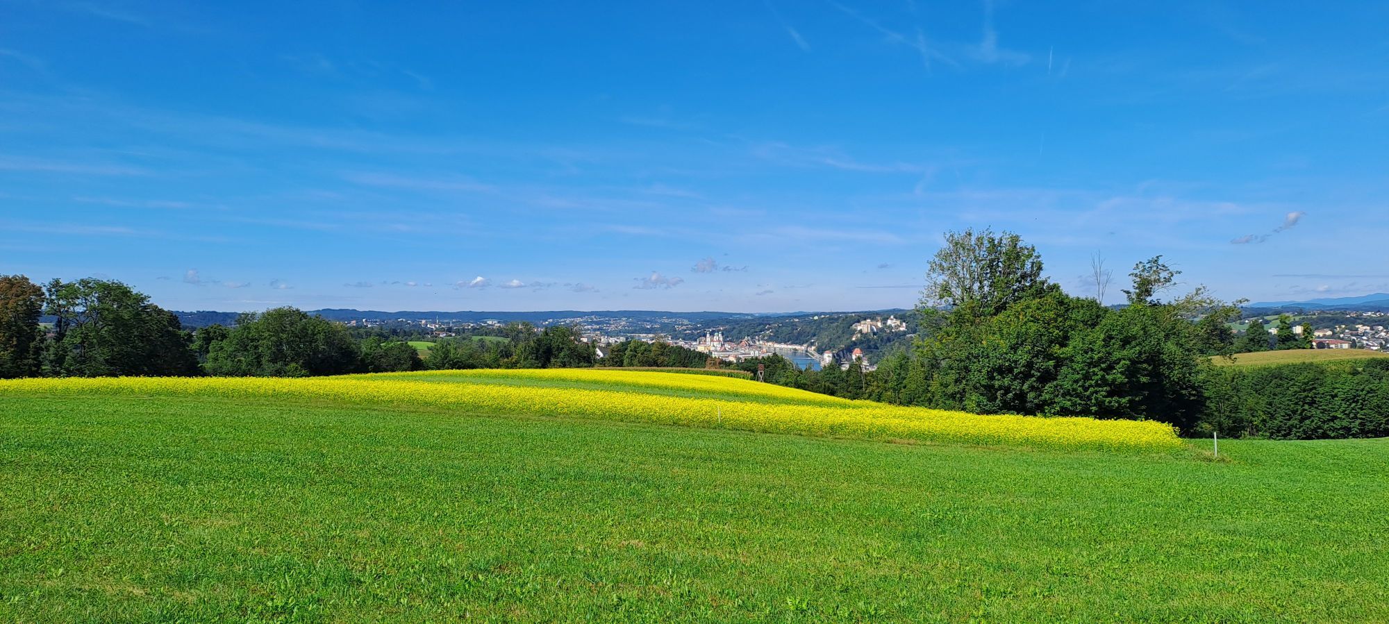
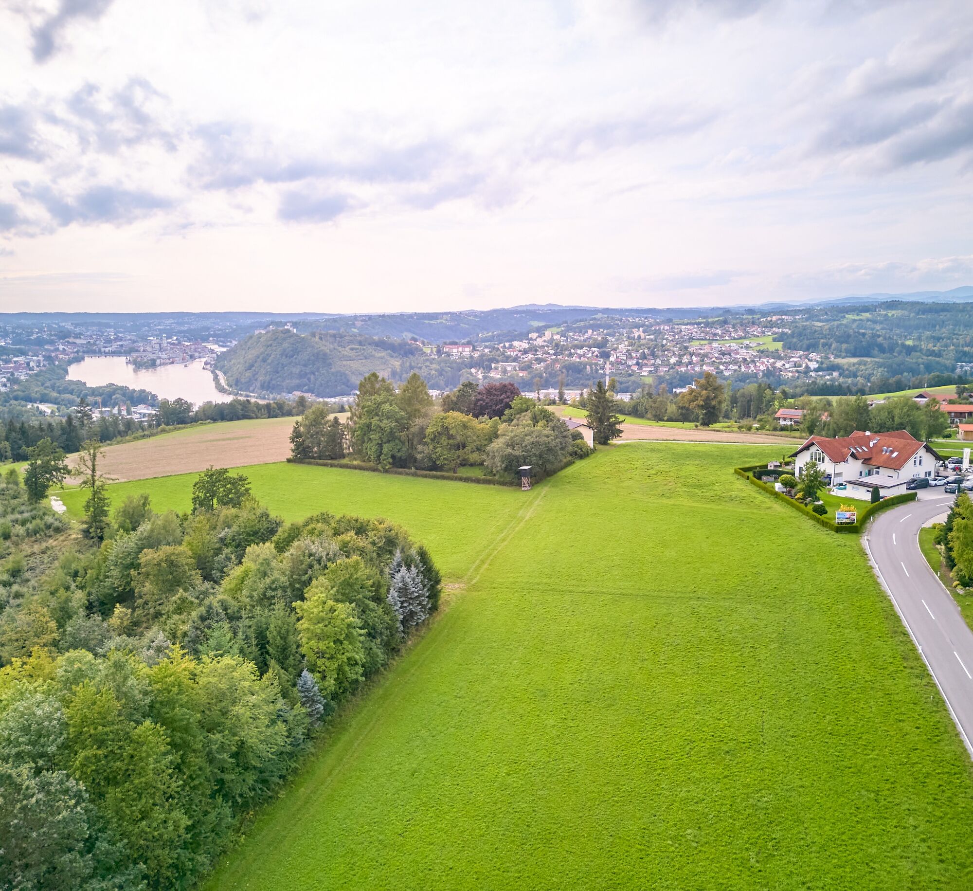
Golf course "Above the roofs of Passau"
SPIRITUAL HIKING ON THE DONAUSTEIG:
Saint SEVERIN, Severinus of Noricum (around 410/482), he was a monastery founder and statesman during the declining Roman rule in Bavaria and later Austria. He was known in the Danube region between Passau and Carnuntum (in the Vienna Basin) as a helper, protector and spiritual caregiver – who gave people support and confidence. Patron saint of Bavaria, prisoners, vintners and linen weavers.
His message for today: Helpfulness – where do I myself need help and to whom do I entrust myself, who needs my support and how can I be helpful.
“Step by step into new territory, taking new paths”
On the Severinsweg I perceive my body in its walking movement:
When do I walk slowly / fast? When do I take big / small steps? When do I step gently / powerfully? When do I walk alone / with others? When do I walk in front / beside / behind others? Do I walk at my own pace / do I adapt? When do I drag myself forward, do I rush through life? What do I need to enjoy walking?

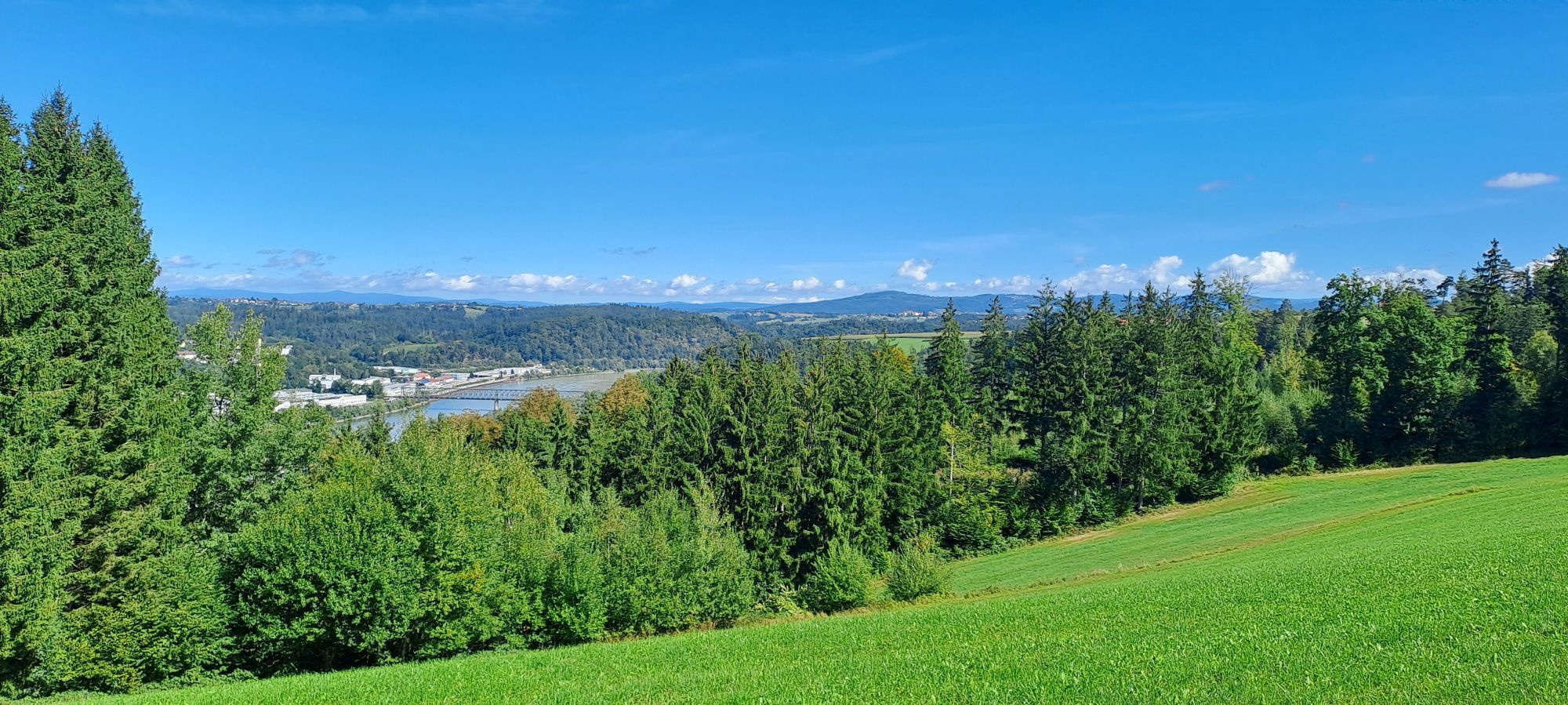
Starting from the village square, we follow the road east and after about 400 m turn right to the sports field. The path now leads into the Edtwald forest and turns south. You leave the forest and walk on the road towards Hareth and turn right at Wirth z’Hareth. Then you descend on streets, field and meadow paths towards Haibach. At the bottom, turn right into Altmanngasse (entry to the Donausteig), after a short rest at the border chapel “Maria im Walde” climb up the Miesberg and reach the height of Unterfreinberg.
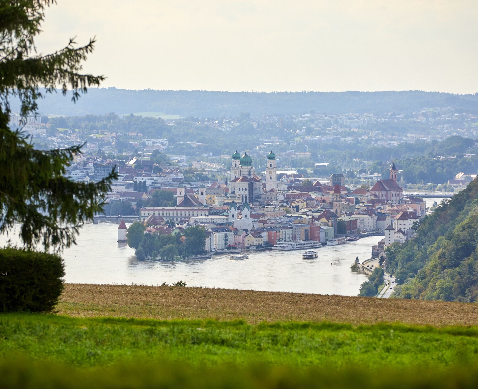
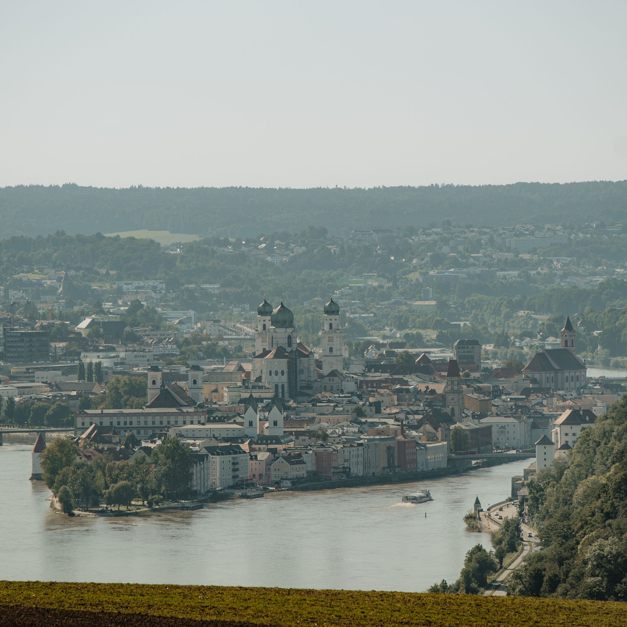
Enjoy the view of Passau. Across the street you return to Freinberg. At the village square next to the town hall, there is also a Donausteig info board that describes the community of Freinberg, the Donausteig and our Passaublick-Severinsweg.
Hiking backpack (including rain cover), sturdy footwear
How to get to the Danube Region Upper Austria?
The fast way to the destination – by train, bus, car, ship or airplane.
Rail connection: Passau station, approx. 4 km away
Village square
Freinberg Tourism Association
Freinberg 4
4785 Freinberg
Tel.: 0043(0)7713/8102-0
tourismus@freinberg.at
www.freinberg.at
Experience Tower - Landmark for Freinberg
Due to its height (15.50 m), unique architecture and visibility of the tower from afar, the Experience Tower serves as a landmark for Freinberg. "Culture in the Tower": The unique gallery rooms open new opportunities for artists to present their works.
The Experience Tower offers professionally equipped rooms spread over 3 floors as a seminar venue for companies and organizations, but also space for small groups and clubs. Sporting offers: Due to the world’s highest tee integrated into a golf course located on a building at a height of 15.5 m and the possibility of climbing, the Experience Tower becomes a sporting attraction with a supraregional character. Furthermore, tennis, squash, badminton, fitness and sauna facilities are already available on the site.
Webcams of the tour
Popular tours in the neighbourhood
-
4,7
Bike round Schärding-Passau-Schärding | Nature & Culture on the Inn Cycle Path
lightVozi bicikl 32,4 km -
4,7
Ilztalwanderweg
mediumPješačenje 15,2 km -
4,5
Von Hals nach Mausmühle
lightPješačenje 12,2 km -
3,5
Esternberg: Kößlbachrunde
lightPješačenje 15,8 km -
Passau-Schärding-Passau
lightVozi bicikl 48,2 km -
3,0
Danube Cycle Path Stage 1 North Bank: Passau - Schlögen
lightMeđugradska biciklistička staza 40,8 km -
4,5
Donaulimes World Heritage Route: Complete Tour
lightVozi bicikl 83,3 km -
3,7
R1.01 Inn-Danube-Round
mediumVozi bicikl 43,7 km -
4,0
Passau: City hiking route from nature to culture
lightPješačenje 6,82 km -
Danube cycle route stage 1 south bank: Passau - Schlögen
lightMeđugradska biciklistička staza 42,1 km
bergfex Tours


Ne propustite ponude i inspiraciju za vaš sljedeći odmor
Your e-mail address has been added to the mailing list.